Sperris Quoit

Last updated

Sperris Quoit
Southwest Cornwall UK location map.svg
Archaeological site icon (red).svg
Shown within Southwest Cornwall
Locationnear Zennor and St Ives
Region Cornwall England
Coordinates 50°11′25″N5°32′41″W / 50.190227°N 5.544605°W / 50.190227; -5.544605
Type Dolmen
Site notes
Conditionextremely ruined

Sperris Quoit is a ruined megalithic burial chamber or dolmen, and one of a type of tomb unique to West Penwith, located on a moor around 365 metres northeast of Zennor Quoit, being roughly halfway between Zennor and Amalveor, Cornwall. It is the northernmost quoit in the Penwith peninsula and a Scheduled Monument. [1]

Contents

Etymology

The word "Sperris" is believed to have been derived from the identical Cornish word "sperris", which means hobgoblin, ghost, or sprite, whereas the word "Quoit" is believed to derive from the Old French word "coite", and means "a large flat stone atop a cromlech", or tomb. [2]

History

Sperris Quoit is over 4000 years old, and may be older, possibly as old as 7000 years, as it has been dated variously at late- or post-neolithic, and late mesolithic or neolithic. [3] [4] It was in relatively good condition until at least the early 19th century, but there is evidence that stones have been removed since then, for local building work in the village of Zennor. The site was rediscovered in 1954 by Thomas and Wakes, who excavated it in part. [5] [6]

Description

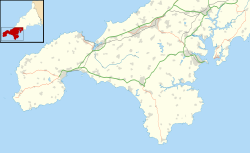
The quoit is situated in rough moorland on the side of Zennor Hill, at about 230 metres above sea level, and is close to several rocky outcrops. About 12 metres in diameter, five stones were found during the excavations, two standing, and three fallen, of which one has eroded to a stump, although due to heavy vegetation and dense gorse, only one upright of the chamber is visible, which is over 1.5 metres tall. [6] It is surrounded on all sides by bracken, gorse, and thick vegetation. The capstone is missing entirely. A cremation pit was discovered during the excavations, and the antechamber faces south. [7] [8]

See also

Related Research Articles

<span class="mw-page-title-main">Dolmen</span> Type of single-chamber megalithic tomb

A dolmen or portal tomb is a type of single-chamber megalithic tomb, usually consisting of two or more upright megaliths supporting a large flat horizontal capstone or "table". Most date from the Late Neolithic period and were sometimes covered with earth or smaller stones to form a tumulus. Small pad-stones may be wedged between the cap and supporting stones to achieve a level appearance. In many instances, the covering has eroded away, leaving only the stone "skeleton".

<span class="mw-page-title-main">Entrance grave</span> Prehistoric burial monument found primarily on the Isles of Scilly, England

Entrance grave is a type of Neolithic and early Bronze Age chamber tomb found primarily in Great Britain. The burial monument typically consisted of a circular mound bordered by a stone curb, erected over a rectangular burial chamber and accessed by a narrow, stone lined entrance. Entrance graves have been discovered in the Isles of Scilly, west Cornwall, southeast Ireland, southwest Scotland, Brittany and the Channel Islands. They are often referred to as the Scillonian Group, named for the Scillonian Islands where the majority of entrance graves have been discovered.

<span class="mw-page-title-main">Pendeen</span> Village and parish in Cornwall, England

Pendeen is a village and ecclesiastical parish on the Penwith peninsula in Cornwall, England. It is 3 miles north-northeast of St Just and 7 mi (11 km) west of Penzance. It lies along the B3306 road which connects St Ives to Land's End and the A30 road.

<span class="mw-page-title-main">Zennor</span> Human settlement in England

Zennor is a village and civil parish in Cornwall, England, United Kingdom. The parish includes the villages of Zennor, Boswednack and Porthmeor and the hamlet of Treen. Zennor lies on the north coast, about 6 miles (10 km) north of Penzance, along the B3306 road which connects St Ives to the A30 road. Alphabetically, the parish is the last in Britain. Its name comes from the Cornish name for the local saint, Saint Senara.

<span class="mw-page-title-main">The Hurlers (stone circles)</span> Group of three stone circles in Cornwall, England

The Hurlers is a group of three stone circles in the civil parish of St Cleer, Cornwall, England, UK. The site is half-a-mile (0.8 km) west of the village of Minions on the eastern flank of Bodmin Moor, and approximately four miles (6 km) north of Liskeard.

<span class="mw-page-title-main">Chûn Quoit</span> Dolmen in the Cornwall region, England

Chûn Quoit is one of the best preserved of all Neolithic quoits in western Cornwall, England, United Kingdom.

<span class="mw-page-title-main">The Merry Maidens</span> Late Neolithic stone circle in Cornwall, England

The Merry Maidens, also known as Dawn's Men is a late neolithic stone circle located 2 miles (3 km) to the south of the village of St Buryan, in Cornwall, England. A pair of standing stones, The Pipers is associated both geographically and in legend.

<span class="mw-page-title-main">Tregiffian Burial Chamber</span>

<span class="mw-page-title-main">Trethevy Quoit</span> Dolmen in the Cornwall region, England

Trethevy Quoit is a well-preserved megalithic structure between St Cleer and Darite in Cornwall, England, United Kingdom. It is known locally as "the giant's house". Standing 9 feet (2.7 m) high, it consists of five standing stones capped by a large slab and was added to the Heritage at Risk Register in 2017.

Bosporthennis is a hamlet south of Treen in the civil parish of Zennor on the Penwith peninsula in west Cornwall, England, United Kingdom.

<span class="mw-page-title-main">St Lythans burial chamber</span> Megalithic dolmen in Wales

The St Lythans burial chamber is a single stone megalithic dolmen, built around 4,000 BC as part of a chambered long barrow, during the mid Neolithic period, in what is now known as the Vale of Glamorgan, Wales.

<span class="mw-page-title-main">Zennor Quoit</span> Dolmen in the Cornwall region, England

Zennor Quoit is a ruined megalithic burial chamber or dolmen, located on a moor about a mile (1.6 km) east of the village of Zennor, Cornwall, England, UK. It dates to 2500–1500 BC. Aside from the 12.5-tonne (12,500 kg) roof, which collapsed some time between 1770 and 1865, the chamber is in good condition.

<span class="mw-page-title-main">Zennor Head</span> Headland on the north coast of Cornwall, England

Zennor Head is a 750-metre (2,460 ft) long promontory on the Cornish coast of England, between Pendour Cove and Porthzennor Cove. Facing the Atlantic Ocean, it lies 1 kilometre north-west of the village of Zennor and 1.6 kilometres east of the next promontory, Gurnard's Head. The granite (Killas) cliffs rise over 200 feet (60 m) from the sea and the highest point of the headland is 314 feet (96 m) above sea level, with an Ordnance Survey triangulation station. Zennor Head is on the South West Coast Path, which follows the cliff edge closely, skirting the entire perimeter of the headland. The promontory is part of the Penwith Heritage Coast, and is the largest coastal feature in the United Kingdom that begins with the letter "Z". It gets its name from a local saint, Senara. Zennor Head was mined for copper and tin in the Victorian Era. There is no longer any residential or commercial occupancy on the headland, but it is occupied by a variety of coastal animals and plants, such as kestrels and gorse.

<span class="mw-page-title-main">B3306 road</span>

The B3306, also known as the West Cornwall Coast Road, is a major road of southwestern Cornwall. It connects St Ives in the east to St Just in the west, and eventually joins the A30 road to the northeast of Sennen in the southwest of the Penwith peninsula. This thirteen-mile road is often considered one of the greatest driving roads in the United Kingdom for its scenery, with most of the road having views both across the Celtic Sea to the north, and the Cornish moorland to the south. It hugs the coastline for a great proportion of its length.

<span class="mw-page-title-main">Carwynnen Quoit</span> Dolmen in the Cornwall region, England

Carwynnen Quoit is a dolmen belonging to the Neolithic period, at Carwynnen near Camborne in west Cornwall. It is also known as 'The Giant's Quoit', 'The Giant's Frying Pan', 'Pendarvis Quoit' and 'Pendarves Quoit'. It collapsed in 1966 and was re-erected in 2014.

<span class="mw-page-title-main">Mulfra Quoit</span> Dolmen in the Cornwall region, England

Mulfra Quoit is a Neolithic dolmen in the county of Cornwall in England. It stands on Mulfra Hill to the north of the hamlet of Mulfra.

<span class="mw-page-title-main">British megalith architecture</span> Study of those ancient cultures that built megalithic sites on the British Isles

British megalith architecture is the study of those ancient cultures that built megalithic sites on the British Isles, including the research and documentation of these sites. The classification sometimes used of these cultures based on geological criteria is problematic.

<span class="mw-page-title-main">Lanyon (Madron)</span> Human settlement in England

Lanyon is a hamlet in the parish of Madron in Cornwall, England, UK. It is situated on a north facing slope on the Madron to Morvah road. The nearest town is Penzance 4 miles (6.4 km) to the south.

<span class="mw-page-title-main">Trefignath</span> Burial chamber in Anglesey, Wales

Trefignath is a Neolithic burial chamber near Trearddur, south of Holyhead on Holy Island, off Anglesey in Wales. In its most complete form it included a large cairn covering three stone tombs, set on a small knoll. It was excavated between 1977 and 1979, revealing several phases of occupation with three separate burial chambers built in succession. It is a scheduled ancient monument, maintained by Cadw.

<span class="mw-page-title-main">Cornish Bronze Age</span> Period of Cornish history from c. 2400 until c. 800 BCE

The Cornish Bronze Age is an era of the history of Cornwall that spanned the period from c. 2400 BCE to c. 800 BCE. It was preceded by the Cornish Neolithic, and followed by the Cornish Iron Age. It is characterized by the introduction and widespread use of copper and copper-alloy (bronze) weapons and tools.

References

  1. Historic England. "Sperris Quoit (1004306)". National Heritage List for England . Retrieved 19 April 2012.
  2. "The Archaeology of the Moors, Downs and Heaths of West Cornwall". Cornwall County Council . Retrieved 15 April 2012.[ page needed ]
  3. Thomas, Charles & Wailes, Bernard 1967 `Sperris Quoit [Cornwall]: the excavation of a new Penwith chamber tomb' Cornish Archaeol 6, 1967 9-23, figs, refs. []
  4. Ancient Sites of West Penwith, Cornwall in Focus, retrieved 15/04/2012
  5. The Archaeological Journal. Royal Archaeological Institute of Great Britain and Ireland, Royal Archaeological Institute (Great Britain), Longman, Rrown [sic] Green, and Longman. 1974. p. 276. Retrieved 14 April 2012.
  6. 1 2 Castleden, Rodney (13 March 1992). Neolithic Britain: New Stone Age Sites of England, Scotland, and Wales. Routledge. p. 48. ISBN   978-0-415-05845-2 . Retrieved 14 April 2012.
  7. Tilley, Christopher (2010). Interpreting Landscapes. Left Coast Press. pp. 443–444. ISBN   978-1598743746 . Retrieved 19 April 2012.
  8. Pevsner, Nikolaus; Radcliffe, Enid (1970). Cornwall. Yale University Press. p. 242. ISBN   978-0-14-071001-4 . Retrieved 14 April 2012.