Related Research Articles

Leavenworth County is located in the U.S. state of Kansas and is part of the Kansas City metropolitan area. Its county seat and most populous city is Leavenworth. As of the 2020 census, the county population was 81,881. The county was named after Henry Leavenworth, a general in the Indian Wars who established Fort Leavenworth.

The Territory of Kansas was an organized incorporated territory of the United States that existed from May 30, 1854, until January 29, 1861, when the eastern portion of the territory was admitted to the Union as the free state of Kansas.

The United States Penitentiary, Leavenworth is a medium security U.S. penitentiary in northeast Kansas. It is operated by the Federal Bureau of Prisons, a division of the United States Department of Justice. It also includes a satellite federal prison camp (FPC) for minimum-security male offenders.
East Leavenworth is an unincorporated community in Platte County, Missouri, United States. It is located on Route 45, approximately three miles east of Leavenworth, Kansas. It is within the Kansas City metropolitan area.
Grant Township is a township in Douglas County, Kansas, USA. As of the 2000 census, its population was 442.

Wakarusa Township is a township in Douglas County, Kansas, USA. As of the 2010 census, its population was 2,318. It was named for the Wakarusa River which flows through Douglas County from Wabaunsee County to the Kansas River near Eudora.

Dunavant is an unincorporated community in Jefferson County, Kansas, United States.
Jarbalo is an unincorporated community in Leavenworth County, Kansas, United States. It is part of the Kansas City metropolitan area.
Kickapoo is an unincorporated community in Kickapoo Township, Leavenworth County, Kansas, United States. It is part of the Kansas City metropolitan area.
Monrovia is an unincorporated community in Atchison County, Kansas, United States. Monrovia is located at 39°31′27″N95°20′46″W.
Reno is an unincorporated community in Leavenworth County, Kansas, United States. Reno is located at 39°03′04″N95°07′12″W. It is part of the Kansas City metropolitan area.
Fall Leaf is an unincorporated community in Leavenworth County, Kansas, United States. It is part of the Kansas City metropolitan area.
Hoge is an unincorporated community in Leavenworth County, Kansas, United States. It is part of the Kansas City metropolitan area.
Lowemont is an unincorporated community in Leavenworth County, Kansas, United States. It is part of the Kansas City metropolitan area.
Millwood is an unincorporated community in Leavenworth County, Kansas, United States. It is part of the Kansas City metropolitan area.
Port Williams is an unincorporated community in Atchison County, Kansas, United States.
Kickapoo Township is a township in Leavenworth County, Kansas, United States.
Soldier Creek is a stream in Jackson County, Kansas and Shawnee County, Kansas and Nemaha County, Kansas, in the United States. It is a tributary of the Kansas River.
Delaware City is a ghost town in Leavenworth County, Kansas, United States.
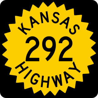
K-292 was a 3⁄4-mile-long (1.21 km) state highway in the U.S. state of Kansas. K-292's western terminus was at K-92 northeast of the unincorporated community of Springdale and the eastern terminus was at K-92 northeast of Springdale. It served the former Springdale Covered Bridge and was a two-lane road its entire length.
References
- ↑ "Springdale, Kansas", Geographic Names Information System , United States Geological Survey, United States Department of the Interior
- ↑ History of the State of Kansas: Containing a Full Account of Its Growth from an Uninhabited Territory to a Wealthy and Important State. A. T. Andreas. 1883. p. 465.
- ↑ "Leavenworth County". Jim Forte Postal History. Retrieved February 14, 2015.
