
Mount Waddington, once known as Mystery Mountain, is the highest peak in the Coast Mountains of British Columbia, Canada. Although it is lower than Mount Fairweather and Mount Quincy Adams, which straddle the United States border between Alaska and British Columbia, Mount Waddington is the highest peak that lies entirely within British Columbia. It and the subrange which surround it, known as the Waddington Range, stand at the heart of the Pacific Ranges, a remote and extremely rugged set of mountains and river valleys.
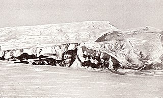
Skelton Glacier is a large glacier flowing from the polar plateau into the Ross Ice Shelf at Skelton Inlet on the Hillary Coast, south of Victoria Land, Antarctica.
The Neptune Range is a mountain range, 70 nautical miles long, lying west-southwest of Forrestal Range in the central part of the Pensacola Mountains, Antarctica. The range comprises Washington Escarpment with its associated ridges, valleys and peaks, the Iroquois Plateau, the Schmidt and the Williams Hills.
The Queen Maud Mountains are a major group of mountains, ranges and subordinate features of the Transantarctic Mountains, lying between the Beardmore and Reedy Glaciers and including the area from the head of the Ross Ice Shelf to the Antarctic Plateau in Antarctica. Captain Roald Amundsen and his South Pole party ascended Axel Heiberg Glacier near the central part of this group in November 1911, naming these mountains for the Norwegian queen Maud of Wales.

The Eisenhower Range is a majestic mountain range, about 45 nautical miles long and rising to 3,070 metres (10,070 ft), which rises between Reeves Névé on the west, Reeves Glacier on the south, and Priestley Glacier on the north and east, in Victoria Land, Antarctica. The range is flat topped and descends gradually to Reeves Névé, but is steep cliffed and marked by sharp spurs along the Priestley Glacier. It is in the north of the Prince Albert Mountains, southwest of the Deep Freeze Range

The Sentinel Range is a major mountain range situated northward of Minnesota Glacier and forming the northern half of the Ellsworth Mountains in Antarctica. The range trends NNW-SSE for about 185 km (115 mi) and is 24 to 48 km wide. Many peaks rise over 4,000 m (13,100 ft) and Vinson Massif (4892 m) in the southern part of the range is the highest elevation on the continent.

The Heritage Range is a major mountain range, 160 km (99 mi) long and 48 km (30 mi) wide, situated southward of Minnesota Glacier and forming the southern half of the Ellsworth Mountains in Antarctica. The range is complex, consisting of scattered ridges and peaks of moderate height, escarpments, hills and nunataks, with the various units of relief set off by numerous intervening glaciers.
The Cook Mountains is a group of mountains bounded by the Mulock and Darwin glaciers in Antarctica. They are south of the Worcester Range and north of the Darwin Mountains and the Britannia Range.

The Darwin Glacier is a large glacier in Antarctica. It flows from the polar plateau eastward between the Darwin Mountains and the Cook Mountains to the Ross Ice Shelf. The Darwin and its major tributary the Hatherton are often treated as one system, the Darwin–Hatherton.
The Darwin Mountains are a group of mountains between the Darwin Glacier and Hatherton Glacier in Antarctica. They were discovered by the British National Antarctic Expedition (1901–04) and named for Major Leonard Darwin, at that time Honorary Secretary of the Royal Geographical Society. They are south of the Cook Mountains and north of the Britannia Range

The Royal Society Range is a majestic range of mountains in Victoria Land, Antarctica, rising to 4,025 metres (13,205 ft) along the west shore of McMurdo Sound between the Koettlitz, Skelton and Ferrar Glaciers. They are south of the Kukri Hills, southeast of the Quartermain Mountains, and northeast of the Worcester Range.

Mount Morning is a shield volcano at the foot of the Transantarctic Mountains in Victoria Land, Antarctica. It lies 100 kilometres (62 mi) from Ross Island. Mount Morning rises to an elevation of 2,723 metres (8,934 ft) and is almost entirely mantled with snow and ice. A 4.1 by 4.9 kilometres wide summit caldera lies at the top of the volcano and several ice-free ridges such as Hurricane Ridge and Riviera Ridge emanate from the summit. A number of parasitic vents mainly in the form of cinder cones dot the mountain.

The Asgard Range is a mountain range in Victoria Land, Antarctica. It divides Wright Valley from Taylor Glacier and Taylor Valley. It is south of the Olympus Range and north of the Quartermain Mountains and the Kukri Hills.
The Mühlig-Hofmann Mountains is a major group of associated mountain features extending east to west for 100 km (62 mi) between the Gjelsvik Mountains and the Orvin Mountains in Queen Maud Land, East Antarctica. With its summit at 3,148 metres (10,328 ft), the massive Jøkulkyrkja Mountain forms the highest point in the Mühlig-Hofmann Mountains.
The Land Glacier is a broad, heavily crevassed glacier, about 35 nautical miles long, descending into Land Bay in Marie Byrd Land, Antarctica. It was discovered by the United States Antarctic Service (1939–41) and named for Rear Admiral Emory S. Land, Chairman of the United States Maritime Commission.
The Cayley Glacier is a glacier flowing northwest into the south side of Brialmont Cove, on the west coast of Graham Land, Antarctica.
The Denton Hills are a group of rugged foothills, 24 nautical miles long southwest–northeast and 9 nautical miles wide, to the east of the Royal Society Range on the Scott Coast, Victoria Land, Antarctica.
Saint Johns Range is a crescent-shaped mountain range about 20 nautical miles long, in Victoria Land, Antarctica. It is bounded on the north by the Cotton Glacier, Miller Glacier and Debenham Glacier, and on the south by Victoria Valley and the Victoria Upper Glacier and Victoria Lower Glacier.
Ramsey Glacier is a glacier about 45 nautical miles long in Antarctica. It originates in the Bush Mountains near the edge of the polar plateau and flows north through the Queen Maud Mountains of Antarctica to the Ross Ice Shelf eastward of Den Hartog Peak.

Doyran Heights are the heights rising to 3473 m at Mount Tuck in the east foothills of Vinson Massif and Craddock Massif in Sentinel Range, Ellsworth Mountains in Antarctica, extending 30.8 km in north–south direction and 16.5 km in east–west direction. They are bounded by Thomas Glacier to the south and southwest, Dater Glacier and Hansen Glacier to the northwest and north, and Sikera Valley to the east, linked to Craddock Massif to the west by Goreme Col, and separated from Veregava Ridge to the north by Manole Pass and from Flowers Hills to the northeast by Kostinbrod Pass. Their interior is drained by Guerrero, Hough, Remington and Obelya Glaciers.
