Peravoor is a town and Grama Panchayat in Kannur district of Kerala state in India. It is located 50 km (31 mi) east of Kannur and 40 km (25 mi) north east of Thalassery. And Iritty, the nearest municipality is 14 km (8.7 mi) north of Peravoor. Peravoor is situated in the Western Ghats mountain range.
Appakudal is a panchayat town in the Erode district in the state of Tamil Nadu, India. Appakudal is an industrial centre. It has a sugar factory, viz., Sakthi Sugars Limited, the families of the workers of which form a major part of population of this town.

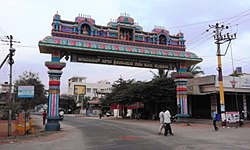
Bogadi is a town within the limits of the Mysore Urban Development Authority, and Mysuru metropolitan area in Mysore district, Karnataka.
Murgathaul is a census town in the Raniganj CD block in the Asansol Sadar subdivision of the Paschim Bardhaman district in the Indian state of West Bengal.

Manathana is a village in Peravoor Grama Panchayat of Kannur district, Kerala, India.

Maniyur Grama Panchayat is located in Vadakara Taluk, in the Kozhikode district in the state of Kerala, India. It covers an area of 31.03 km2.
Valayam is a town in Kozhikode district in the state of Kerala, India.

Kalna subdivision is an administrative subdivision of the Purba Bardhaman district in the state of West Bengal, India.
Kadakola is a Town and a suburb of Mysuru metropolitan area in the southern state of Karnataka, India. It is located in the Mysore taluk of Mysore district. In November 2020, Kadakola was upgraded from a Gram Panchayat to a Town Panchayat and a gazetted notification was passed on November 26, 2020.2. The combined population of the newly formed town is 19,969.

Rammanahalli is a Town and a suburb of Mysore in the Mysuru metropolitan area of Karnataka, India. It is located in the Mysore taluk of Mysore district. In November 2020, Kadakola was upgraded from a Gram Panchayat to a Town Panchayat and a gazetted notification was passed on November 26, 2020. The notification combines Rammanahalli GP villages, Nadanahalli and Alanahalli of Alanahalli GP, Hanchya and Sathagalli villages of Hanchya GP, covering a total area of 22.81 sq. km. The combined population of the town according to 2011 census was 20,804.
Vivekananda Nagar is a suburb of Mysore City in Karnataka state, India.

Purbasthali I is a community development block that forms an administrative division in Kalna subdivision of Purba Bardhaman district in the Indian state of West Bengal.

The MysoreUrban Development Authority (MUDA) of Mysore, India, is a governmental organization that oversees planning and development of infrastructure, provision of development-related sites and services, and the housing needs of underprivileged citizens in Mysore.

Banashankari, abbreviated as BSK, is a locality spread over South and West Bangalore. It gets its name from the Banashankari Amma Temple on Kanakapura Road, one of Bangalore's well-known temples constructed by Subramanya Shetty in 1915.
Changrabandha is a census town and a gram panchayat in Mekhliganj CD block in Mekhliganj subdivision of Cooch Behar district in the state of West Bengal, India. It is a border checkpoint on the Bangladesh-India border.

Meenangadi is an old town situated on the highway NH 766 between Kalpetta and Sulthan Bathery in Wayanad District, in Kerala, India. This place is one among the Provinces where the existence of Dolmens provide an historical evidence of earlier civilisation. Coffee bean, Black pepper, Ginger, Rice and Areca are the major crops cultivated in this area. Meenangadi is famous for its Fish Market and Cattle Market. The nearest railway station is at Kozhikode at 87 km and airport is Kannur International Airport with 94 km from Meenangadi. Meenangadi is surrounded by, Ambalavayal Panchayat, Kalpetta Taluk towards west, Gudalur Taluk towards East, Mananthavady Taluk towards west. Kalpetta, Sultan Bathery, Kozhikode are the nearby Cities and towns to Meenangadi.
Kerala's first carbon neutrality project launched in Meenangadi in June 2016. Upon achieving the goals of the project, Meenangadi will be the first village in India to go completely carbon neutral. Meenangadi has a population of 33450 According to 2011 Census with two Villages Purakkadi and (Part)Krishnagiri.

Mananthavady Road is an agricultural suburb of Mysore district in the Indian state of Karnataka.

Lingambudhi Park is a park in the Indian city of Mysore.

Hootagalli or Hutagalli is a city and a Suburb of Mysore, situated in Mysuru metropolitan area ಮೈಸೂರು ಜಿಲ್ಲೆ of Karnataka, India. Hootagalli is located in the outskirts of the city of Mysuru and forms a continuous urban area. Hootagalli city municipal council consists of previous census towns of Hinkal, Hootagalli and Gram Panchyats of Koorgalli and Belavadi totally covering an area of 28.48 square km. In November 2020, the government of Karnataka approved the formation of Hootagalli City Municipal Council by merging four gram panchayats. The initial plan was to include it with MCC to form Greater Mysuru City Corporation (BMMP) however, due to MCC disputing the proposal, a separate body was created. According to 2011 census, the city municipal council has combined population of 56,876. On November 26, 2020, a gazetted notification was passed making the CMC official.
Mysuru Local Planning Area is the metropolitan area limit defined in City Development Plan 2031 by Mysore Urban Development Authority. Mysuru Planning Area is divided into 45 planning districts spanning across the Taluks of Mysore, Nanjangud and Srirangapatna of Mandya district. As per City Development Plan 2031, this metropolitan area covers 509sq.km of area and has a population of 1,696,577.