Mysore, officially Mysuru, is a city in the southern part of the state of Karnataka, India. Mysore city is geographically located between 12° 18′ 26″ north latitude and 76° 38′ 59″ east longitude. It is located at an altitude of 770 m (2,530 ft) above mean sea level.

Kuppali Venkatappa Puttappa, popularly known by his pen name Kuvempukuu-VEM-poo, was an Indian poet, playwright, novelist and critic. He is widely regarded as the greatest Kannada poet of the 20th century. He was the first Kannada writer to receive the Jnanpith Award.

Thyagaraya Nagar, commonly known as T. Nagar, is a very affluent commercial and residential neighbourhood in Chennai, Tamil Nadu, India. It is surrounded by Nungambakkam in the North, Teynampet in the East, Nandanam in the South-East, C.I.T. Nagar in the South and West Mambalam and Kodambakkam in the West. The stretch between Duraiswamy Road and T. Nagar Bus Stand has some of the costliest real estates in Chennai. It was constructed between 1923 and 1925 by the Madras Presidency government of the Raja of Panagal as a part of town planning activities initiated according to the Madras Town Planning Act of 1920. The town was named after P. Thyagaraya Chetty. The streets, parks and localities in the new neighbourhood were named after important officials in the provincial government.

Nanganallur or Nangainallur is one of the southern neighbourhood of Chennai, India. Since September 2011, it is a part of Chennai Corporation. It is a residential area close to the Chennai International Airport. In Tamil language, Nangainallur means place of good-natured women.
Pammal is a residential neighbourhood and industrial district of Chennai, India. It is located 22 kilometers from Chennai Central Railway Station. It is located next to Pallavaram on the western side. It lies on the western side of the Grand Southern Trunk Road and close to Chennai International Airport. The neighborhood is served by Pallavaram Railway Station of the Chennai Suburban Railway Network.
Kuvempu Nagar is a residential layout in Mysore, Karnataka, India.

Tirusulam is a neighbourhood in Chennai, India. For administrative purposes, it is a census town in Chennai city. The Chennai International Airport is located here opposite the Tirusulam Railway station, with the cargo terminal located at the adjacent Meenambakkam. Chennai International Airport is the primary airport serving the city of Chennai. The airport is the regional headquarters of the Airports Authority of India for South India comprising the states of Tamil Nadu, Andhra Pradesh, Karnataka and Kerala and the union territories of Puducherry and Lakshadweep.
Thirumullaivoyal is a western residential neighbourhood of Chennai, the capital of the South Indian state of Tamil Nadu. It is located in the Chennai Metropolitan Area in Tiruvallur district, 2 km (1.2 mi) from Ambattur. The neighbourhood is served by Thirumullaivoyal railway station and Annanur Railway Station. The region was historically part of Thondaimandalam, a region in Chola Empire during 9th century A.D.

Yachenahalli is a panchayat town in Mysore district in the state of Karnataka, India. It is located 35 km from Mysore and 17 km from Mandya. The nearest city is Bannur with 10 km distance.
Vivekananda Nagar is a suburb of Mysore City in Karnataka state, India.

Jayaprakash Narayan Nagara, popularly known as J. P. Nagar, is one of the residential layouts in Mysore that is very adjacent to the outer ring road. J.P. Nagar was originally meant to be an industrial layout. But recently it has become an important residential area with many shops and establishments catering to the residents.
Srirampura is a town and residential suburb of Mysore city in India. It is located in the Southern part of the city. It has a population of approximately 11,000 according to the 2011 Census. The main landmarks of this area are Brahmarahbha Choultrey, SBM park, Madhuvana Park. There are several schools in and around this area. North of Srirampura is Vivekananda Nagar and Kuvempunagar. West of Srirampura is Ramakrishnanagar, East of Srirampura is Asokapuram. South of Srirampura is the Mananthavady-Mysore Highway. In November 2020, a gazetted notification was passed upgrading the census town to a town panchayat. The notification combines towns and villages of Srirampura, Lingambudhipalya, Gurur, Koppalur and Kalalavadi villages coming under Srirampura GP, covering a total area of 17.99 sq. km. According to 2011 census, the town has a combined population of 18,511.
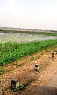
Mananthavady Road is an agricultural suburb of Mysore district in the Indian state of Karnataka.

Kannegowdana Koppal, popularly known as K. G. Koppal is a locality in Chamarajapuram, Mysore, Karnataka. The locality is named after Kannegowda.

Ballal Circle, officially known as Asoka Circle is one of the suburbs of Mysore city in Karnataka state of India.

Gurur is a small village in Mysore district, Karnataka, India.

Ashokapuram is a suburb of Mysore coming on the southern side of the city. It is part of Mysore district in Karnataka state of India.

Varuna is a village in Mysore district of Karnataka state, India.

Ashokapuram is a railway station on Mysore–Chamarajanagar branch line. The station is located in Mysore district, Karnataka state, India.
Akshaya Bhandar is a suburb of Mysore in Karnataka, India.