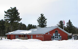
Lake of Bays is a township municipality within the District Municipality of Muskoka, Ontario, Canada. The township, situated 193 kilometres (120 mi) north of Toronto, is named after the Lake of Bays. During the 2016 census, the township had a population of 3,167 and encompassed 677.91 square kilometres (261.74 sq mi) of land.
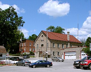
Marmora and Lake is a municipality along the banks of Crowe River and Beaver Creek, about midway between Toronto and Ottawa on provincial Highway 7 in Hastings County in Central Ontario, Canada. It is home to over 4,000 full time and seasonal residents, many of whom enjoy outdoor recreation and relaxation on Crowe Lake.
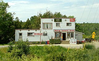
Wanup is a dispersed rural community and unincorporated place in the geographic township of Dill in the southeast of the city of Greater Sudbury, Ontario, Canada. Wanup became part of Greater Sudbury on January 1, 2001, when that city was created by amalgamating the former Regional Municipality of Sudbury, to which the townships of Dill and Cleland were added.
The Pottawatomi River is a river in the municipalities of Owen Sound and Georgian Bluffs, Grey County in Southwestern Ontario, Canada. It is in the Great Lakes Basin and empties into Owen Sound, an inlet of Georgian Bay on Lake Huron, at Owen Sound Harbour.

The Municipality of Trent Hills is a township municipality in Northumberland County in Central Ontario, Canada. It is on the Trent River and was created in 2001 through the amalgamation of the municipalities of Campbellford/Seymour, Percy Township and Hastings. Thereafter it was known in brief as Campbellford/Seymour, Percy, Hastings.

Limerick Lake is a lake in the Trent River and Lake Ontario drainage basins in the township of Limerick, Hastings County, Ontario, Canada, about 3 kilometres (1.9 mi) northwest of the community of St. Ola, 2.5 kilometres (1.6 mi) northeast of Highway 62, and 25 kilometres (16 mi) southeast of the town of Bancroft. In 1934, the building of St. Ola Dam raised the level of Big Salmon Lake by two metres. The lake was then renamed, as part of a process in Ontario to give each large lake a unique name. The original concrete dam was assessed in 2002 and significant cracking was found. The dam was replaced in 2004 with a new concrete dam. The waterway falls under the jurisdiction of the Crowe Valley Conservation Authority which has responsibility for furthering the conservation, development, and management of natural resources, but whose main activity is flood control.
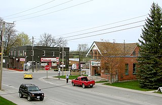
Little Britain is a compact rural community in the City of Kawartha Lakes, Ontario, Canada. It is located 15 kilometres (9.3 mi) southwest of Lindsay. Formerly a part of Mariposa Township and Victoria County, Little Britain is now part of Ward 4, City of Kawartha Lakes.

Val Rita-Harty is a township municipality in Cochrane District in Northeastern Ontario, Canada.

Chapple is a township municipality in Rainy River District in Northwestern Ontario, Canada.
Bear Brook is a small stream in the municipalities of Clarence-Rockland and The Nation, United Counties of Prescott and Russell, and the city of Ottawa in eastern Ontario, Canada. It forms in the fields and forests just north of Edwards, and flows in a mostly eastern direction to its mouth as a left tributary of the South Nation River.
Lake St. Peter Provincial Park is a recreation-class provincial park in the municipality of Hastings Highlands, Hastings County, Ontario, Canada. It is operated by the Ontario Parks branch of the Ontario Ministry of Natural Resources and Forestry.

Dunchurch is a compact rural community in the Canadian province of Ontario, located in the municipality of Whitestone in Parry Sound District.

Kitigan is a dispersed rural community in the Unorganized North Part of Cochrane District in Northeastern Ontario, Canada. It is located in geographic O'Brien Township along Ontario Highway 11 between the incorporated municipalities of Moonbeam to the east and Kapuskasing to the west.

Queensborough is an unincorporated community in the municipality of Tweed, Hastings County, in Central Ontario, Canada. It is located north of Ontario Highway 7 on the Black River, about 20 kilometres (12 mi) north-west of the village of Tweed and 15 kilometres (9.3 mi) north-east of the town of Madoc.
Kamaniskeg Lake is a lake in the municipalities of Hastings Highlands, Hastings County, and Madawaska Valley, Renfrew County, in Southern Ontario, Canada. It is part of the Ottawa River drainage basin and is located in the Madawaska River Valley, with nearby communities of Barry's Bay and Combermere. The lake is known for its simple beauty, with a mixture of forest, and rock and sand beaches.
Shawanaga is an unincorporated geographic township in the Unorganized Centre Part of Parry Sound District in central Ontario, Canada.
Bervie is an unincorporated place and Compact Rural Community in the municipality of Kincardine, Bruce County in southwestern Ontario, Canada. It is located on Ontario Highway 9, and is on the Penetangore River, which flows to Lake Huron at the town centre of Kincardine.
René Brunelle Provincial Park is a provincial park in both the municipality of Moonbeam and the geographic Township of Gurney in Unorganized North Cochrane District, Cochrane District, in Northeastern Ontario, Canada. Established in 1957 and named in 1981 for René Brunelle, it is operated by Ontario Parks and has camping, hiking, swimming and other facilities on or near Remi Lake.
McKenzie Lake is a lake in South Algonquin, Nipissing District and Hastings Highlands, Hastings County in Ontario, Canada. It is in the Saint Lawrence River drainage basin, is part of the Madawaska River river system, and lies about 14 kilometres (9 mi) south of the community of Madawaska and a similar distance north of the small town of Maynooth. The settlement of McKenzie Lake is on the north shore of the lake.
Fourcorner Lake is a lake in the municipality of Dysart et al, Haliburton County in Central Ontario, Canada. It is partly within Algonquin Provincial Park and is in the Ottawa River drainage basin. The lake takes its name from its location at a quadripoint, the junction point of four geographic townships: Harburn at northwest, Bruton at the northeast, Harcourt at the southeast, and Dudley at the southwest.
