St. Pauls, Cheltenham

Last updated

Coordinates: 51°54′04″N2°04′37″W / 51.901°N 2.077°W / 51.901; -2.077 St. Pauls is one of a number of areas of the Cotswold town Cheltenham, Gloucestershire, England. St. Pauls is home to the Francis Close Hall, a campus of the University of Gloucestershire, St. Paul's Church, and many leisure facilities. Numerous stories exist of the gallows that were once housed there when the area was characterized by fields rather than housing.

Geographic coordinate system Coordinate system

A geographic coordinate system is a coordinate system that enables every location on Earth to be specified by a set of numbers, letters or symbols. The coordinates are often chosen such that one of the numbers represents a vertical position and two or three of the numbers represent a horizontal position; alternatively, a geographic position may be expressed in a combined three-dimensional Cartesian vector. A common choice of coordinates is latitude, longitude and elevation. To specify a location on a plane requires a map projection.

Cheltenham Place in England

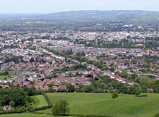
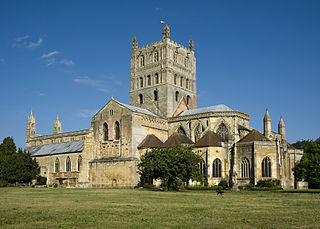
Cheltenham is a regency spa town and borough on the edge of the Cotswolds, an Area of Outstanding Natural Beauty in Gloucestershire, England. Cheltenham has been a health and holiday spa town resort since the discovery of mineral springs in 1716 and has a number of internationally renowned and historic schools.

Gloucestershire County of England

Gloucestershire is a county in South West England. The county comprises part of the Cotswold Hills, part of the flat fertile valley of the River Severn, and the entire Forest of Dean.

St Paul's Church, Cheltenham St Paul's Church, Cheltenham, Gloucestershire.jpg
St Paul's Church, Cheltenham

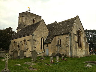
The area of St. Pauls takes its name from St. Paul’s Church at its centre. St. Pauls sits to the north-west of Cheltenham town centre and is a largely residential area of predominantly red-brick artisan housing built in the early 19th century. St. Pauls is located within a short walk of the town centre of Cheltenham, and has a population of approximately 5,500. Examples of the oldest housing in the area can be seen at St. Paul’s Street North, whose stuccoed houses date from the 1830s.

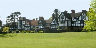
Francis Close Hall, a former teacher training college and now a campus of the University of Gloucestershire, is situated in St. Pauls and has a state-of-the-art studio, laboratory, ICT, Gloucester suite training restaurant and Learning Centre. Francis Close Hall, built in Tudor-Gothic style was constructed in 1849 by Samuel Daukes.

University of Gloucestershire

The University of Gloucestershire is a public university based in Gloucestershire, England. It is located over three campuses, two in Cheltenham and one in Gloucester, namely Francis Close Hall, The Park and Oxstalls and a Centre for Fashion, Art and Photography in Cheltenham.

Tudor Revival architecture architectural style

Tudor Revival architecture first manifested itself in domestic architecture beginning in the United Kingdom in the mid to late 19th century based on a revival of aspects of Tudor architecture or, more often, the style of English vernacular architecture of the Middle Ages that survived into the Tudor period. It later became an influence in some other countries, especially the British colonies. For example, in New Zealand, the architect Francis Petre adapted the style for the local climate. Elsewhere in Singapore, then a British colony, architects such as R. A. J. Bidwell pioneered what became known as the Black and White House. The earliest examples of the style originate with the works of such eminent architects as Norman Shaw and George Devey, in what at the time was thought of as a neo-Tudor design.

Samuel Whitfield Daukes or Dawkes (1811–1880) was an English architect, based in Gloucester and London.

There are numerous leisure facilities located in and nearby St. Pauls. At Pittville Park nearby there are tennis courts, skating ramps and an 18-hole golf course. The park also houses Cheltenham Leisure Centre, which has three swimming pools, a gym and health spa. Prince of Wales Stadium, opposite the leisure centre, houses a running track and rugby field.

Pittville human settlement in United Kingdom

Pittville is a residential suburb of Cheltenham, Gloucestershire, England, founded in the early 19th century by Joseph Pitt. The population of Pittville Ward at the 2011 Census was 5,327. It now contains Pittville Park, with its two lakes, skatepark, three cafes, tennis courts, menagerie, children's play area, 9-hole pitch and putt golf course, and Pump Room, and Pittville School. The upmarket tone of the area is set by the architecture: Pittville contains some of the finest examples of Regency and Victorian housing in the town. Gustav Holst's father, Adolph von Holst was organist at All Saints' Church, Pittville.

Prince of Wales title granted to princes born in Wales

Prince of Wales was a title granted to princes born in Wales from the 12th century onwards; the term replaced the use of the word king. One of the last Welsh princes, Llywelyn ap Gruffudd, was killed in battle in 1282 by Edward I, King of England, whose son Edward was invested as the first English Prince of Wales in 1301.

The recent Brewery development, in the town's Lower High Street, has brought new life to the area providing leisure activities, such as cinema, various shops and numerous restaurants.

Related Research Articles

Thornbury, Gloucestershire market town in South Gloucestershire, Gloucestershire, England

Thornbury is a market town and civil parish in South Gloucestershire district of the county of Gloucestershire, England, about 12 miles (19 km) north of Bristol. It had a population of 12,063 at the 2011 Census. Thornbury is a Britain in Bloom award-winning town, with its own competition, Thornbury in Bloom. Nearby villages include Morton and Thornbury Park. The civil parish includes the hamlet of Milbury Heath.

Yate town in Gloucestershire, England

Yate is a commuter town and civil parish in South Gloucestershire, England, at the southwest extremity of the Cotswold Hills, 12 miles (19.3 km) northeast of Bristol city centre and 98 miles due west of London. Yate developed from a village into a sizable town from the 1960s onwards partly as an over-spill or commuter town for the city of Bristol. Although not a new town in the official sense, Yate took on many of the characteristics of one.

Tewkesbury town and civil parish in Gloucestershire, England

Tewkesbury is a town and civil parish in Gloucestershire, England. It stands at the confluence of the River Severn and the River Avon, and also minor tributaries the Swilgate and Carrant Brook. It gives its name to the Borough of Tewkesbury, of which the town is the second largest settlement. It lies in the far north of the county, forming part of the border with Worcestershire.

Haywards Heath town in West Sussex, England

Haywards Heath is a town in the Mid Sussex District of West Sussex, within the historic county of Sussex, England. It lies 36 miles (58 km) south of London, 14 miles (23 km) north of Brighton, 13 miles (21 km) south of Gatwick Airport and 31 miles (50 km) east northeast of the county town of Chichester. Nearby towns include Burgess Hill to the southwest, Horsham to the northwest, Crawley north-northwest and East Grinstead north-northeast. Being a commuter town with only a relatively small number of jobs available in the immediate vicinity, mostly in the agricultural or service sector, many of the residents commute daily via road or rail to London, Brighton, Crawley or Gatwick for work.

Newton Mearns town

Newton Mearns is an affluent suburban town and the largest settlement in East Renfrewshire, Scotland. It lies 7 miles (11 km) southwest of Glasgow City Centre on the main road to Ayrshire, 410 feet (125 m) above sea level. It has a population of approximately 22,636, stretching from Whitecraigs to Mearnskirk.

Gipton human settlement in United Kingdom

Gipton is a suburb of east Leeds, West Yorkshire, England, between the A58 to the north and the A64 to the south.

Coolock Suburb in County Dublin, Leinster, Ireland

Coolock is a large suburban area, centred on a village, on Dublin city's Northside in Ireland. Coolock is crossed by the Santry River, a prominent feature in the middle of the district, with a linear park and ponds. The Coolock suburban area encompasses parts of three Dublin postal districts: Dublin 5, Dublin 13 and Dublin 17.

Ferencváros District of Budapest in Central Hungary, Hungary


Ferencváros is the 9th district of Budapest, Hungary.

Teesville

Teesville is an area of Middlesbrough in the north east of England and is part of the unitary authority of Redcar and Cleveland and in the ceremonial county of North Yorkshire. It has a population of approximately 7,000 residents. It is between South Bank and the River Tees, to the north, and Normanby, Eston and the Eston Hills, commanding an excellent view of the monument at Eston Nab, to the south.

Shurdington is a village near Cheltenham in Gloucestershire, England. The area constitutes a civil parish within the Borough of Tewkesbury. It is located south of Cheltenham on the A46. The population at the 2011 census was 1,936 Shurdington has an 11th-century church, a modern Social Centre containing the Century Hall and Millennium Hall, a Primary School, a post office and general store and a hairdresser. There are two public houses: the Bell Inn and The Cheese Rollers. The latter is named for the annual cheeserolling event which takes place at nearby Cooper's Hill.

Leckhampton

Leckhampton is a district in south Cheltenham, Gloucestershire, England. The area constitutes a civil parish and is part of the district of Cheltenham. The population of the civil parish taken at the 2011 census was 4,409.

Wymans Brook is a district in the north-west of Cheltenham, Gloucestershire, England, named after the small river which flows through the district. It is situated relatively close to Cheltenham racecourse, Pittville Park, the Prince of Wales Stadium/ Leisure @ Cheltenham and the area of Cheltenham known as "Swindon Village".

Swindon Village village/suburb of Cheltenham, Gloucestershire

Swindon Village is both a village and a suburb in the spa town of Cheltenham, Gloucestershire, England. It is located northwest of Arle.

Cheltenham Minster, St Marys Church

Cheltenham Minster, St Mary's is a minster and the parish church of Cheltenham.

Gloucestershire College

Gloucestershire College, abbreviated GC or Gloscol, is a college of further and higher education in the county of Gloucestershire, United Kingdom.

SA1 Swansea Waterfront

SA1 Swansea Waterfront is the marketing name given to the brownfield development area located in northern part of Swansea Docks. The area is located directly to the southeast of Swansea city centre. It is bordered by the Fabian Way to the north and covers the Prince of Wales Dock area.

Woolverstone village in the United Kingdom

Woolverstone is a small village and civil parish in Suffolk, England located on the Shotley peninsula. It is situated about 6.4 km (4.0 mi) south of Ipswich, near the southern shore of the River Orwell. In 2005 it had a population of 240, increasing to 265 at the 2011 census.

References