
Adderbury is a winding linear village and rural civil parish about 3 miles (5 km) south of Banbury in northern Oxfordshire, England. The settlement has five sections: the new Milton Road housing Development & West Adderbury towards the southwest; East Adderbury to the centre, both with a village green and a manor house; and the new housing Development on the Aynho Road; and the northeast, which is known as Twyford, named after a small outlying settlement by a forked section of the River Cherwell.
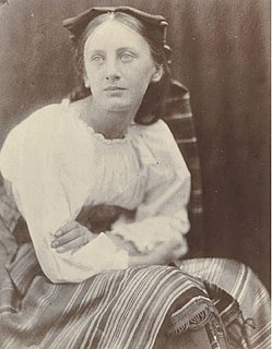
Prinsep may mean any of several notable members of the British Prinsep family.
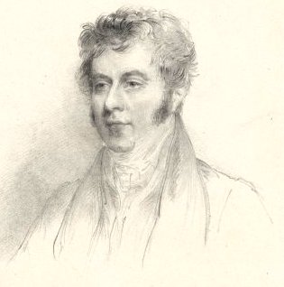
Sir Robert John Wilmot-Horton, 3rd Baronet, GCH, PC, FRS was a British politician, sociopolitical theorist, and colonial administrator. He was Under-Secretary of State for War and the Colonies between 1821 and 1828, and Governor of Ceylon between 1831 and 1837. He is most widely known for his writings on assisted emigration to the colonies of the British Empire.

Horton is a village in Northamptonshire, England. The village manor, Horton Hall, now demolished, was home to the first governor of the Bank of England and William Parr, 1st Baron Parr of Horton. An outline of its former nucleus can be seen in neighbouring fields, by its grade II park and garden which features an ornamental bridge. It is in the civil parish of Hackleton.

Breadsall Priory is a former Augustinian priory in Derbyshire, situated around two kilometres north of Breadsall, and two kilometres east of Little Eaton. The priory was established before 1266 by a member of the Curzon family. Only a small priory, Breadsall was dissolved in 1536.

Longworth is a village and civil parish in the Vale of White Horse, England. Part of Berkshire until the 1974 boundary changes transferred it to Oxfordshire, it lies about 7 miles (11 km) west of Abingdon-on-Thames and 9 miles (14 km) south-west of Oxford. The 2011 Census recorded a population of 566; it was estimated at 570 in 2019. The parish is bounded by the River Thames to the north, the A420 road to the south, and field boundaries to the east and west. The land slopes from the A420 to the river, except at Harrowdown Hill near the north-east corner of the parish, whose summit is 325 feet (99 m).
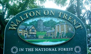
Walton-on-Trent is a village and civil parish in the National Forest in Derbyshire, England. The population of the civil parish as taken at the 2011 Census was 872. As its name implies it is an ancient crossing point of the River Trent. It was at this point that King Edward II crossed the river in pursuit of the disaffected barons including the Earl of Lancaster. Listed buildings in the parish include Catton Hall, Walton Hall. Today the village is very close to Burton upon Trent).

Catton Hall is a country house near the boundary between Derbyshire and Staffordshire. It gives its postal address as Walton-on-Trent although there was a village of Catton at one time. It is a Grade II* listed building.

Congerstone is a small settlement in Leicestershire, England. It is three miles north west of Market Bosworth, of which it was historically a daughter parish. It is near the Ashby-de-la-Zouch Canal and the A444 road.

St Mary's Church is a Church of England parish church in Chaddesden, a suburb of Derby, England. One of the oldest churches in the city, it is a Grade I listed building dating back to the mid-14th century.
Thomas Levett-Prinsep (1800/1–1849), born Thomas Levett, was an English landowner in Derbyshire and Staffordshire. He took on the additional name of Prinsep on inheriting his uncle's holding of Croxall Hall.
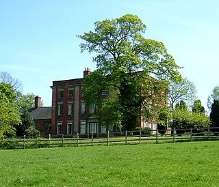
Walton Hall is an 18th-century country house situated in the village of Walton on Trent, Derbyshire. It is a Grade II* listed building but is in slow decay and is officially registered on the Buildings At Risk Register.

Croxall Hall is a restored and extended 16th century manor house situated in the small village of Croxall, Staffordshire. It is a Grade II* listed building.

Croxall is a hamlet and former civil parish in England that was historically in Derbyshire, but since 1895 has been part of Edingale parish, Staffordshire. The settlement today is mainly the Church of England parish church of St John and Croxall Hall. Population details for the 2011 census can be found under the civil parish.

All Saints' Church, Kedleston, is a redundant Anglican Church approx. 4 miles [6km] north-west of Derby, and all that remains of the medieval village of Kedleston, demolished in 1759 by Nathaniel Curzon to make way for the adjacent Kedleston Hall, a country house in Derbyshire, England. It is recorded in the National Heritage List for England as a designated Grade I listed building. Kedleston Hall is owned by the National Trust, and the church is under the care of the Churches Conservation Trust. Kedleston Hall has been occupied by the Curzon family for over 700 years.

St Mary's Church is a Grade I listed parish church in the Church of England in Mildenhall, Suffolk.

St Lawrence's Church, Walton-on-Trent is a Grade II* listed parish church in the Church of England in Walton-on-Trent, Derbyshire.
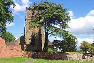
St Peter's Church, Netherseal is a Grade II* listed parish church in the Church of England in Netherseal, Derbyshire.
Colonel Thomas Moody (1779–1849) was a British expert aide-de-camp to the British Colonial Office, geopolitical theorist, Royal Engineer, and colonial merchant.

South Audley Street is a major shopping street in Mayfair, London. It runs north to south from the southwest corner of Grosvenor Square to Curzon Street.


