
Diffwys is a mountain in Snowdonia, Wales, near Barmouth and forms part of the Rhinogydd. On the north side is an exposure of the Caerdion Syncline. It is technically a subsidiary summit of Y Llethr, missing Marilyn status by 2m. It is therefore a sub Marilyn.
Foel Wen is a subsidiary summit of Cadair Berwyn in north east Wales. It is one of the summits found on the most easterly of Cadair Berwyn's long south ridges.

Cadair Bronwen is a mountain in North Wales and forms part of the Berwyn range. To the south are the higher Berwyn summits, including Cadair Berwyn. To the north lies Moel yr Henfaes and Moel Fferna, which top the north end of the Berwyn range. Cadair Bronwen used to be accompanied by a Nuttall top, Cadair Bronwen North-East Top, 700 m (2297 ft). This top was deleted in 2007 after re-surveying.

Butlers Lane railway station serves the northern part of the Four Oaks district of Sutton Coldfield, England. It is sited on the Cross-City Line between Bromsgrove/Redditch and Lichfield Trent Valley, via Birmingham New Street. The station, and all trains calling there, are operated by West Midlands Trains.
Ogilby is a ghost town in Imperial County, California, United States. Ogilby is located on the Southern Pacific Railroad 42 miles (68 km) east of El Centro, and 3.8 miles (6.1 km) north of Interstate 8 on County Road S34. The name is official for federal use, and a feature ID number of 252950 has been assigned. Ogilby is defined by the US Geological Survey as a populated place at 356 feet (109 m) AMSL elevation. NAD27 latitude and longitude are listed at 32°49′01″N114°50′20″W on the "Ogilby, California" 7.5-minute quadrangle (map). It is included in the Imperial County Air Pollution Control District. It lies at an elevation of 364 feet (111 m).

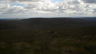
Godor is a top of Cadair Berwyn in north east Wales. It lies as the last summit on a boggy ridge heading south from Cadair Berwyn's summit. The summits of Tomle and Godor North Top are also to be found on the ridge.

Foel Hafod-fynydd is a subsidiary summit of Aran Fawddwy in southern Snowdonia, North Wales, Wales, United Kingdom. It tops the east ridge of Erw y Ddafad-ddu. Creiglyn Dyfi nestles in the bowl between Foel Hafod-fynydd and Aran Fawddwy.

Aran Benllyn is a subsidiary summit of Aran Fawddwy in southern Snowdonia, North Wales, Wales, United Kingdom. It is the second highest peak in the Aran mountain range.

Mynydd Moel is the second highest summit of Cadair Idris in the Snowdonia National Park, in Gwynedd, northwest Wales.

Carnedd y Filiast is a mountain near Cerrigydrudion on the border of the Snowdonia National Park, North Wales and is 669 metres (2,195 ft) high.

Arenig Fach is a mountain in southern Snowdonia, north Wales. It is a peak in the Arenig range and lies to the north of its parent peak Arenig Fawr.

Cyrniau Nod is a mountain summit in north east Wales. It is a former Marilyn, the Marilyn summit now being the nearby Foel Cedig. Its summit has the Snowdonia National Park boundary running through it. A number of rivers and streams rise from near the mountain including Afon Tanat, Afon Cedig and Nant Ystrad-y-Groes.

Pen y Boncyn Trefeilw is a subsidiary summit of Cyrniau Nod in north east Wales. It forms a part of the Berwyn range called the Hirnantau. It has two tops: Stac Rhos and Pen y Cerrig Duon. Pen y Cerrig Duon is now listed as a deleted Nuttall due to re-surveying.

Foel Cwm Sian Llŵyd is a subsidiary summit of Cyrniau Nod in north east Wales. It forms a part of the Berwyn range known as the Hirnantau. Its summit has the Snowdonia National Park boundary running through it, and is the most easterly 2000 ft summit in the park.

Y Groes Fagl is a top of Cyrniau Nod in north east Wales. It forms a part of the Berwyn range known as the Hirnantau. Its summit has the Snowdonia National Park boundary located just to the east of it.
Cefn Gwyntog is a top of Cyrniau Nod in north east Wales. It forms a part of the Berwyn range known as the Hirnantau. Its summit lies just outside the Snowdonia National Park.
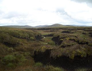
Llechwedd Du is a subsidiary summit of Esgeiriau Gwynion in north Wales. It forms a long peat bog plateau that start at the end of Esgeiriau Gwynion's south ridge, and ends with the higher summit of Moel y Cerrig Duon.

Moel y Cerrig Duon is a subsidiary summit of Esgeiriau Gwynion in Gwynedd in north Wales.

Post Gwyn is a subsidiary summit of Cadair Berwyn in north east Wales. It is the western outpost of the main central Berwyn range. The range also includes the Hirnantau to the west, which are crowned by Cyrniau Nod.
Godor North Top is a top of Cadair Berwyn in north east Wales. It is the lower twin summit of Godor.
