
Malbork is a town in the Pomeranian Voivodeship, Poland. It is the seat of Malbork County and has a population of 37,898 people as of 2021. The town is located on the Nogat river, in the historical region of Pomerelia.
Miastko, is a town in the Middle Pomerania region of northern Poland, administratively located in the Bytów County in the Pomeranian Voivodeship.

VII Dwór, read as Siódmy Dwór, is an administrative district (dzielnica) in the city of Gdańsk, Poland.

Biskupia Górka is a neighbourhood and hill in Gdańsk, Poland, located in the Śródmieście district. Historically, Biskupia Górka had important strategic meaning, since it is a hill close to the main city.

Malchin is a town in the Mecklenburgische Seenplatte district, in Mecklenburg-Western Pomerania, in north-eastern Germany.

Usedom is a town on Usedom Island, in the Vorpommern-Greifswald district in Mecklenburg-Vorpommern, in north-eastern Germany, close to the border with Poland. It is the seat of the Amt Usedom-Süd, to which 14 other communities also belong.

Lübz is a town in the Ludwigslust-Parchim district, in Mecklenburg-Western Pomerania, in north-eastern Germany. It is situated on the river Elde, 12 kilometres (7.5 mi) northeast of Parchim.

Plau am See is a town in the Ludwigslust-Parchim district, in Mecklenburg-Western Pomerania, in north-eastern Germany. It is situated 28 kilometres (17 mi) east of Parchim, and 29 kilometres (18 mi) west of Waren.

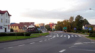
Karlino is a town in Białogard County, West Pomeranian Voivodeship, Poland. It has a population of 5,729 (2004).

Biały Bór is a town in Szczecinek County, West Pomeranian Voivodeship, Poland, with 2,226 inhabitants as of December 2021.

Vollrathsruhe is a municipality in the Mecklenburgische Seenplatte district, in Mecklenburg-Vorpommern, in north-eastern Germany.
Postlow is a municipality in the Vorpommern-Greifswald district, in Mecklenburg-Vorpommern, in north-eastern Germany.

Tychowo is a town in Białogard County, West Pomeranian Voivodeship, in north-western Poland. It is the seat of the gmina called Gmina Tychowo. It lies approximately 20 kilometres (12 mi) south-east of Białogard and 125 km (78 mi) north-east of the regional capital Szczecin. It is located in the historic region of Pomerania.

Skrzydłowo is a village in the administrative district of Gmina Nowa Karczma, within Kościerzyna County, Pomeranian Voivodeship, in northern Poland. It lies approximately 4 kilometres (2 mi) east of Nowa Karczma, 18 km (11 mi) east of Kościerzyna, and 37 km (23 mi) south-west of the regional capital Gdańsk. It is located within the ethnocultural region of Kashubia in the historic region of Pomerania.
Szpęgawa is a village in the administrative district of Gmina Tczew, within Tczew County, Pomeranian Voivodeship, in northern Poland. It lies approximately 2 kilometres (1 mi) east of Tczew and 31 km (19 mi) south of the regional capital Gdańsk. It is located within the ethnocultural region of Kociewie in the historic region of Pomerania.

Dargosław is a village in the administrative district of Gmina Brojce, within Gryfice County, West Pomeranian Voivodeship, in north-western Poland. It lies approximately 5 kilometres (3 mi) north of Brojce, 16 km (10 mi) north-east of Gryfice, and 84 km (52 mi) north-east of the regional capital Szczecin.
Rarwino is a village in the administrative district of Gmina Kamień Pomorski, within Kamień County, West Pomeranian Voivodeship, in north-western Poland. It lies approximately 7 kilometres (4 mi) south-east of Kamień Pomorski and 58 km (36 mi) north of the regional capital Szczecin.

Dobropole is a village in the administrative district of Gmina Wolin, within Kamień County, West Pomeranian Voivodeship, in north-western Poland. It lies approximately 10 kilometres (6 mi) east of Wolin, 14 km (9 mi) south of Kamień Pomorski, and 50 km (31 mi) north of the regional capital Szczecin.

The Gau Pomerania formed on 22 March 1925, was an administrative division of Nazi Germany from 1933 to 1945 comprising the Prussian province of Pomerania. Before that, from 1925 to 1933, it was the regional subdivision of the Nazi Party in that area. Most of the Gau became part of Poland after the Second World War while the remainder became part of what would become East Germany.

Poland–South Africa relations are the bilateral relations between Poland and South Africa. Both nations are members of the United Nations and the World Trade Organization.
