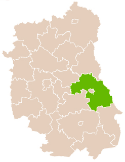
Kurmanów is a village in the administrative district of Gmina Białopole, within Chełm County, Lublin Voivodeship, in eastern Poland. It lies approximately 4 kilometres (2 mi) south of Białopole, 29 km (18 mi) south-east of Chełm, and 88 km (55 mi) east of the regional capital Lublin.
Świerże is a village in the administrative district of Gmina Dorohusk, within Chełm County, Lublin Voivodeship, in eastern Poland, close to the border with Ukraine. It lies approximately 9 kilometres (6 mi) north-west of Dorohusk, 19 km (12 mi) north-east of Chełm, and 82 km (51 mi) east of the regional capital Lublin.
Brzozowiec is a village in the administrative district of Gmina Dubienka, within Chełm County, Lublin Voivodeship, in eastern Poland, close to the border with Ukraine. It lies approximately 5 kilometres (3 mi) south-west of Dubienka, 30 km (19 mi) south-east of Chełm, and 94 km (58 mi) east of the regional capital Lublin.
Janostrów is a village in the administrative district of Gmina Dubienka, within Chełm County, Lublin Voivodeship, in eastern Poland, close to the border with Ukraine. It lies approximately 5 kilometres (3 mi) south-west of Dubienka, 30 km (19 mi) south-east of Chełm, and 94 km (58 mi) east of the regional capital Lublin.
Bielin is a village in the administrative district of Gmina Żmudź, within Chełm County, Lublin Voivodeship, in eastern Poland. It lies approximately 8 kilometres (5 mi) north-east of Żmudź, 23 km (14 mi) south-east of Chełm, and 87 km (54 mi) east of the regional capital Lublin.
Dryszczów is a village in the administrative district of Gmina Żmudź, within Chełm County, Lublin Voivodeship, in eastern Poland. It lies approximately 3 kilometres (2 mi) east of Żmudź, 22 km (14 mi) south-east of Chełm, and 83 km (52 mi) east of the regional capital Lublin.
Gałęzów is a village in the administrative district of Gmina Żmudź, within Chełm County, Lublin Voivodeship, in eastern Poland. It lies approximately 12 kilometres (7 mi) north-east of Żmudź, 24 km (15 mi) east of Chełm, and 88 km (55 mi) east of the regional capital Lublin.
Kazimierówka is a village in the administrative district of Gmina Żmudź, within Chełm County, Lublin Voivodeship, in eastern Poland. It lies approximately 10 kilometres (6 mi) north-east of Żmudź, 23 km (14 mi) south-east of Chełm, and 87 km (54 mi) east of the regional capital Lublin.
Klesztów is a village in the administrative district of Gmina Żmudź, within Chełm County, Lublin Voivodeship, in eastern Poland. It lies approximately 3 kilometres (2 mi) north-east of Żmudź, 20 km (12 mi) south-east of Chełm, and 83 km (52 mi) east of the regional capital Lublin.
Leszczany is a village in the administrative district of Gmina Żmudź, within Chełm County, Lublin Voivodeship, in eastern Poland. It lies approximately 5 kilometres (3 mi) west of Żmudź, 17 km (11 mi) south-east of Chełm, and 77 km (48 mi) east of the regional capital Lublin.
Lipinki is a village in the administrative district of Gmina Żmudź, within Chełm County, Lublin Voivodeship, in eastern Poland. It lies approximately 10 kilometres (6 mi) north-east of Żmudź, 21 km (13 mi) east of Chełm, and 85 km (53 mi) east of the regional capital Lublin.
Pobołowice is a village in the administrative district of Gmina Żmudź, within Chełm County, Lublin Voivodeship, in eastern Poland. It lies approximately 3 kilometres (2 mi) north-west of Żmudź, 17 km (11 mi) south-east of Chełm, and 78 km (48 mi) east of the regional capital Lublin.
Poręb is a village in the administrative district of Gmina Żmudź, within Chełm County, Lublin Voivodeship, in eastern Poland. It is around 15 km south-east of Siedlce and around 100 km east of Warsaw.
Puszcza is a village in the administrative district of Gmina Żmudź, within Chełm County, Lublin Voivodeship, in eastern Poland. It lies approximately 8 kilometres (5 mi) north of Żmudź, 17 km (11 mi) south-east of Chełm, and 81 km (50 mi) east of the regional capital Lublin.
Syczów is a village in the administrative district of Gmina Żmudź, within Chełm County, Lublin Voivodeship, in eastern Poland. It lies approximately 6 kilometres (4 mi) east of Żmudź, 24 km (15 mi) south-east of Chełm, and 87 km (54 mi) east of the regional capital Lublin.
Wólka Leszczańska is a village in the administrative district of Gmina Żmudź, within Chełm County, Lublin Voivodeship, in eastern Poland. It lies approximately 3 kilometres (2 mi) west of Żmudź, 19 km (12 mi) south-east of Chełm, and 79 km (49 mi) east of the regional capital Lublin.
Wołkowiany is a village in the administrative district of Gmina Żmudź, within Chełm County, Lublin Voivodeship, in eastern Poland. It lies approximately 3 kilometres (2 mi) north-west of Żmudź, 17 km (11 mi) south-east of Chełm, and 78 km (48 mi) east of the regional capital Lublin.
Żmudź is a village in Chełm County, Lublin Voivodeship, in eastern Poland. It is the seat of the gmina called Gmina Żmudź. It lies approximately 20 kilometres (12 mi) south-east of Chełm and 81 km (50 mi) east of the regional capital Lublin.
Żmudź-Kolonia is a village in the administrative district of Gmina Żmudź, within Chełm County, Lublin Voivodeship, in eastern Poland.
Małków is a village in the administrative district of Gmina Mircze, within Hrubieszów County, Lublin Voivodeship, in eastern Poland, close to the border with Ukraine. It lies approximately 8 kilometres (5 mi) east of Mircze, 21 km (13 mi) south-east of Hrubieszów, and 122 km (76 mi) south-east of the regional capital Lublin.