Gmina Łagów is a rural gmina in Kielce County, Świętokrzyskie Voivodeship, in south-central Poland. Its seat is the village of Łagów, which lies approximately 35 kilometres (22 mi) east of the regional capital Kielce.
Gmina Nowa Słupia is a rural gmina in Kielce County, Świętokrzyskie Voivodeship, in south-central Poland. Its seat is the village of Nowa Słupia, which lies approximately 34 kilometres (21 mi) east of the regional capital Kielce.

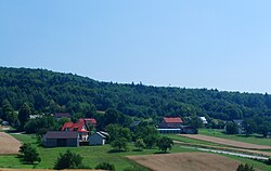
Belno is a village in the administrative district of Gmina Bieliny, within Kielce County, Świętokrzyskie Voivodeship, in south-central Poland. It lies approximately 5 kilometres (3 mi) south-east of Bieliny and 25 km (16 mi) east of the regional capital Kielce.

Bieliny is a village in Kielce County, Świętokrzyskie Voivodeship, in south-central Poland. It is the seat of the gmina called Gmina Bieliny. It lies approximately 21 km (13 mi) east of the regional capital Kielce.
Bieliny Poduchowne is a village in the administrative district of Gmina Bieliny, within Kielce County, Świętokrzyskie Voivodeship, in south-central Poland. It lies approximately 3 kilometres (2 mi) east of Bieliny and 24 km (15 mi) east of the regional capital Kielce.
Czaplów is a village in the administrative district of Gmina Bieliny, within Kielce County, Świętokrzyskie Voivodeship, in south-central Poland. It lies approximately 3 kilometres (2 mi) south-east of Bieliny and 24 km (15 mi) east of the regional capital Kielce.
Górki Napękowskie is a village in the administrative district of Gmina Bieliny, within Kielce County, Świętokrzyskie Voivodeship, in south-central Poland. It lies approximately 3 kilometres (2 mi) south of Bieliny and 23 km (14 mi) east of the regional capital Kielce.
Huta Podłysica is a village in the administrative district of Gmina Bieliny, within Kielce County, Świętokrzyskie Voivodeship, in south-central Poland. It lies approximately 6 kilometres (4 mi) east of Bieliny and 27 km (17 mi) east of the regional capital Kielce.

Kakonin is a village in the administrative district of Gmina Bieliny, within Kielce County, Świętokrzyskie Voivodeship, in south-central Poland. It lies approximately 3 kilometres (2 mi) north of Bieliny and 22 km (14 mi) east of the regional capital Kielce.
Lechów is a village in the administrative district of Gmina Bieliny, within Kielce County, Świętokrzyskie Voivodeship, in south-central Poland. It lies approximately 9 kilometres (6 mi) south-east of Bieliny and 29 km (18 mi) east of the regional capital Kielce.
Makoszyn is a village in the administrative district of Gmina Bieliny, within Kielce County, Świętokrzyskie Voivodeship, in south-central Poland. It lies approximately 7 kilometres (4 mi) south-east of Bieliny and 27 km (17 mi) east of the regional capital Kielce.
Napęków is a village in the administrative district of Gmina Bieliny, within Kielce County, Świętokrzyskie Voivodeship, in south-central Poland. It lies approximately 4 kilometres (2 mi) south of Bieliny and 22 km (14 mi) east of the regional capital Kielce.
Huta Nowa is a village in the administrative district of Gmina Bieliny, within Kielce County, Świętokrzyskie Voivodeship, in south-central Poland. It lies approximately 6 kilometres (4 mi) east of Bieliny and 27 km (17 mi) east of the regional capital Kielce.
Porąbki is a village in the administrative district of Gmina Bieliny, within Kielce County, Świętokrzyskie Voivodeship, in south-central Poland. It lies approximately 3 kilometres (2 mi) north-west of Bieliny and 20 km (12 mi) east of the regional capital Kielce.
Stara Huta-Koszary is a village in the administrative district of Gmina Bieliny, within Kielce County, Świętokrzyskie Voivodeship, in south-central Poland. It lies approximately 8 kilometres (5 mi) east of Bieliny and 28 km (17 mi) east of the regional capital Kielce.
Szklana Huta is a village in the administrative district of Gmina Bieliny, within Kielce County, Świętokrzyskie Voivodeship, in south-central Poland. It lies approximately 8 kilometres (5 mi) east of Bieliny and 29 km (18 mi) east of the regional capital Kielce.
Stara Zbelutka is a village in the administrative district of Gmina Łagów, within Kielce County, Świętokrzyskie Voivodeship, in south-central Poland. It lies approximately 6 kilometres (4 mi) south of Łagów and 39 km (24 mi) south-east of the regional capital Kielce.
Stara Słupia is a village in the administrative district of Gmina Nowa Słupia, within Kielce County, Świętokrzyskie Voivodeship, in south-central Poland. It lies approximately 2 kilometres (1 mi) east of Nowa Słupia and 35 km (22 mi) east of the regional capital Kielce.
Wronów is a village in the administrative district of Gmina Waśniów, within Ostrowiec County, Świętokrzyskie Voivodeship, in south-central Poland. It lies approximately 7 kilometres (4 mi) south-west of Waśniów, 18 km (11 mi) south-west of Ostrowiec Świętokrzyski, and 40 km (25 mi) east of the regional capital Kielce.