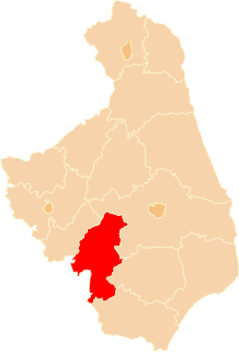
Radziszewo Stare is a village in the administrative district of Gmina Ciechanowiec, within Wysokie Mazowieckie County, Podlaskie Voivodeship, in north-eastern Poland. It lies approximately 9 kilometres (6 mi) east of Ciechanowiec, 29 km (18 mi) south of Wysokie Mazowieckie, and 63 km (39 mi) south-west of the regional capital Białystok.
Wojtkowice Stare is a village in the administrative district of Gmina Ciechanowiec, within Wysokie Mazowieckie County, Podlaskie Voivodeship, in north-eastern Poland. It lies approximately 8 kilometres (5 mi) south of Ciechanowiec, 34 km (21 mi) south of Wysokie Mazowieckie, and 73 km (45 mi) south-west of the regional capital Białystok.
Stare Zalesie is a village in the administrative district of Gmina Czyżew-Osada, within Wysokie Mazowieckie County, Podlaskie Voivodeship, in north-eastern Poland.
Kuczyn is a village in the administrative district of Gmina Klukowo, within Wysokie Mazowieckie County, Podlaskie Voivodeship, in north-eastern Poland. It lies approximately 23 kilometres (14 mi) south of Wysokie Mazowieckie and 62 km (39 mi) south-west of the regional capital Białystok.
Stare Warele is a village in the administrative district of Gmina Klukowo, within Wysokie Mazowieckie County, Podlaskie Voivodeship, in north-eastern Poland. It lies approximately 17 kilometres (11 mi) south of Wysokie Mazowieckie and 54 km (34 mi) south-west of the regional capital Białystok.
Stare Zalesie is a village in the administrative district of Gmina Klukowo, within Wysokie Mazowieckie County, Podlaskie Voivodeship, in north-eastern Poland. It lies approximately 18 kilometres (11 mi) south of Wysokie Mazowieckie and 55 km (34 mi) south-west of the regional capital Białystok.
Stare Wnory is a village in the administrative district of Gmina Kobylin-Borzymy, within Wysokie Mazowieckie County, Podlaskie Voivodeship, in north-eastern Poland. It lies approximately 15 kilometres (9 mi) north of Wysokie Mazowieckie and 41 km (25 mi) west of the regional capital Białystok.
Chojane-Sierocięta is a village in the administrative district of Gmina Kulesze Kościelne, within Wysokie Mazowieckie County, Podlaskie Voivodeship, in north-eastern Poland. It lies approximately 6 kilometres (4 mi) north of Wysokie Mazowieckie and 47 km (29 mi) west of the regional capital Białystok.
Chojane-Stankowięta is a village in the administrative district of Gmina Kulesze Kościelne, within Wysokie Mazowieckie County, Podlaskie Voivodeship, in north-eastern Poland. It lies approximately 6 kilometres (4 mi) north of Wysokie Mazowieckie and 47 km (29 mi) west of the regional capital Białystok.
Nowe Rzepki is a village in the administrative district of Gmina Nowe Piekuty, within Wysokie Mazowieckie County, Podlaskie Voivodeship, in north-eastern Poland. It lies approximately 5 kilometres (3 mi) south-west of Nowe Piekuty, 16 km (10 mi) south-east of Wysokie Mazowieckie, and 47 km (29 mi) south-west of the regional capital Białystok.
Stare Racibory is a village in the administrative district of Gmina Sokoły, within Wysokie Mazowieckie County, Podlaskie Voivodeship, in north-eastern Poland.
Nowe Warele is a village in the administrative district of Gmina Szepietowo, within Wysokie Mazowieckie County, Podlaskie Voivodeship, in north-eastern Poland. It lies approximately 10 kilometres (6 mi) south-east of Szepietowo, 16 km (10 mi) south-east of Wysokie Mazowieckie, and 52 km (32 mi) south-west of the regional capital Białystok.
Stawiereje Podleśne is a village in the administrative district of Gmina Szepietowo, within Wysokie Mazowieckie County, Podlaskie Voivodeship, in north-eastern Poland. It lies approximately 5 kilometres (3 mi) east of Szepietowo, 9 km (6 mi) south-east of Wysokie Mazowieckie, and 47 km (29 mi) south-west of the regional capital Białystok.
Wojny-Pietrasze is a village in the administrative district of Gmina Szepietowo, within Wysokie Mazowieckie County, Podlaskie Voivodeship, in north-eastern Poland. It lies approximately 9 kilometres (6 mi) south of Szepietowo, 15 km (9 mi) south of Wysokie Mazowieckie, and 54 km (34 mi) south-west of the regional capital Białystok.
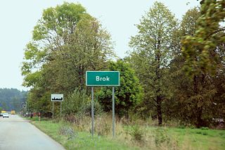
Brok is a village in the administrative district of Gmina Wysokie Mazowieckie, within Wysokie Mazowieckie County, Podlaskie Voivodeship, in north-eastern Poland. It lies approximately 6 kilometres (4 mi) east of Wysokie Mazowieckie and 44 km (27 mi) south-west of the regional capital Białystok.
Jabłonka Kościelna is a village in the administrative district of Gmina Wysokie Mazowieckie, within Wysokie Mazowieckie County, Podlaskie Voivodeship, in north-eastern Poland. It lies approximately 11 kilometres (7 mi) west of Wysokie Mazowieckie and 57 km (35 mi) west of the regional capital Białystok.
Mystki-Rzym is a village in the administrative district of Gmina Wysokie Mazowieckie, within Wysokie Mazowieckie County, Podlaskie Voivodeship, in north-eastern Poland. It lies approximately 3 kilometres (2 mi) south of Wysokie Mazowieckie and 50 km (31 mi) south-west of the regional capital Białystok.
Stare Osipy is a village in the administrative district of Gmina Wysokie Mazowieckie, within Wysokie Mazowieckie County, Podlaskie Voivodeship, in north-eastern Poland.
Wiśniówek-Kolonia is a village in the administrative district of Gmina Wysokie Mazowieckie, within Wysokie Mazowieckie County, Podlaskie Voivodeship, in north-eastern Poland. It lies approximately 6 kilometres (4 mi) west of Wysokie Mazowieckie and 54 km (34 mi) south-west of the regional capital Białystok.
Wólka Duża is a village in the administrative district of Gmina Wysokie Mazowieckie, within Wysokie Mazowieckie County, Podlaskie Voivodeship, in north-eastern Poland. It lies approximately 11 kilometres (7 mi) west of Wysokie Mazowieckie and 59 km (37 mi) south-west of the regional capital Białystok.