Hradčany, the Castle District, is the district of the city of Prague, Czech Republic surrounding Prague Castle.

Staré Hradiště is a village in the Pardubice Region of the Czech Republic, very near to city of Pardubice. It has around 1,200 inhabitants.

Staré Ždánice is a village in the Pardubice Region of the Czech Republic. It has around 600 inhabitants.

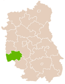
Górecko Stare is a village in the administrative district of Gmina Józefów, within Biłgoraj County, Lublin Voivodeship, in eastern Poland. It lies approximately 6 kilometres (4 mi) north-west of Józefów, 19 km (12 mi) east of Biłgoraj, and 87 km (54 mi) south of the regional capital Lublin.

Stare Króle is a village in the administrative district of Gmina Księżpol, within Biłgoraj County, Lublin Voivodeship, in eastern Poland. It lies approximately 3 kilometres (2 mi) north-east of Księżpol, 13 km (8 mi) south of Biłgoraj, and 92 km (57 mi) south of the regional capital Lublin.

Stare Zalesie is a village in the administrative district of Gmina Wyszki, within Bielsk County, Podlaskie Voivodeship, in north-eastern Poland. It lies approximately 26 kilometres (16 mi) west of Bielsk Podlaski and 38 km (24 mi) south-west of the regional capital Białystok.

Stare Guty German: Gutten is a village in the administrative district of Gmina Grabowo, within Kolno County, Podlaskie Voivodeship, in north-eastern Poland. It lies approximately 14 kilometres (9 mi) north-east of Kolno and 80 km (50 mi) north-west of the regional capital Białystok.
Stare Żochy is a village in the administrative district of Gmina Nowe Piekuty, within Wysokie Mazowieckie County, Podlaskie Voivodeship, in north-eastern Poland.
Stare Krajewo is a village in the administrative district of Gmina Zambrów, within Zambrów County, Podlaskie Voivodeship, in north-eastern Poland.

Stare Wądołki is a village in the administrative district of Gmina Zambrów, within Zambrów County, Podlaskie Voivodeship, in north-eastern Poland.
Stare Zakrzewo is a village in the administrative district of Gmina Zambrów, within Zambrów County, Podlaskie Voivodeship, in north-eastern Poland.

Stare Miasto is a village in the administrative district of Gmina Leżajsk, within Leżajsk County, Subcarpathian Voivodeship, in south-eastern Poland. It lies approximately 3 kilometres (2 mi) north-west of Leżajsk and 41 km (25 mi) north-east of the regional capital Rzeszów.

Stare Oleszyce is a village in the administrative district of Gmina Oleszyce, within Lubaczów County, Subcarpathian Voivodeship, in south-eastern Poland. It lies approximately 3 kilometres (2 mi) west of Oleszyce, 9 km (6 mi) west of Lubaczów, and 73 km (45 mi) east of the regional capital Rzeszów.

Stare Sioło is a village in the administrative district of Gmina Oleszyce, within Lubaczów County, Subcarpathian Voivodeship, in south-eastern Poland. It lies approximately 5 kilometres (3 mi) west of Oleszyce, 11 km (7 mi) west of Lubaczów, and 70 km (43 mi) east of the regional capital Rzeszów.

Świniary Stare is a village in the administrative district of Gmina Łoniów, within Sandomierz County, Świętokrzyskie Voivodeship, in south-central Poland. It lies approximately 3 kilometres (2 mi) south of Łoniów, 22 km (14 mi) south-west of Sandomierz, and 75 km (47 mi) south-east of the regional capital Kielce.

Stare Baraki is a village in the administrative district of Gmina Zaklików, within Stalowa Wola County, Subcarpathian Voivodeship, in south-eastern Poland. It lies approximately 8 kilometres (5 mi) north-west of Zaklików, 25 km (16 mi) north of Stalowa Wola, and 86 km (53 mi) north of the regional capital Rzeszów.

Stare Garkowo is a village in the administrative district of Gmina Szreńsk, within Mława County, Masovian Voivodeship, in east-central Poland. It lies approximately 3 kilometres (2 mi) west of Szreńsk, 22 km (14 mi) south-west of Mława, and 109 km (68 mi) north-west of Warsaw.

Królewo Malborskie is a village in the administrative district of Gmina Stare Pole, within Malbork County, Pomeranian Voivodeship, in northern Poland. It lies approximately 6 kilometres (4 mi) south-west of Stare Pole, 6 km (4 mi) east of Malbork, and 50 km (31 mi) south-east of the regional capital Gdańsk.

Ostrów is a village in the administrative district of Gmina Stare Juchy, within Ełk County, Warmian-Masurian Voivodeship, in northern Poland. It lies approximately 12 kilometres (7 mi) south-west of Stare Juchy, 21 km (13 mi) west of Ełk, and 103 km (64 mi) east of the regional capital Olsztyn.

Stare Wierzchowo is a village in the administrative district of Gmina Szczecinek, within Szczecinek County, West Pomeranian Voivodeship, in north-western Poland. It lies approximately 13 kilometres (8 mi) north of Szczecinek and 146 km (91 mi) east of the regional capital Szczecin.


