Wschowa County is a unit of territorial administration and local government (powiat) in Lubusz Voivodeship, western Poland. It was created in 2002 out of three gminas which previously belonged to Nowa Sól County. Its administrative seat and largest town is Wschowa, which lies 57 km (35 mi) east of Zielona Góra and 126 km (78 mi) south-east of Gorzów Wielkopolski. The county also contains the towns of Sława, lying 18 km (11 mi) north-west of Wschowa, and Szlichtyngowa, 10 km (6 mi) south of Wschowa.
Gmina Sława is an urban-rural gmina in Wschowa County, Lubusz Voivodeship, in western Poland. Its seat is the town of Sława, which lies approximately 18 kilometres (11 mi) north-west of Wschowa and 41 km (25 mi) east of Zielona Góra.
Gmina Szlichtyngowa is an urban-rural gmina in Wschowa County, Lubusz Voivodeship, in western Poland. Its seat is the town of Szlichtyngowa, which lies approximately 10 kilometres (6 mi) south of Wschowa and 57 km (35 mi) south-east of Zielona Góra.

Osowa Sień is a village in the administrative district of Gmina Wschowa, within Wschowa County, Lubusz Voivodeship, in western Poland. It lies approximately 5 kilometres (3 mi) north-east of Wschowa and 59 km (37 mi) east of Zielona Góra.
Cegłówko is a village in the administrative district of Gmina Sława, within Wschowa County, Lubusz Voivodeship, in western Poland.
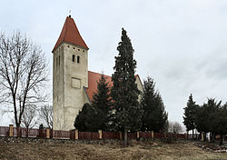
Ciepielówek is a village in the administrative district of Gmina Sława, within Wschowa County, Lubusz Voivodeship, in western Poland.

Ciosaniec is a village in the administrative district of Gmina Sława, within Wschowa County, Lubusz Voivodeship, in western Poland. It lies approximately 9 kilometres (6 mi) north-west of Sława, 25 km (16 mi) north-west of Wschowa, and 37 km (23 mi) east of Zielona Góra.
Dąb is a village in the administrative district of Gmina Sława, within Wschowa County, Lubusz Voivodeship, in western Poland. It lies approximately 6 kilometres (4 mi) north-west of Sława, 23 km (14 mi) north-west of Wschowa, and 36 km (22 mi) east of Zielona Góra.
Głuchów is a settlement in the administrative district of Gmina Sława, within Wschowa County, Lubusz Voivodeship, in western Poland. It lies approximately 6 kilometres (4 mi) south-west of Sława, 21 km (13 mi) west of Wschowa, and 37 km (23 mi) east of Zielona Góra.
Krążkowo is a village in the administrative district of Gmina Sława, within Wschowa County, Lubusz Voivodeship, in western Poland. It lies approximately 10 kilometres (6 mi) south of Sława, 17 km (11 mi) west of Wschowa, and 42 km (26 mi) east of Zielona Góra.
Krępina is a settlement in the administrative district of Gmina Sława, within Wschowa County, Lubusz Voivodeship, in western Poland. It lies approximately 8 kilometres (5 mi) north-west of Sława, 25 km (16 mi) north-west of Wschowa, and 34 km (21 mi) east of Zielona Góra.
Kuźnica Głogowska is a village in the administrative district of Gmina Sława, within Wschowa County, Lubusz Voivodeship, in western Poland. It lies approximately 5 kilometres (3 mi) west of Sława, 21 km (13 mi) west of Wschowa, and 37 km (23 mi) east of Zielona Góra.
Lipinki is a village in the administrative district of Gmina Sława, within Wschowa County, Lubusz Voivodeship, in western Poland. It lies approximately 5 kilometres (3 mi) south-west of Sława, 18 km (11 mi) west of Wschowa, and 40 km (25 mi) east of Zielona Góra.
Łupice is a village in the administrative district of Gmina Sława, within Wschowa County, Lubusz Voivodeship, in western Poland. It lies approximately 10 kilometres (6 mi) north of Sława, 24 km (15 mi) north-west of Wschowa, and 41 km (25 mi) east of Zielona Góra.
Nowe Strącze is a village in the administrative district of Gmina Sława, within Wschowa County, Lubusz Voivodeship, in western Poland. It lies approximately 8 kilometres (5 mi) east of Sława, 11 km (7 mi) north-west of Wschowa, and 48 km (30 mi) east of Zielona Góra.
Przydroże is a settlement in the administrative district of Gmina Sława, within Wschowa County, Lubusz Voivodeship, in western Poland. It lies approximately 9 kilometres (6 mi) south of Sława, 13 km (8 mi) west of Wschowa, and 45 km (28 mi) east of Zielona Góra.
Radzyń is a village in the administrative district of Gmina Sława, within Wschowa County, Lubusz Voivodeship, in western Poland. It lies approximately 3 kilometres (2 mi) south-west of Sława, 20 km (12 mi) north-west of Wschowa, and 38 km (24 mi) east of Zielona Góra.
Śmieszkowo is a village in the administrative district of Gmina Sława, within Wschowa County, Lubusz Voivodeship, in western Poland. It lies approximately 4 kilometres (2 mi) north of Sława, 19 km (12 mi) north-west of Wschowa, and 41 km (25 mi) east of Zielona Góra.
Szreniawa is a village in the administrative district of Gmina Sława, within Wschowa County, Lubusz Voivodeship, in western Poland. It lies approximately 7 kilometres (4 mi) north of Sława, 23 km (14 mi) north-west of Wschowa, and 38 km (24 mi) east of Zielona Góra.
Tarnów Jezierny is a village in the administrative district of Gmina Sława, within Wschowa County, Lubusz Voivodeship, in western Poland. It lies approximately 9 kilometres (6 mi) west of Sława, 25 km (16 mi) west of Wschowa, and 33 km (21 mi) east of Zielona Góra.