
Bashkortostan, officially the Republic of Bashkortostan, also known as Bashkiria, is a republic of Russia located between the Volga and the Ural Mountains in Eastern Europe. The republic borders Perm Krai to the north, Sverdlovsk Oblast to the northeast, Chelyabinsk Oblast to the east, Orenburg Oblast to the south, Tatarstan to the west and Udmurtia to the northwest. It covers 143,600 square kilometres and has a population of 4 million. It is the seventh-most populous federal subject in Russia and the most populous republic. Its capital and largest city is Ufa.

Beloretsk is a town in the Republic of Bashkortostan, Russia, located on the Belaya River, 245 kilometers (152 mi) from Ufa. Population: 68,806 (2010 Census); 71,093 (2002 Census); 72,434 (1989 Census).
The flag of the Republic of Bashkortostan, in the Russian Federation, is one of the official symbols of the Republic of Bashkortostan, alongside the coat of arms and the national anthem of Bashkortostan. The flag has three horizontal stripes. From top to bottom, the stripes are teal blue, white, and green. The flag has been used officially as the flag of the Republic of Bashkortostan since 25 February 1992. The white stripe of the flag is charged with a Kurai flower in the center.
Alsheyevsky District is an administrative and municipal district (raion), one of the fifty-four in the Republic of Bashkortostan, Russia. It is located in the west of the republic. The area of the district is 2,415 square kilometers (932 sq mi). Its administrative center is the rural locality of Rayevsky. As of the 2010 Census, the total population of the district was 43,647, with the population of Rayevsky accounting for 44.8% of that number.

Arkhangelsky District is an administrative and municipal district (raion), one of the fifty-four in the Republic of Bashkortostan, Russia. It is located in the east of the republic. The area of the district is 2,422 square kilometers (935 sq mi). Its administrative center is the rural locality of Arkhangelskoye. As of the 2010 Census, the total population of the district was 18,514, with the population of Arkhangelskoye accounting for 31.4% of that number.

Bakalinsky District is an administrative and municipal district (raion), one of the fifty-four in the Republic of Bashkortostan, Russia. It is located in the west of the republic and borders with Ilishevsky District in the northeast, Chekmagushevsky District in the east, Sharansky District in the south, and with the Republic of Tatarstan in the west and northwest. The area of the district is 1,951 square kilometers (753 sq mi). Its administrative center is the rural locality of Bakaly. As of the 2010 Census, the total population of the district was 28,776, with the population of Bakaly accounting for 33.3% of that number.

Beloretsky District is an administrative and municipal district (raion), one of the fifty-four in the Republic of Bashkortostan, Russia. It is located in the east of the republic and borders with Chelyabinsk Oblast in the north, Uchalinsky District in the east, Abzelilovsky District in the southeast, Burzyansky District in the south, Ishimbaysky District in the southwest, and with Gafuriysky and Arkhangelsky Districts in the west. The area of the district is 11,302.58 square kilometers (4,363.95 sq mi). Its administrative center is the town of Beloretsk. As of the 2010 Census, the total population of the district was 38,442.

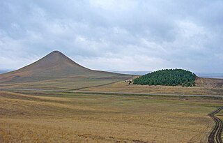
Bizhbulyaksky District is an administrative and municipal district (raion), one of the fifty-four in the Republic of Bashkortostan, Russia. It is located in the west of the republic and borders with Belebeyevsky District in the north, Alsheyevsky District in the northeast, Miyakinsky District in the east, Orenburg Oblast in the south and west, and with Yermekeyevsky District in the northwest. The area of the district is 2,133.9 square kilometers (823.9 sq mi). Its administrative center is the rural locality of Bizhbulyak. As of the 2010 Census, the total population of the district was 26,080, with the population of Bizhbulyak accounting for 24.7% of that number.
Buzdyaksky District is an administrative and municipal district (raion), one of the fifty-four in the Republic of Bashkortostan, Russia. It is located in the west of the republic and borders with Chekmagushevsky District in the north, Blagovarsky District in the east, Davlekanovsky District in the southeast, Belebeyevsky District in the south, Tuymazinsky District in the southwest and west, and with Sharansky District in the west and northwest. The area of the district is 1,632.8 square kilometers (630.4 sq mi). Its administrative center is the rural locality of Buzdyak. As of the 2010 Census, the total population of the district was 30,688, with the population of Buzdyak accounting for 33.6% of that number.

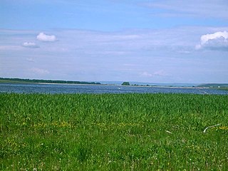
Davlekanovsky District is an administrative and municipal district (raion), one of the fifty-four in the Republic of Bashkortostan, Russia. It is located in the center of the republic and borders with Blagovarsky and Chishminsky Districts in the north, Karmaskalinsky District in the northeast, Aurgazinsky District in the east, Alsheyevsky District in the south, Belebeyevsky District in the west, and with Buzdyaksky District in the northwest. The area of the district is 1,907 square kilometers (736 sq mi). Its administrative center is the town of Davlekanovo. As of the 2010 Census, the total population of the district was 18,392.

Gafuriysky District is an administrative and municipal district (raion), one of the fifty-four in the Republic of Bashkortostan, Russia. It is located in the center of the republic and borders with Arkhangelsky District in the north, Beloretsky District in the east, Ishimbaysky District in the south, Sterlitamaksky District in the southwest, Aurgazinsky District in the west, and with Karmaskalinsky District in the northwest. The area of the district is 3,038.02 square kilometers (1,172.99 sq mi). Its administrative center is the rural locality of Krasnousolsky. As of the 2010 Census, the total population of the district was 33,869, with the population of Krasnousolsky accounting for 35.4% of that number.
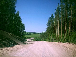
Iglinsky District is an administrative and municipal district (raion), one of the fifty-four in the Republic of Bashkortostan, Russia. It is located in the east of the republic and borders with Nurimanovsky District in the north, Chelyabinsk Oblast in the east, Arkhangelsky District in the south, Karmaskalinsky District in the southwest, Ufimsky District in the west, and with Blagoveshchensky District in the northwest. The area of the district is 2,450 square kilometers (950 sq mi). Its administrative center is the rural locality of Iglino. As of the 2010 Census, the total population of the district was 49,675, with the population of Iglino accounting for 33.8% of that number.

Karmaskalinsky District is an administrative and municipal district (raion), one of the fifty-four in the Republic of Bashkortostan, Russia. It is located in the center of the republic and borders with Ufimsky and Iglinsky Districts in the north, Arkhangelsky District in the east, Gafuriysky District in the southeast, Aurgazinsky District in the south, Alsheyevsky District in the southwest, and with Chishminsky District in the west. The area of the district is 1,750 square kilometers (680 sq mi). Its administrative center is the rural locality of Karmaskaly. As of the 2010 Census, the total population of the district was 51,504, with the population of Karmaskaly accounting for 16.6% of that number.

Kugarchinsky District is an administrative and municipal district (raion), one of the fifty-four in the Republic of Bashkortostan, Russia. It is located in the southwest of the republic and borders Meleuzovsky District in the north, Burzyansky District in the northeast, Zilairsky District in the east, Zianchurinsky District in the south, Orenburg Oblast in the southwest, and Kuyurgazinsky District in the west. The area of the district is 3,371 square kilometers (1,302 sq mi). Its administrative center is the rural locality of Mrakovo. As of the 2010 Census, the total population of the district was 31,444, with the population of Mrakovo accounting for 27.6% of that number.

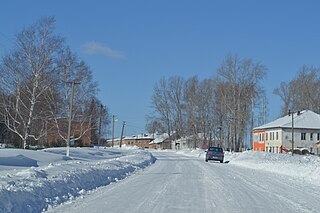
Sharansky District is an administrative and municipal district (raion), one of the fifty-four in the Republic of Bashkortostan, Russia. It is located in the west of the republic and borders with Bakalinsky District in the northwest and north, Chekmagushevsky District in the northeast, Buzdyaksky District in the southeast, Tuymazinsky District in the south, and with the Republic of Tatarstan in the west. The area of the district is 1,384 square kilometers (534 sq mi). Its administrative center is the rural locality of Sharan. As of the 2010 Census, the total population of the district was 22,514, with the population of Sharan accounting for 26.3% of that number.
Tuymazinsky District is an administrative and municipal district (raion), one of the fifty-four in the Republic of Bashkortostan, Russia. It is located in the west of the republic and borders with Sharansky District in the north, Buzdyaksky District in the east, Belebeyevsky District in the southeast and south, Yermekeyevsky District in the south, and with the Republic of Tatarstan in the west. The area of the district is 2,403 square kilometers (928 sq mi). Its administrative center is the town of Tuymazy. As of the 2010 Census, the total population of the district was 64,389.

Yanaulsky District is an administrative and municipal district (raion), one of the fifty-four in the Republic of Bashkortostan, Russia. It is located in the northwest of the republic and borders with Perm Krai in the north, Tatyshlinsky District in the east, Burayevsky District in the southeast, Kaltasinsky District in the south, Krasnokamsky District in the southwest, and with the Udmurt Republic in the west. The area of the district is 2,094 square kilometers (808 sq mi). Its administrative center is the town of Yanaul. As of the 2010 Census, the total population of the district was 21,210.

Rustem Zakievich Khamitov is a Russian politician and engineer who served as the 2nd Head of the Republic of Bashkortostan from 19 July 2010 to 11 October 2018. Khamitov is a member of the United Russia party, and belongs to the party's Supreme Council.

The Government of Bashkortostan is a governing body of Bashkortostan in Russia which exercises executive power under the authority of the Republic Head whom appoints cabinet which is composed of the Prime Minister, the deputy prime ministers, and the ministers that are approved by the governing legislature is the State Assembly.

Zarif Zakirovich Baiguskarov is a Russian political figure, deputy of the 7th and 8th State Duma convocations.


