This article relies largely or entirely on a single source .(March 2012) |
 16 | |
|---|---|
| Route information | |
| Length | 276 km (171 mi) |
| Major junctions | |
| West end | Chawa, Rajasthan |
| East end | Amritia, Rajasthan |
| Location | |
| Districts | Rajasthan: Barmer district, Jalore district, Pali district and Rajsamand district |
| Primary destinations | Sindhari, Jalore, Takhatgarh, Sanderao, Sadri, Desuri |
| Highway system | |
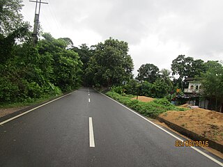
State Highway 16 ( RJ SH 16) is a State Highway in Rajasthan state of India that connects Chawa in Barmer district of Rajasthan with Amritia in Rajsamand district of Rajasthan. The total length of RJ SH 16 is 276 km.

Rajasthan is a state in northern India. The state covers an area of 342,239 square kilometres (132,139 sq mi) or 10.4 percent of the total geographical area of India. It is the largest Indian state by area and the seventh largest by population. Rajasthan is located on the northwestern side of India, where it comprises most of the wide and inhospitable Thar Desert and shares a border with the Pakistani provinces of Punjab to the northwest and Sindh to the west, along the Sutlej-Indus river valley. Elsewhere it is bordered by five other Indian states: Punjab to the north; Haryana and Uttar Pradesh to the northeast; Madhya Pradesh to the southeast; and Gujarat to the southwest.

India, also known as the Republic of India, is a country in South Asia. It is the seventh largest country by area and with more than 1.3 billion people, it is the second most populous country and the most populous democracy in the world. Bounded by the Indian Ocean on the south, the Arabian Sea on the southwest, and the Bay of Bengal on the southeast, it shares land borders with Pakistan to the west; China, Nepal, and Bhutan to the northeast; and Bangladesh and Myanmar to the east. In the Indian Ocean, India is in the vicinity of Sri Lanka and the Maldives, while its Andaman and Nicobar Islands share a maritime border with Thailand and Indonesia.

Barmer District is a district in Rajasthan state of India. It is located in the western part of Rajasthan state forming a part of the Thar Desert. Barmer is the third largest district by area in Rajasthan and fifth largest district in India. Occupying an area of 28,387 km2. Being in the western part of the state, it includes a part of the Thar Desert. Jaisalmer is to the north of this district while Jalore is in its south. Pali and Jodhpur form its eastern border and it shares a border with Pakistan in the west. Partially being a desert, this district has a large variation in temperature. The temperature in summer can rise up to 51 °C and falls near to 0 °C in winter. Luni is the longest river in Barmer district. After travelling a length of almost 500 km, it passes through Jalore and merges in the marshy land of Runn of Kutch. District headquarters is in the town of Barmer. The other major towns in the district are: Balotra, Guda Malani, Baytoo, Siwana, and Chohatan. Recently, a large onshore oil field has been discovered and made functional in Barmer district.
This highway connects National Highway 112 in Chawa to National Highway 8 in Amartiya. Other cities and towns on this highway are: Sindhari, Jalore, Ahore, Takhatgarh, Sanderao, Falna, Bali, Sadri, Desuri and Garbor.
National Highway 112 is a highway in the Indian state of West Bengal. It runs from Barasat to Petrapole border with Bangladesh.

Jalor, also known as granite cityJalore, is a city in Rajasthan state of western India. It is the administrative headquarters of Jalore District.
Takhatgarh is a town in Sumerpur tehsil of Pali District of Rajasthan state in India. The town is one of the nine municipalities in the district, located near the district border. It is only about 150 years old.
From Jalore to Sanderao, this road is being converted into National Highway 325 (India).
Sanderao is a village in Pali district of Rajasthan state in India. It lies 16 km north west of Bali town. It was founded by Yasobhadra in the tenth century. This place was governed by Sisodia rulers of Udaipur. There is a holy 5000 years old pilgrimage " Nimbeshvara Mahadeva ". Many visit Holy Pilgrimage Nimbodanathji Shiva Temple. Sanderao history is incomplete without Sanderao Thakore Family.

National Highway 325 (NH 325) is a National Highway in India that connects Balotra, Rajasthan, with Sanderao, Rajasthan. The total length of NH 325 is 135 kilometres (84 mi). This highway connects NH 25 in Balotra to NH 62 in Sanderao.

