The Western Baseball League was an independent baseball league based in the Western United States and Western Canada. Its member teams were not associated with any Major League Baseball teams. It operated from 1995 to 2002. The league was founded in 1994 by Portland, Oregon businessman Bruce L. Engel. It began play in 1995, with the following teams:

Sonoma County is a county in the U.S. state of California. As of the 2010 United States Census, its population was 483,878. Its county seat and largest city is Santa Rosa. It is to the north of Marin County and the south of Mendocino County. It is west of Napa County and Lake County.

Wine Country is the region of California, in the northern Bay Area, known worldwide as a premium wine-growing region. The region is famed for its wineries, its cuisine,, Michelin star restaurants, boutique hotels, luxury resorts, historic architecture, and culture. Viticulture and wine-making have been practiced in the region since the Spanish missionaries from Mission San Francisco Solano established the first vineyards in 1812.

Sonoma Creek is a 33.4-mile-long (53.8 km) stream in northern California. It is one of two principal drainages of southern Sonoma County, California, with headwaters rising in the rugged hills of Sugarloaf Ridge State Park and discharging to San Pablo Bay, the northern arm of San Francisco Bay. The watershed drained by Sonoma Creek is roughly equivalent to the wine region of Sonoma Valley, an area of about 170 square miles (440 km2). The State of California has designated the Sonoma Creek watershed as a “Critical Coastal Water Resource”. To the east of this generally rectangular watershed is the Napa River watershed, and to the west are the Petaluma River and Tolay Creek watersheds.

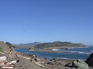
Sonoma Coast State Park is a State of California property in Sonoma County consisting of public access use on lands adjoining the Pacific Ocean. This extent of beach runs from a coastal point about 4 miles (6 km) north of Jenner and continues for approximately 17 miles (27 km) to the south to terminate at Bodega Head. The property lies along State Route 1 and consists of a number of named beaches including Arched Rock Beach, Gleason Beach and Goat Rock Beach. The ecosystem consists of alternating sandy beaches and rocky shoreline, with a marine terrace extending above the entire extent with an upland California coastal prairie habitat.

Copeland Creek is a 9.0-mile-long (14.5 km) perennial stream that rises on Sonoma Mountain in Sonoma County, California.
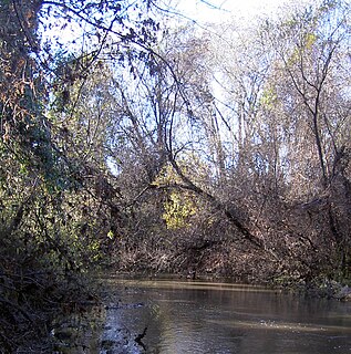
Mark West Creek is a 29.9-mile-long (48.1 km) stream that rises in the Mayacamas Mountains of Sonoma County, California, United States. Tributaries of Mark West Creek include Porter Creek and Hummingbird Creek, both of which originate in the same mountain range. Discharge waters of Mark West Creek reach the Russian River after a confluence with the Laguna de Santa Rosa. The Community Clean Water Institute has developed a program for monitoring pollutants in Mark West Creek.

Rio Dell is an unincorporated community in Sonoma County, California, United States. It is located on the south bank of the Russian River about 2 mi (3 km) north of Forestville. It adjoins Steelhead Beach Regional Park, which provides a beach, picnic area, and a small craft launching area.

Atascadero Creek is an 8.8-mile-long (14.2 km) north-flowing stream in Sonoma County, California, United States, which empties into Green Valley Creek.

Adobe Creek is a southward-flowing stream in Sonoma County, California, United States, which flows past the historic Rancho Petaluma Adobe on the creek's 7.5-mile (12.1 km) course to its confluence with the Petaluma River. It has also been called Casa Grande Creek.

Big Sulphur Creek is a westward-flowing stream in northern Sonoma County, California, United States, which springs from The Geysers in the Mayacamas Mountains and runs 20 miles (32 km) to empty into the Russian River.
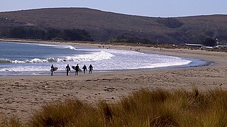
Doran Regional Park is a regional park south of Bodega Bay, California, U.S.A. that is maintained by the Sonoma County Regional Parks Department. It covers an area of 127 acres (51 ha). It is located at 38.314°N 123.0428°W on the sand spit separating Bodega Harbor from Bodega Bay. The park address is 201 Doran Beach Road, Bodega Bay, CA.
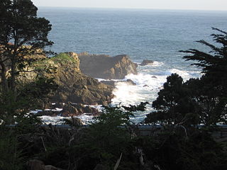
Stillwater Cove Regional Park is a regional park north of Jenner, California, U.S.A. that is maintained by the Sonoma County Regional Parks Department. It is located near the mouth of Stockhoff Creek. Access is by means of State Route 1. It was one of the filming locations for 20th Century Fox's 1947 fantasy film, The Ghost and Mrs. Muir.

Gualala Point Regional Park is a regional park on Gualala Point at the mouth of the Gualala River in Sonoma County, California, south of Gualala. The 103-acre (42 ha) park is maintained by the Sonoma County Regional Parks Department. The park address is 42401 State Route 1, Sea Ranch, California at milepost 58.50.

Russian River State Marine Recreational Management Area (SMRMA) and Russian River State Marine Conservation Area (SMCA) are two adjoining marine protected areas in the Russian River estuary area in Sonoma County, California, on the north-central coast of the state. The combined area of these marine protected areas is 1.21 square miles (3.1 km2), with 0.35 square miles (0.91 km2) in the SMRMA and 0.86 square miles (2.2 km2) in the SMCA.
Sonoma Water, formerly known as the Sonoma County Water Agency, maintains a water transmission system that provides naturally filtered Russian River water to more than 600,000 residents in portions of Sonoma County, California and Marin County, California. The Water Agency is a water wholesaler that sells potable water to nine cities and special districts that in turn sell drinking water to their residents. These cities and special districts are: the City of Santa Rosa, Rohnert Park, Cotati, Petaluma, Sonoma, the Town of Windsor, Valley of the Moon Water District, Marin Municipal Water District, and North Marin Water District.

