Gmina Dębno is a rural gmina in Brzesko County, Lesser Poland Voivodeship, in southern Poland. Its seat is the village of Dębno, which lies approximately 8 kilometres (5 mi) east of Brzesko and 57 km (35 mi) east of the regional capital Kraków.
Jadowniki is a village in the administrative district of Gmina Brzesko, within Brzesko County, Lesser Poland Voivodeship, in southern Poland. It lies approximately 3 kilometres (2 mi) east of Brzesko and 52 km (32 mi) east of the regional capital Kraków.

Jasień is a village in the administrative district of Gmina Brzesko, within Brzesko County, Lesser Poland Voivodeship, in southern Poland. It lies approximately 4 kilometres (2 mi) west of Brzesko and 47 km (29 mi) east of the regional capital Kraków.
Poręba Spytkowska is a village in the administrative district of Gmina Brzesko, within Brzesko County, Lesser Poland Voivodeship, in southern Poland. It lies approximately 6 kilometres (4 mi) south-west of Brzesko and 46 km (29 mi) east of the regional capital Kraków.
Łęki is a village in the administrative district of Gmina Borzęcin, within Brzesko County, Lesser Poland Voivodeship, in southern Poland. It lies approximately 8 kilometres (5 mi) south-west of Borzęcin, 7 km (4 mi) north-east of Brzesko, and 53 km (33 mi) east of the regional capital Kraków.
Biskupice Melsztyńskie is a village in the administrative district of Gmina Czchów, within Brzesko County, Lesser Poland Voivodeship, in southern Poland. It lies approximately 4 kilometres (2 mi) north-east of Czchów, 14 km (9 mi) south-east of Brzesko, and 60 km (37 mi) east of the regional capital Kraków.
Tworkowa is a village in the administrative district of Gmina Czchów, within Brzesko County, Lesser Poland Voivodeship, in southern Poland. It lies approximately 3 kilometres (2 mi) north-west of Czchów, 12 km (7 mi) south of Brzesko, and 57 km (35 mi) south-east of the regional capital Kraków.
Złota is a village in the administrative district of Gmina Czchów, within Brzesko County, Lesser Poland Voivodeship, in southern Poland. It lies approximately 4 kilometres (2 mi) north of Czchów, 12 km (7 mi) south-east of Brzesko, and 59 km (37 mi) east of the regional capital Kraków.
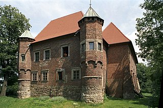
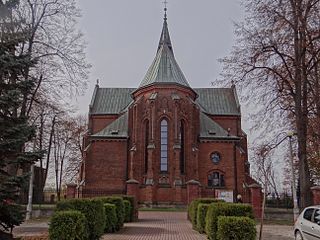
Dębno is a village in Brzesko County, Lesser Poland Voivodeship, in southern Poland. It is the seat of the gmina called Gmina Dębno. It lies approximately 8 kilometres (5 mi) east of Brzesko and 57 km (35 mi) east of the regional capital Kraków.
Jastew is a village in the administrative district of Gmina Dębno, within Brzesko County, Lesser Poland Voivodeship, in southern Poland. It lies approximately 4 kilometres (2 mi) north-west of Dębno, 4 km (2 mi) east of Brzesko, and 54 km (34 mi) east of the regional capital Kraków.
Łysa Góra is a village in the administrative district of Gmina Dębno, within Brzesko County, Lesser Poland Voivodeship, in southern Poland. It lies approximately 5 kilometres (3 mi) south of Dębno, 11 km (7 mi) south-east of Brzesko, and 60 km (37 mi) east of the regional capital Kraków.
Maszkienice is a village in the administrative district of Gmina Dębno, within Brzesko County, Lesser Poland Voivodeship, in southern Poland. It lies approximately 5 kilometres (3 mi) north-west of Dębno, 6 km (4 mi) east of Brzesko, and 54 km (34 mi) east of the regional capital Kraków.
Perła is a village in the administrative district of Gmina Dębno, within Brzesko County, Lesser Poland Voivodeship, in southern Poland. It lies approximately 5 kilometres (3 mi) north-east of Dębno, 10 km (6 mi) east of Brzesko, and 59 km (37 mi) east of the regional capital Kraków.
Porąbka Uszewska is a village in the administrative district of Gmina Dębno, within Brzesko County, Lesser Poland Voivodeship, in southern Poland. It lies approximately 1 kilometre (1 mi) south-east of Dębno, 8 km (5 mi) east of Brzesko, and 58 km (36 mi) east of the regional capital Kraków.
Sufczyn is a village in the administrative district of Gmina Dębno, within Brzesko County, Lesser Poland Voivodeship, in southern Poland. It lies approximately 4 kilometres (2 mi) south-east of Dębno, 11 km (7 mi) east of Brzesko, and 60 km (37 mi) east of the regional capital Kraków.
Wola Dębińska is a village in the administrative district of Gmina Dębno, within Brzesko County, Lesser Poland Voivodeship, in southern Poland. It lies approximately 4 kilometres (2 mi) north of Dębno, 8 km (5 mi) east of Brzesko, and 57 km (35 mi) east of the regional capital Kraków.
Żerków is a village in the administrative district of Gmina Gnojnik, within Brzesko County, Lesser Poland Voivodeship, in southern Poland. It lies approximately 5 kilometres (3 mi) east of Gnojnik, 10 km (6 mi) south of Brzesko, and 56 km (35 mi) east of the regional capital Kraków.
Rylowa is a village in the administrative district of Gmina Szczurowa, within Brzesko County, Lesser Poland Voivodeship, in southern Poland. It lies approximately 3 kilometres (2 mi) south-east of Szczurowa, 16 km (10 mi) north of Brzesko, and 53 km (33 mi) east of the regional capital Kraków.
Kidałowice is a village in the administrative district of Gmina Pawłosiów, within Jarosław County, Subcarpathian Voivodeship, in south-eastern Poland. It lies approximately 2 kilometres (1 mi) east of Pawłosiów, 5 km (3 mi) south of Jarosław, and 48 km (30 mi) east of the regional capital Rzeszów.
Widna Góra is a village in the administrative district of Gmina Pawłosiów, within Jarosław County, Subcarpathian Voivodeship, in south-eastern Poland. It lies approximately 2 kilometres (1 mi) east of Pawłosiów, 5 km (3 mi) south of Jarosław, and 48 km (30 mi) east of the regional capital Rzeszów.


