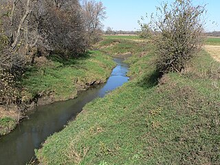
Stevens Creek is a waterway near Lincoln in eastern Nebraska in the Great Plains region of the United States. Stevens Creek is a tributary of Salt Creek which is itself a tributary of the Platte River. [1] [2] [3] [4]

East Fairfield Township is a township in Crawford County, Pennsylvania, United States. It was formed from Fairfield Township in 1869. The population was 922 at the 2010 census.

The Mohawk River is a 149-mile-long (240 km) river in the U.S. state of New York. It is the largest tributary of the Hudson River. The Mohawk flows into the Hudson in Cohoes, New York, a few miles north of the city of Albany. The river is named for the Mohawk Nation of the Iroquois Confederacy. It is a major waterway in north-central New York. The largest tributary, the Schoharie Creek, accounts for over one quarter (26.83%) of the Mohawk River's watershed. Another main tributary is the West Canada Creek, which makes up for 16.33% of the Mohawk's watershed.

The Stillwater River is a 69.3-mile-long (111.5 km) tributary of the Great Miami River in western Ohio in the United States. Via the Great Miami and Ohio rivers, it is part of the Mississippi River watershed.

The Feather River is the principal tributary of the Sacramento River, in the Sacramento Valley of Northern California. The river's main stem is about 73 miles (117 km) long. Its length to its most distant headwater tributary is just over 210 miles (340 km). The main stem Feather River begins in Lake Oroville, where its four long tributary forks join—the South Fork, Middle Fork, North Fork, and West Branch Feather Rivers. These and other tributaries drain part of the northern Sierra Nevada, and the extreme southern Cascades, as well as a small portion of the Sacramento Valley. The total drainage basin is about 6,200 square miles (16,000 km2), with approximately 3,604 square miles (9,330 km2) above Lake Oroville.
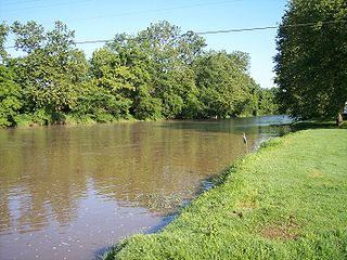
The Walhonding River is a principal tributary of the Muskingum River, 23.5 miles (37.8 km) long, in east-central Ohio in the United States. Via the Muskingum and Ohio Rivers, it is part of the watershed of the Mississippi River. It drains an area of 2,252 square miles (5,830 km2).

The Kokosing River (ko-KO-sing) is a tributary of the Walhonding River, 57.2 miles (92.1 km) long, in east-central Ohio in the United States. Via the Walhonding, Muskingum and Ohio Rivers, it is part of the watershed of the Mississippi River, draining an area of 482 square miles (1248 km²). Etymologically, "Kokosing" translates roughly to "River of Little Owls." The Kokosing River rises in Morrow County, northeast of Mount Gilead, and initially flows southwardly. It turns eastwardly near Chesterville and flows through Knox and Coshocton Counties, passing the communities of Mount Vernon, Gambier and Howard. In western Coshocton County the Kokosing joins the Mohican River to form the Walhonding River, about 2 miles (3 km) northwest of Nellie.
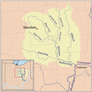
Killbuck Creek is a tributary of the Walhonding River, 81.7 mi (131.5 km) long, in north-central Ohio in the United States. Via the Walhonding, Muskingum and Ohio Rivers, it is part of the watershed of the Mississippi River. It drains an area of 613 mi² (1588 km²).

Wills Creek is a tributary of the Muskingum River, 92.2 mi (148.4 km) long, in eastern Ohio in the United States. Via the Muskingum and Ohio Rivers, it is part of the watershed of the Mississippi River. It drains an area of 853 mi² (2,209 km²).
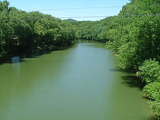
Ohio Brush Creek is a 59.9-mile-long (96.4 km) tributary of the Ohio River in southern Ohio in the United States. Via the Ohio River, it is part of the watershed of the Mississippi River, draining an area of 435 square miles (1,130 km2). According to the Geographic Names Information System, it has also been known historically as "Brush Creek," "Elk Creek," and "Little Scioto River".
Loramie Creek is a 40.0-mile-long (64.4 km) tributary of the Great Miami River in western Ohio in the United States. Via the Great Miami and Ohio rivers, it is part of the watershed of the Mississippi River, draining an area of 265 square miles (690 km2). According to the Geographic Names Information System, the stream has also been known historically as "Laramie Creek," "Loramie Ditch," "Loramies Creek," and "Lonamie Creek." It is named after Louis Lorimier, a French-Canadian fur trader who had a trading post in the area in the 18th century.
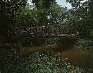
Wakatomika Creek is a tributary of the Muskingum River, 42.6 mi (68.6 km) long, in central Ohio in the United States. Via the Muskingum and Ohio Rivers, it is part of the watershed of the Mississippi River, draining an area of 234 mi² (606 km²)

Chiques Creek is a 31.6-mile-long (50.9 km) tributary of the Susquehanna River in Lebanon and Lancaster counties, Pennsylvania in the United States.
Black Bear Creek is a 116-mile-long (187 km) creek in northern Oklahoma. Black Bear Creek drains an area of 538 square miles (1,390 km2) in Garfield County, Noble County and Pawnee County, Oklahoma. It takes on a red color from the red clay of this area. The creek gets its name from the black bear. Though the area is outside of the range of the black bear, sightings have been rumored.

Greenville Creek is a 44.4-mile-long (71.5 km) tributary of the Stillwater River in southwestern Ohio in the United States. Via the Stillwater River, the Great Miami River, and the Ohio River, its water flows to the Mississippi River and ultimately the Gulf of Mexico. The creek starts in extreme eastern Indiana in Randolph County. It soon flows into Darke County, Ohio, and joins with a tributary that also starts in Indiana, Dismal Creek. It flows through Greenville and Gettysburg before entering Miami County. Near its confluence with the Stillwater River at Covington it drops 20 feet (6.1 m) at Greenville Falls in a glacially-cut gorge that is a state nature preserve.
Rock Creek is a 19.1-mile-long (30.7 km) tributary of the Elkhorn River that flows south of Wisner and enters the Elkhorn one mile west of Beemer. The railway water stop and original plats where the village of Beemer is now located were named "Rock Creek" before Beemer was incorporated as a village in 1886.
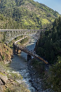
The North Fork Feather River is a watercourse of the northern Sierra Nevada in the U.S. state of California. It flows generally southwards from its headwaters near Lassen Peak to Lake Oroville, a reservoir formed by Oroville Dam in the foothills of the Sierra, where it runs into the Feather River. The river drains about 2,100 square miles (5,400 km2) of the western slope of the Sierras. By discharge, it is the largest tributary of the Feather.
Sweetwater is an unincorporated community in Beaver Township, Buffalo County, Nebraska, United States. It lies along Nebraska Highway 2, half way between Ravenna and Hazard. It is a part of the Kearney, Nebraska Micropolitan Statistical Area. Sweetwater is located on Mud Creek, a tributary of the South Loup River.

Raccoon Creek is a 114-mile-long (183 km) stream that drains parts of five Ohio counties in the United States. It originates in Hocking County, Ohio. It flows through Vinton County and Gallia County and a corner of Meigs County. Its largest tributary, Little Raccoon Creek, arises in Jackson County. The watershed also includes part of Athens County, drained by another tributary, Hewett Fork. The other major tributaries are Elk Fork, located entirely in Vinton County, and Brushy Fork, which is mostly in Vinton County with a small area in Hocking County.
Spring Creek is a 6.0-mile-long (9.7 km) tributary of the Susquehanna River in Dauphin County, Pennsylvania, in the United States.
Pumpkin Creek is a stream in Morrill County and Banner County, Nebraska in the United States.
Coordinates: 40°53′06″N96°36′30″W / 40.8850001°N 96.6083458°W