Stone Meadows

Last updated
Stone Meadows
Crown Meadow, Staffordshire 3.jpg
Crown Meadow
Staffordshire UK location map.svg
Red pog.svg
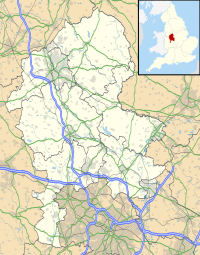
Location in Staffordshire
Location Stone, Staffordshire
OS grid SJ 901 336
Coordinates 52°53′59″N2°8′55″W / 52.89972°N 2.14861°W / 52.89972; -2.14861
Designation Local nature reserve
Website www.staffordbc.gov.uk/stone-meadows

Stone Meadows is a local nature reserve adjacent to Stone, in Staffordshire, England. There are three separate meadows by the River Trent. [1] Goodall Meadow and Southern Meadow are reserves of Stafford Borough Council; Crown Meadow is a reserve of Stone Town Council. [2]

Contents

Description

Goodall Meadow

Also known as the Northern Meadow, at grid reference SJ 896 339 . It is a mostly low-lying area, bisected by a railway line. [1]

Crown Meadow

The central meadow, between the River Trent and the town, at grid reference SJ 901 336 . It was bought in 1889 by John Joule and Sons, along with the Crown Hotel, and it was used by the hotel to exercise horses. It was bought by the Town Council in 1976. [3]

It is an example of a floodplain meadow, most of which have been lost, along with the habitats of associated wildlife, since the 1940s because of changes in farming practices and drainage schemes. It is intended that, by sowing of wildflower seeds in recent years, the flora of a traditional floodplain meadow will be achieved. [3]

Southern Meadow

At grid reference SJ 909 326 . It is a low-lying area on the flood plain of the River Trent. It is mostly grassland. In the south-west there is wet woodland, mostly willow and alder, by two small ponds, with wetland plants including common bistort and marsh marigold. Around the wood is wet grassland, with plants including cuckooflower and meadowsweet. [1]

Related Research Articles

<span class="mw-page-title-main">Durham Wildlife Trust</span> Wildlife conservation charity

Durham Wildlife Trust is a registered charity that was established in 1971, originally as the Durham County Conservation Trust, becoming Durham Wildlife Trust in 1988. The Trust operates across the area of the old County Durham, which includes Darlington, Gateshead, South Tyneside and Sunderland.

<span class="mw-page-title-main">Cotswold Water Park</span> Lake system and park in England

The Cotswold Water Park is the United Kingdom's largest marl lake system, straddling the Wiltshire–Gloucestershire border, north-west of Cricklade and south of Cirencester. There are 180 lakes, spread over 42 square miles (110 km2).

Killay is the name of a suburb and local government community in Swansea, Wales. Killay has its own community council. The village is set high above sea level, about 3.5 miles (5.6 km) west of Swansea city centre. It adjoins the town of Dunvant and the Tycoch area of Swansea. Gowerton lies to the north. The community had a population of 5,702 in 2011.

<span class="mw-page-title-main">Coombe Hill Canal</span> Canal in the United Kingdom

Coombe Hill Canal lies in the Vale of Gloucester, south west England, north of Leigh and runs west 2.75 miles (4.43 km) from Coombe Hill Basin to the River Severn near Wainlode Hill. It opened in 1796 and closed 80 years later in 1876, after the only lock was damaged by flooding. The Gloucestershire Wildlife Trust purchased the Coombe Hill Canal nature reserve in 1985 and the area is managed by the trust. Adjacent to the Coombe Hill Canal is a large area of wet meadowland situated midway between Gloucester and Tewkesbury to the west of the A38, which was purchased by the trust in 1999. There is a north and a south meadow. This land and the Canal itself often flood in winter, which attracts hundreds of wildfowl.

Upper Waterhay Meadow is a 2.8 hectare biological Site of Special Scientific Interest in north Wiltshire, England, notified in 1971. It lies on the Thames floodplain in Ashton Keynes parish, downstream (east) of Ashton Keynes village and west of the town of Cricklade.

<span class="mw-page-title-main">Aiviekste</span> River in Latvia

Aiviekste is a river in Latvia. It begins at Lake Lubāns and drains into the Daugava. Aiviekste is the largest tributary of Daugava in Latvia. Aiviekste, along with the Pededze, forms the unofficial border between two historical Latvian regions Vidzeme and Latgale, although the administrative border was slightly different. The river is 114 kilometers long, with annual drainage 1.81 km³. Aiviekste is about 10-12 thousand years old, formed at the end of the last ice age and nearly after the ice age. Nearly a quarter of the river's flow is unregulated, but most of the river has been excavated, including with explosions.

<span class="mw-page-title-main">Burham Marsh</span>

Burham Marsh nature reserve is an 11 hectare tidal Reed bed on the River Medway 5 miles northwest of Maidstone. It is just east of Snodland but being on the east bank of the river it is accessed via Burham. It is part the Holborough to Wouldham Marshes Site of Special Scientific Interest.

<span class="mw-page-title-main">Ashleworth Ham</span> Biological Site of Special Scientific Interest in Gloucestershire, England

Ashleworth Ham is a 104.73-hectare (258.8-acre) biological Site of Special Scientific Interest. It is a large area of grassland on the Severn floodplain, north of Ashleworth in Gloucestershire, England. It is registered as a Site of Special Scientific Interest and was notified in 1974 and renotified in 1985. Ashleworth Ham received this designation because it is one of three sites in the Severn Vale where migratory waterfowl winter.

<span class="mw-page-title-main">Dowdeswell Reservoir</span>

Dowdeswell Reservoir and former water treatment works lie below the parish of Dowdeswell in Gloucestershire. They were originally built by Cheltenham Corporation to supply the town of Cheltenham with drinking water and subsequently became part of the Severn Trent network.

<span class="mw-page-title-main">Croxall Lakes</span> Quarry lake in Staffordshire, United Kingdom

Croxall Lakes is a nature reserve located between the villages of Croxall and Alrewas, Staffordshire, in the United Kingdom. The nature reserve comprises two lakes and grassland between them. The lakes were formed through the quarrying of sand and gravel deposits, these excavations subsequently flooded and were then restored to create the nature reserve. The site is managed by Staffordshire Wildlife Trust and owned by the National Forest Company. The reserve is an important stop off point for a wide variety of migrating birds due to its location at the meeting point of three rivers, the Trent, Tame and Mease.

<span class="mw-page-title-main">Alam-Pedja Nature Reserve</span> Protected area in Estonia

Alam-Pedja Nature Reserve is the largest nature reserve in Estonia. It is a vast wilderness area which covers 342 km2 and consists of a complex of 5 large bogs separated by unregulated rivers, their floodplains, and extensive forests. The nature reserve aims to protect diverse ecosystems and rare species, mainly through preserving the natural development of forests and bogs and securing the continuing management of semi-natural floodplain grasslands.

Gwent Wildlife Trust (GWT) is a wildlife trust covering the area between the lower Wye and Rhymney rivers which forms the vice county of Monmouthshire in south-east Wales. It is a registered charity and a member of the Wildlife Trusts Partnership.

<span class="mw-page-title-main">Ord River Floodplain</span> Floodplain in Australia

The Ord River floodplain is the floodplain of the lower Ord River in the Shire of Wyndham-East Kimberley, in the Kimberley region of northern Western Australia. It lies within the Victoria Bonaparte IBRA bioregion and contains river, seasonal creek, tidal mudflat and floodplain wetlands, with extensive stands of mangroves, that support saltwater crocodiles and many waterbirds. It is recognised as an internationally important wetland area, with 1,384 square kilometres (534 sq mi) of it designated on 7 June 1990 as Ramsar Site 477 under the Ramsar Convention on Wetlands.

<span class="mw-page-title-main">Gunnersbury Triangle</span> Nature reserve in Ealing and Hounslow, UK

Gunnersbury Triangle is a 2.57-hectare (6.4-acre) local nature reserve in Chiswick, in the London boroughs of Ealing and Hounslow, immediately to the east of Gunnersbury. It was created in 1983 when, for the first time in Britain, a public inquiry ruled that a planned development of the land could not go ahead because of its value for nature. It opened as a nature reserve in 1985.

<span class="mw-page-title-main">Sweetbriar Road Meadows, Norwich</span> Site of Special Scientific Interest in Norwich, England

Sweetbriar Road Meadows is a 9.7-hectare (24-acre) biological Site of Special Scientific Interest in Norwich in Norfolk.

<span class="mw-page-title-main">Frays Farm Meadows</span>

Frays Farm Meadows is a 28.2-hectare (70-acre) biological Site of Special Scientific Interest near Denham in the London Borough of Hillingdon. It was notified as an SSSI in 1981, and has been managed by the London Wildlife Trust on behalf of Hillingdon Council since 1999. It is part of the Colne Valley Regional Park.

Chaceley Meadow is a 1.8-hectare (4.4-acre) biological Site of Special Scientific Interest in Gloucestershire, notified in 1954 and renotified in 1993. It lies on the eastern edge of Chaceley village and is about half a mile west of the River Severn.

<span class="mw-page-title-main">Salmonsbury Meadows SSSI</span> English Site of Special Scientific Interest

Salmonsbury Meadows is an 18-hectare (44-acre) biological and geological Site of Special Scientific Interest in Gloucestershire, notified in 1985. The site is listed in the 'Cotswold District' Local Plan 2001-2011 as a Key Wildlife Site (KWS).

<span class="mw-page-title-main">Severn Ham, Tewkesbury</span>

Severn Ham, Tewkesbury is a 70.82-hectare (175.0-acre) biological Site of Special Scientific Interest in Gloucestershire near Tewkesbury, notified in 1974.

<span class="mw-page-title-main">Khingan Nature Reserve</span> Strict nature reserve in Amur Oblast, Russia

Khingan Nature Reserve is a Russian 'zapovednik', located in the extreme south-east of the Amur River region of the Russian Far East. The reserve covers two types of habitat: the flat Arkharinskaya lowlands with abundant wetlands, and forested spurs of the Lesser Khingan mountains. In particular, Khingan Reserve was created to protect steppe and forest-steppe landscapes, and nesting sites of the endangered Red-crowned crane and the vulnerable White-naped crane. The reserve is situated in the Arkharinsky District of Amur Oblast.

References

  1. 1 2 3 "Stone Meadows" Stafford Borough Council. Retrieved 22 January 2021.
  2. "Sites of Nature Conservation in Stafford Borough" Stafford Borough Council. Retrieved 23 January 2021.
  3. 1 2 Information board by Crown Meadow, June 2021. Image File:Information board at Crown Meadow, Stone.jpg