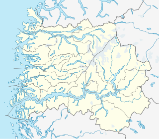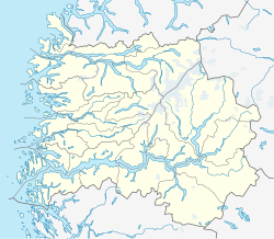
Fjaler is a municipality in the county of Sogn og Fjordane, Norway. It is located in the traditional district of Sunnfjord. The administrative centre is the village of Dale. Other places in Fjaler include Espedal, Flekke, Folkestad, Guddal, and Hellevika.

Dale or Dale i Sunnfjord is the administrative centre of the municipality of Fjaler in Sogn og Fjordane county, Norway. The village is located at the mouth of the river Vassdalselva on the southern shore of the Dalsfjorden in the northern part of Fjaler, about 6.5 kilometres (4.0 mi) northeast of the village of Flekke and about 20 kilometres (12 mi) west of the village of Bygstad.

Tjårdavatnet or Kjårdavatnet (Norwegian) or Čoađgejávri (Northern Sami) is a lake that is located on the border of Norway and Sweden, about 15 kilometres (9.3 mi) south of the village of Elvegård in Norway. The Norwegian side lies in Narvik Municipality in Nordland county and the Swedish side lies in Gällivare Municipality in Norrbotten County. The lake has an area of about 3.63 square kilometres (1.40 sq mi), with 3.5 square kilometres (1.4 sq mi) being in Norway, the tiny remainder is in Sweden.

Ramsgjelvatnet is a lake that lies in the municipality of Beiarn in Nordland county, Norway. The lake is located about 5 kilometres (3.1 mi) northeast of the village of Høyforsmoen and about 15 kilometres (9.3 mi) southeast of the village of Moldjord.

Sausvatnet is a lake that is located in Brønnøy Municipality in Nordland county, Norway. There is also a small village on the eastern shore called Sausvatn. The lake is located about 7 kilometres (4.3 mi) south of the village of Hommelstø and about 15 kilometres (9.3 mi) northwest of the village of Lande.

Kolsvatnet is a lake in the municipality of Valle in Aust-Agder county, Norway. It is located about 14 kilometres (8.7 mi) southwest of the village of Valle and about 15 kilometres (9.3 mi) northwest of the village of Rysstad. The lake is located south of the lake Botnsvatnet, east of the mountain Urddalsknuten, and northeast of the lake Rosskreppfjorden. The lake has an area of 2.72 square kilometres (1.05 sq mi) and sits at an elevation of 1,034 metres (3,392 ft) above sea level.

Nelaug is a lake in the municipalities of Froland and Åmli in Aust-Agder county, Norway. The 10 kilometres (6.2 mi) lake is formed by a dam which regulates a hydroelectric power plant on the Nidelva river. The village of Nelaug is located near the dam in Froland municipality. The lake is located about 11 kilometres (6.8 mi) south of the village of Åmli, about 15 kilometres (9.3 mi) southeast of the village of Dølemo, and about 20 kilometres (12 mi) north of Blakstad.
Veivatnet is a lake in the municipality of Ullensvang in Hordaland county, Norway. The 4.64-square-kilometre (1.79 sq mi) lake lies on the vast Hardangervidda plateau, inside Hardangervidda National Park. It is located about 15 kilometres (9.3 mi) southeast of the village of Lofthus and about 30 kilometres (19 mi) northeast of the town of Odda.

Ytre Øydnavatnet is a lake in the municipality of Audnedal in Vest-Agder county, Norway. The 3.22-square-kilometre (1.24 sq mi) lake is located along the river Audna, just south of the lake Øvre Øydnavatnet. The lake sits at an elevation of 96 metres (315 ft) above sea level. The 17.5-kilometre (10.9 mi) long lake lies about 5.5 kilometres (3.4 mi) south of the village of Byremo and about 3.6 kilometres (2.2 mi) north of the village of Konsmo.

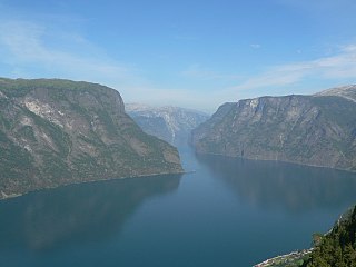
Dalsfjorden is a fjord in Sogn og Fjordane county, Norway. It is located in the municipalities of Askvoll, Fjaler, and Gaular. It is one of the two main fjords that comprise the Sunnfjord region of the county. The fjord is about 40 kilometres (25 mi) long and it is generally about 0.5 to 1 kilometre wide.

Kvammen is a small village located on the south side of the Førdefjorden in Askvoll Municipality in Sogn og Fjordane county, Norway. It is located about 10 kilometres (6.2 mi) north of the village of Dale and about 30 kilometres (19 mi) northeast of the municipal center of Askvoll. The town of Førde and access to the European route E39 highway is 27 kilometres (17 mi) east of Kvammen. The smaller village of Stongfjorden lies about 15 kilometres (9.3 mi) to the west.

Frøya Church is a parish church in Bremanger Municipality in Sogn og Fjordane county, Norway. It is located in the village of Kalvåg, on the southern coast of the small island of Frøya. The church is part of the Frøya parish in the Nordfjord deanery in the Diocese of Bjørgvin.

Bulandet is an archipelago in the sea off the mainland coast of Western Norway. The island group is part of Askvoll Municipality in Sogn og Fjordane county, Norway. It sits about 20 kilometres (12 mi) west of the mainland coast of Askvoll. The islands of Værlandet and Alden lie immediately east of Bulandet. The Geita Lighthouse lies about 10 kilometres (6.2 mi) southeast of Bulandet.

Atløy or Atløyna is an island in Askvoll Municipality in Sogn og Fjordane county, Norway.

Indrevevring is a village in Naustdal Municipality in Sogn og Fjordane county, Norway. The village is located on the northern shore of the Førdefjorden, about 20 kilometres (12 mi) southeast of the village of Stavang and about 10 kilometres (6.2 mi) northwest of the village of Helle. The village of Kvammen lies directly south, across the fjord. The village of Indrevevring had a population (2001) of 143 residents.

Alden is an island in Askvoll Municipality in Sogn og Fjordane County, Norway. The 3.4-square-kilometre (1.3 sq mi) island lies off the mainland coast of the Sunnfjord region. The island sits a few kilometers west of the mouth of the Dalsfjorden, 2 kilometres (1.2 mi) to the east of the Værlandet islands and about 5 kilometres (3.1 mi) west of the island of Atløyna. The residents of the island live on the southern shore of the island. The only access to the island is by boat. There are no regular ferries that stop at the island. The nearest ferry stop is on Værlandet island, about 2.2 kilometres (1.4 mi) to the southwest. The ferry at Værlandet travels to the village of Askvoll about 20 kilometres (12 mi) to the east.

Værlandet is an island in Askvoll Municipality in Sogn og Fjordane county, Norway. The 9-square-kilometre (3.5 sq mi) island lies immediately east of the Bulandet island group. The island of Alden lies about 2 kilometres (1.2 mi) northeast of Værlandet. The island lies about 16 kilometres (9.9 mi) west of the mainland coast of Askvoll, and it is only accessible by boat. There is a regular ferry route connecting Værlandet to the mainland village of Askvoll. There is a series of bridges that connect Værlandet to the islands of Bulandet to the west. Værlandet Chapel is located on the island. The Værlandet LORAN-C transmitter is located on the island.

Holmedal is a village in Askvoll Municipality in Sogn og Fjordane county, Norway. The village is located on the northern shore of the Dalsfjorden, about 7 kilometres (4.3 mi) east of the village of Askvoll. The village was a part of Fjaler municipality before 1990 when it was administratively transferred to Askvoll municipality. The village has some industries, such as knife factory, Helle Fabrikker. Holmedal Church is also located here.


