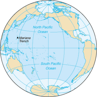
The Pacific Ocean is the largest and deepest of Earth's five oceanic divisions. It extends from the Arctic Ocean in the north to the Southern Ocean in the south, and is bounded by the continents of Asia and Australia in the west and the Americas in the east.
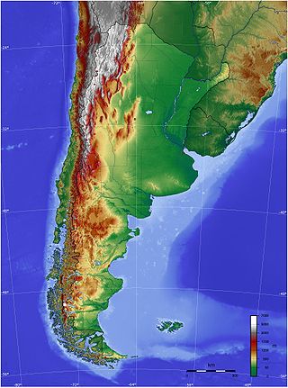
The geography of Argentina is heavily diverse, consisting of the Andes Mountains, pampas, and various rivers and lakes. Bordered by the Andes in the west and the South Atlantic Ocean to the east, its neighbouring countries are Chile to the west, Bolivia and Paraguay to the north, and Brazil and Uruguay to the northeast.

The Southern Hemisphere is the half (hemisphere) of Earth that is south of the Equator. It contains all or parts of five continents and four oceans, as well as New Zealand and most of the Pacific Islands in Oceania. Its surface is 80.9% water, compared with 60.7% water in the Northern Hemisphere, and it contains 32.7% of Earth's land.

The Strait of Magellan, also called the Straits of Magellan, is a navigable sea route in southern Chile separating mainland South America to the north and the Tierra del Fuego archipelago to the south. The strait is considered the most important natural passage between the Atlantic and Pacific oceans. The strait is approximately 570 km long and 2 km wide at its narrowest point. In 1520, the Spanish expedition of the Portuguese navigator Ferdinand Magellan, after whom the strait is named, became the first Europeans to discover it.

Chiloé Island also known as Greater Island of Chiloé, is the largest island of the Chiloé Archipelago off the west coast of Chile, in the Pacific Ocean. The island is located in southern Chile, in the Los Lagos Region.
Riesco Island lies at west of the Brunswick Peninsula, Chile. It is one of the largest islands in Chile, with an area of 5,110 square kilometres (1,970 sq mi). Its highest point is Mount Atalaya at 1,830 metres (6,000 ft). The island is bordered by two large piedmont embayments: Otway Sound and Skyring Sound. The narrow Fitzroy Channel connects both bodies of water and separates the island from mainland Patagonia. The island is separated from the southern part of the Muñoz Gamero Peninsula by another narrow channel, the Geronimo Channel.

The Asia–Pacific (APAC) is the region of the world adjoining the western Pacific Ocean. The region's precise boundaries vary depending on context, but countries and territories in Australasia, East Asia, and Southeast Asia are often included. In a wider context, Central Asia, North Asia, the Pacific Islands, South Asia, West Asia, and even Pacific-adjoining countries in the Americas can be included. For example, the Asia-Pacific Economic Cooperation (APEC) includes five economies in the New World. The term has become popular since the late 1980s in commerce, finance, and politics. Despite the heterogeneity of the regions' economies, most individual nations within the zone are emerging markets experiencing significant growth. Sometimes, the notion of "Asia–Pacific excluding Japan" (APEJ) is considered useful.
The Cordillera Sarmiento is a mountain range located in the Chilean Patagonia to the west of Puerto Natales named after Pedro Sarmiento de Gamboa, who was a Spanish explorer who navigated the region's waterways between 1579 and 1580. It extends in north–south direction on the western shore of the Fjord of the Mountains and parallel to the Cordillera Riesco. The highest mountain in this range is La Dama Blanca, with an elevation of 1,941 m (6,368 ft), which is located at 51°48′S73°24′W. It is a subrange of the Andes and has a number of small glaciers.
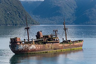
Messier Channel is a channel located in western Patagonia, Chile. It trends north–south between Wellington Island and other Pacific islands and the continent.
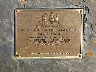
Juan Ladrillero was a 16th-century Spanish navigator and explorer who from 1557 to 1559 explored the coast of Chile from Valdivia to the Barbara Channel. He was the first to navigate the Strait of Magellan from its western entrance to its eastern and back again.
The southern coast of Chile presents a large number of fjords and fjord-like channels from the latitudes of Cape Horn to Reloncaví Estuary. Some fjords and channels are important navigable channels providing access to ports like Punta Arenas, Puerto Chacabuco and Puerto Natales.

SMS Stosch was a Bismarck-class corvette built for the German Imperial Navy in the late 1870s. The ship was named for Admiral Albrecht von Stosch, the first chief of staff of the newly created Imperial Navy. She was the third member of the class, which included five other vessels. The Bismarck-class corvettes were ordered as part of a major naval construction program in the early 1870s, and she was designed to serve as a fleet scout and on extended tours in Germany's colonial empire. Stosch was laid down in November 1875, launched in October 1876, and was commissioned into the fleet in June 1879. She was armed with a battery of ten 15 cm (5.9 in) guns and had a full ship rig to supplement her steam engine on long cruises abroad.

The Bismarck-class corvettes were a class of six corvettes built for the German Kaiserliche Marine in the 1870s. The six ships were Bismarck, Blücher, Stosch, Moltke, Gneisenau, and Stein. The Bismarck-class corvettes were ordered as part of a major naval construction program in the early 1870s, and they were designed to serve as fleet scouts and on extended tours in Germany's colonial empire. The ships were armed with a battery of between ten and sixteen 15 cm (5.9 in) guns and they had a full ship rig to supplement their steam engine on long cruises abroad. One ship, Blücher, was converted into a torpedo testing and training ship shortly after she was completed, having her guns replaced with a variety of torpedo launchers.

The Ladrillero Channel is a strait between Angamos Island and Stosch Island in the Magallanes Region of Chile. It forms, with the Picton Channel and the Fallos Channel, an optional route to the Messier Channel-Grappler Channel-Wide Channel. It has several arms or fiords.

Fallos Channel is a waterway in the Aisen Region of Chile that runs north of Ladrillero Channel between the Little Wellington Island and Prat Island at the east and Campana Island at the west.

Picton Channel is a waterway in the Magallanes Region of Chile that continues southward the Ladrillero Channel, and it runs between the Chipana Island (east) and Mornington Island (Chile) (west).
Francisco Cortés Ojea was a 16th-century Spanish sailor and explorer who took part in the first expeditions sent from the General Captaincy of Chile to the Strait of Magellan. The times and places of his birth and death have not been documented.
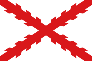
The Governorate of Terra Australis or Governorate of Pedro Sancho de la Hoz was a Spanish Governorate of the Crown of Castile created in 1539 which was granted to Pedro Sánchez de la Hoz and consisted in all the territories to the south of the Strait of Magellan until the South Pole, and, to the east and west, the borders were the ones specified in the treaties of Tordesillas and Zaragoza, respectively.


