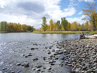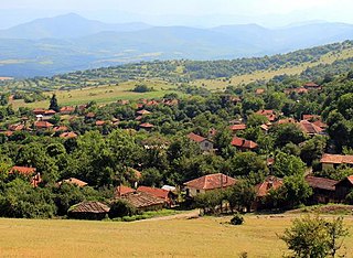
The Big Hole River is a tributary of the Jefferson River, approximately 153 miles (246 km) long, in Beaverhead County, in southwestern Montana, United States. It is the last habitat in the contiguous United States for native fluvial Arctic grayling and is a historically popular destination for fly fishing, especially for trout.

Vratsa Province is a Bulgarian province located in the northwestern part of the country, between Danube river in the north and Stara Planina mountain in the south. It is named after its main town: Vratsa. As of 2016, the province had a population of 170 367, on territory of 3,619.7 km2 (1,397.6 sq mi).

Montana Province is a province in northwestern Bulgaria, bordering Serbia in the southwest and Romania in the north. It spreads its area between the Danube river and the Balkan Mountains. As of February 2011, the province had a population of 148,098, on territory of 3,635.5 km2 (1,403.7 sq mi). It was named after its administrative centre the city of Montana.

Vratsa is the largest city in northwestern Bulgaria and the administrative and economic centre of the municipality of Vratsa and Vratsa district. It is about 112 km north of Sofia, 40 km southeast of Montana.
Berkovitsa is a town and ski resort in northwestern Bulgaria. It is the administrative centre of the homonymous Berkovitsa Municipality, Montana Province and is close to the town of Varshets. As of December 2009, it had a population of 13,917.
Iliochori is one of the Zagori villages in northwest Greece. It is located in the municipal unit of Tymfi in the northern part of the regional unit of Ioannina. According to a local legend, the village was founded as Rasciana, on the river of the same name. However, that site was abandoned because of a lack of drinking water, and the inhabitants scattered to found Iliochori and the nearby town of Laista. Iliochori was traditionally an agricultural village, with husbandry and cultivation of barley and vetch being among its primary areas of economic activity. Viticulture was also prominent, and the village produced a wine, Dobrovino, that gave it its original name. Caravans leaving from Iliochori carried products from the region to the Balkans for trade. The town suffered severe damage in both World War II and the Greek Civil War and lost a large portion of its population during the 1940s as a result.

Varshets is a spa town in Montana Province, northwestern Bulgaria. It is the administrative centre of the homonymous Varshets Municipality. As of December 2019, its population was 5,444. The town is located on the northern slopes of the western part of the Balkan Mountains in the small valley of the Botunya River, at 43°12′N23°17′E, 359 metres above sea level. It is one of the oldest resorts in northern Bulgaria, and is known for its mineral springs, mild mountain climate, and natural environment. The town's tourist infrastructure includes two spa centres, a polyclinic, several rest houses, hotels and also many private lodgings. Varshets has an art gallery, a municipal museum and an Eastern Orthodox church dedicated to Saint George.

Pancharevo is a resort village and district located on the outskirts of Sofia close to Vitosha, Lozenska and Plana mountains and occupies the southeastern part of the Capital Municipality.As of 2011 the village has 3,433 inhabitants, but the district has about 28,000 inhabitants. It is the largest region in Sofia with a total area of 3,647 km2 (1,408 sq mi). It includes the largest artificial lake in Bulgaria Lake Pancharevo, also as Iskar Reservoir and Pasarel Reservoir, located one above the other. The districts consists of 10 villages, and Pancharevo is the municipal seat:

Krivodol is a town in northwestern Bulgaria, part of Vratsa Province. It is the administrative centre of Krivodol municipality, which lies in the western part of Vratsa Province, halfway between Vratsa and Montana and 130 kilometres north of Sofia.
Koynare is a town in northern Bulgaria, part of Cherven Bryag Municipality, Pleven Province. It lies on the left bank of the Iskar River, at one of the river's meanders. As of December 2009, the town had a population of 4,464.
Two of the highest waterfalls in Bulgaria are located near the town of Vratsa, North-West Bulgaria. One is named Skaklia and the other one Borov Kamak. Skaklia is the name of two different waterfalls in Bulgaria. The one near Vratsa is 141 metres and is located 1.5 kilometres south of the town behind the Kaleto hill top 43°10′57″N23°32′59″E. It is considered one of the highest waterfalls in Bulgaria and on the Balkan peninsula. Nevertheless, this remains a debatable question in Bulgaria until today, as this is a semi-active waterfall, not a constant one unlike the 124.5 metres high Raysko Praskalo also situated in Bulgaria. Water falls from the vertical Skaklia cliff when there is heavy raining or after the massive melting of snow at the end of winter or early spring, otherwise little water can be seen from farther distances. When active, however, the waterfall is easy to recognize from tourists standing many kilometres away from it, especially if they approach it from the north-west parts of Bulgaria. In the waterfall area a lot of remains from the ancient Bulgarian village Patleina have been found. Beautiful throughout the entire year it overlooks the town of Vratsa and the Vratsa lowlands. The waterfall is a summit spot of different goat routes. The Skaklia cliff itself is situated in a difficult to reach area and regardless of its clear visibility from the city, remains a difficult spot to reach by the majority of the tourists visiting Vratsa.

Chiprovtsi Municipality is a small frontier municipality (obshtina) in Montana Province, Northwestern Bulgaria, located on the northern slopes of western Stara Planina mountain and the area of the so-called Fore-Balkan. It is named after its administrative centre - the town of Chiprovtsi. In the southwest, the municipality borders on Republic of Serbia.

Brusartsi Municipality is a small municipality (obshtina) in Montana Province, Northwestern Bulgaria, located in the Danubian Plain about 6 km south of Danube river. It is named after its administrative centre - the town of Brusartsi.

Kornitsa is a village in Gotse Delchev Municipality, in Blagoevgrad Province, Bulgaria. It is situated 9 kilometers northwest of Gotse Delchev and 63 kilometers southeast of Blagoevgrad in the foothills of Pirin mountain. The river of Marevo flows through the village.

Berkovitsa Municipality is a municipality (obshtina) in Montana Province, Northwestern Bulgaria, located in the area of the so-called Fore-Balkan to the northern slopes of the western Stara planina mountain. It is named after its administrative centre - the town of Berkovitsa.

Boychinovtsi Municipality is a municipality (obshtina) in Montana Province, Northwestern Bulgaria, located in the transition between the Danubian Plain and the area of the so-called Fore-Balkan. It is named after its administrative centre – the town of Boychinovtsi.

Gorna Bela Rechka is a small village in the northwestern region of Bulgaria, about 25 kilometers from the Serbian border. It belongs to the community of Varshets in the province of Montana. Nothing is known about its history. Montana, the provincial capital, is situated about 36 km to the northwest.

Ledenik is a village in Central North Bulgaria, in the Veliko Tarnovo Municipality, Veliko Tarnovo Province - near the municipal city of Veliko Tarnovo. South of the village passes the river Yantra. The name of the village comes from the fact that it was famous for its ice houses in the past.

The Botunya is a river in northwestern Bulgaria, a right tributary of the Ogosta, itself a right tributary of the Danube. With a length of 69 km, it is the Ogosta's second largest tributary after the Skat.


