Related Research Articles

Conglomerate is a clastic sedimentary rock that is composed of a substantial fraction of rounded to subangular gravel-size clasts. A conglomerate typically contains a matrix of finer-grained sediments, such as sand, silt, or clay, which fills the interstices between the clasts. The clasts and matrix are typically cemented by calcium carbonate, iron oxide, silica, or hardened clay.
The geology of Shropshire is very diverse with a large number of periods being represented at outcrop. The bedrock consists principally of sedimentary rocks of Palaeozoic and Mesozoic age, surrounding restricted areas of Precambrian metasedimentary and metavolcanic rocks. The county hosts in its Quaternary deposits and landforms, a significant record of recent glaciation. The exploitation of the Coal Measures and other Carboniferous age strata in the Ironbridge area made it one of the birthplaces of the Industrial Revolution. There is also a large amount of mineral wealth in the county, including lead and baryte. Quarrying is still active, with limestone for cement manufacture and concrete aggregate, sandstone, greywacke and dolerite for road aggregate, and sand and gravel for aggregate and drainage filters. Groundwater is an equally important economic resource.
In geology, the term Torridonian is the informal name for the Torridonian Group, a series of Mesoproterozoic to Neoproterozoic arenaceous and argillaceous sedimentary rocks, which occur extensively in the Northwest Highlands of Scotland. The strata of the Torridonian Group are particularly well exposed in the district of upper Loch Torridon, a circumstance which suggested the name Torridon Sandstone, first applied to these rocks by James Nicol. Stratigraphically, they lie unconformably on gneisses of the Lewisian complex and their outcrop extent is restricted to the Hebridean Terrane.

The Ecca Group is the second of the main subdivisions of the Karoo Supergroup of geological strata in southern Africa. It mainly follows conformably after the Dwyka Group in some sections, but in some localities overlying unconformably over much older basement rocks. It underlies the Beaufort Group in all known outcrops and exposures. Based on stratigraphic position, lithostratigraphic correlation, palynological analyses, and other means of geological dating, the Ecca Group ranges between Early to earliest Middle Permian in age.
The Triassic Lockatong Formation is a mapped bedrock unit in Pennsylvania, New Jersey, and New York. It is named after the Lockatong Creek in Hunterdon County, New Jersey.
The Enon Formation is a geological formation found in the Eastern and Western Cape provinces in South Africa. It is the lowermost of the four formations found within the Uitenhage Group of the Algoa Basin, its type locality, where it has been measured at a maximum thickness of 480 metres (1,570 ft). Discontinuous outcrops are also found in the Worcester-Pletmos and Oudshoorn-Gamtoos Basins, including isolated occurrences in the Haasvlakte, Jubilee, and Soutpansvlakte Basins near the small town Bredasdorp.

The Straight Cliffs Formation is a stratigraphic unit in the Kaiparowits Plateau of south central Utah. It is Late Cretaceous in age and contains fluvial, paralic, and marginal marine (shoreline) siliciclastic strata. It is well exposed around the margin of the Kaiparowits Plateau in the Grand Staircase – Escalante National Monument in south central Utah. The formation is named after the Straight Cliffs, a long band of cliffs creating the topographic feature Fiftymile Mountain.

The Hebridean Terrane is one of the terranes that form part of the Caledonian orogenic belt in northwest Scotland. Its boundary with the neighbouring Northern Highland Terrane is formed by the Moine Thrust Belt. The basement is formed by Archaean and Paleoproterozoic gneisses of the Lewisian complex, unconformably overlain by the Neoproterozoic Torridonian sediments, which in turn are unconformably overlain by a sequence of Cambro–Ordovician sediments. It formed part of the Laurentian foreland during the Caledonian continental collision.
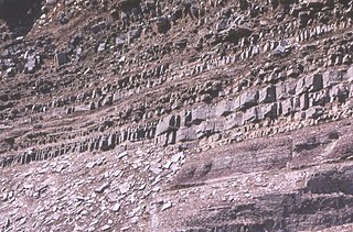
The Longmyndian Supergroup is a 6,000-metre-thick (20,000 ft) sequence of Late Precambrian rocks that outcrop between the Pontesford–Linley Fault System and the Church Stretton Fault System in the Welsh Borderland Fault System. The supergroup consists of two major geological groups, the Stretton Group and the overlying Wentnor Group. The rocks are a generally regressive sequence from basinal facies to clastic sedimentation. The rocks are thought to be derived from Uriconian mountains that were formed during the southward subduction of an oceanic plate beneath a continental block. The rocks have since been folded due to fault movements and plunge gently to the south.

The Great Estuarine Group is a sequence of Middle Jurassic sedimentary rocks deposited in the Inner Hebrides of Scotland. The sedimentary sequence was originally named the 'Great Estuarine Series' by geologist John Wesley Judd in 1878. Sedimentary outcrops occur on Skye, Raasay, Eigg and Muck. It comprises a series of shales, clays, silts, mudstones, and sandstones deposited in two drainage basins: the Inner Hebrides basin and the Sea of the Hebrides basin. The sediments are equivalent in age to the Inferior and Great Oolite Groups found in southern England.

The Wrekin Terrane is one of five inferred fault bounded terranes that make up the basement rocks of the southern United Kingdom. The other notable geological terranes in the region are the Charnwood Terrane, Fenland Terrane, Cymru Terrane and the Monian Composite Terrane. The Wrekin Terrane is bounded to the west by the Welsh Borderland Fault System and to the east by the Malvern Lineament. The geological terrane to the west is the Cymru Terrane and to the east is Charnwood Terrane. The majority of rocks in the area are associated with the outcrops that are evident at the faulted boundaries.
The Wentnor Group is a group of rocks associated with the Longmyndian Supergroup of Precambrian age in present-day Wales, U.K.

The Dox Formation, also known as the Dox Sandstone, is a Mesoproterozoic rock formation that outcrops in the eastern Grand Canyon, Coconino County, Arizona. The strata of the Dox Formation, except for some more resistant sandstone beds, are relatively susceptible to erosion and weathering. The lower member of the Dox Formation consists of silty-sandstone and sandstone, and some interbedded argillaceous beds, that form stair-stepped, cliff-slope topography. The bulk of the Dox Formation typically forms rounded and sloping hill topography that occupies an unusually broad section of the canyon.
The Albert Formation is a stratigraphic unit of Early Mississippian (Tournaisian) age in the Moncton Subbasin of southeastern New Brunswick. It was deposited in a lacustrine environment and includes fossils of fish and land plants, as well as trace fossils. It also includes significant deposits of oil shale. The oil shale beds are the source rocks for the petroleum and natural gas that has been produced from Albert Formation reservoirs at the Stoney Creek and McCully fields. In addition, the solid asphalt-like hydrocarbon albertite was mined from the Albert Formation at Albert Mines between 1854 and 1884.

The Himalayan foreland basin is an active collisional foreland basin system in South Asia. Uplift and loading of the Eurasian Plate on to the Indian Plate resulted in the flexure (bending) of the Indian Plate, and the creation of a depression adjacent to the Himalayan mountain belt. This depression was filled with sediment eroded from the Himalaya, that lithified and produced a sedimentary basin ~3 to >7 km deep. The foreland basin spans approximately 2,000 kilometres (1,200 mi) in length and 450 kilometres (280 mi) in width. From west to east the foreland basin stretches across five countries: Pakistan, India, Nepal, Bangladesh, and Bhutan.

The Bokkeveld Group is the second of the three main subdivisions of the Cape Supergroup in South Africa. It overlies the Table Mountain Group and underlies the Witteberg Group. The Bokkeveld Group rocks are considered to range between Lower Devonian (Lochkovian) to Middle Devonian (Givetian) in age.
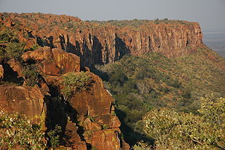
The Omingonde Formation is an Early to Middle Triassic geologic formation, part of the Karoo Supergroup, in the western Otjozondjupa Region and northeastern Erongo Region of north-central Namibia. The formation has a maximum thickness of about 600 metres (2,000 ft) and comprises sandstones, shales, siltstones and conglomerates, was deposited in a fluvial environment, alternating between a meandering and braided river setting.
The geology of Loch Lomond and The Trossachs National Park in the southwestern part of the Scottish Highlands consists largely of Neoproterozoic and Palaeozoic bedrock faulted and folded and subjected to low grade metamorphism during the Caledonian orogeny. These older rocks, assigned to the Dalradian Supergroup, lie to the northwest of the northeast – southwest aligned Highland Boundary Fault which defines the southern edge of the Highlands. A part of this mountainous park extends south of this major geological divide into an area characterised by younger Devonian rocks which are assigned to the Old Red Sandstone.
The geology of Anglesey, the largest (714 km2) island in Wales is some of the most complex in the country. Anglesey has relatively low relief, the 'grain' of which runs northeast–southwest, i.e. ridge and valley features extend in that direction reflecting not only the trend of the late Precambrian and Palaeozoic age bedrock geology but also the direction in which glacial ice traversed and scoured the island during the last ice age. It was realised in the 1980s that the island is composed of multiple terranes, recognition of which is key to understanding its Precambrian and lower Palaeozoic evolution. The interpretation of the island's geological complexity has been debated amongst geologists for decades and recent research continues in that vein.
The geology of the Peak District National Park in England is dominated by a thick succession of faulted and folded sedimentary rocks of Carboniferous age. The Peak District is often divided into a southerly White Peak where Carboniferous Limestone outcrops and a northerly Dark Peak where the overlying succession of sandstones and mudstones dominate the landscape. The scarp and dip slope landscape which characterises the Dark Peak also extends along the eastern and western margins of the park. Although older rocks are present at depth, the oldest rocks which are to be found at the surface in the national park are dolomitic limestones of the Woo Dale Limestone Formation seen where Woo Dale enters Wye Dale east of Buxton.
References
- ↑ http://www.bgs.ac.uk/Lexicon/lexicon.cfm?pub=YST BGS lexicon of named rock units
- 1 2 3 4 5 6 7 8 P. J. Brenchley, P. F. Rawson The Geology of England and Wales, 2006, 2nd Ed
- 1 2 3 4 J. N. Carney, J. M. Horak, et al., Precambrian Rocks of England and Wales, Joint Nature Conservation Committee. Geological Conservation Review Series 20
- ↑ Pharaoh, T.C., Gibbons, W., Precambrian Rocks in England and Wales south of the Menai Strait Fault System, 1987 A Revised Correlation of the Precambrian Rocks in the British Isles
- 1 2 3 4 5 W. Compston, A. E. Wright, P. Toghill, Dating the Late Precambrian volcanicity of England and Wales. 2002, Journal of the Geological Society of London. 159 323-339.
- 1 2 3 4 5 6 7 8 J.C. Pauley, “A revision of the stratigraphy of the Longmyndian Supergroup, Welsh Borderland, and its relationship to the Uriconian Volcanic Complex”, 1991, Geological Journal. 26 167-183