The Sorbian languages are two closely related, but only partially mutually intelligible, West Slavic languages spoken by the Sorbs, a West Slavic minority in the Lusatia region of eastern Germany. They are classified under the West Slavic branch of the Indo-European languages and are therefore closely related to the other two West Slavic subgroups: Lechitic and Czech–Slovak. Historically, the languages have also been known as Wendish or Lusatian. Their collective ISO 639-2 code is wen.

Cottbus is a university city and the second-largest city in Brandenburg, Germany. Situated around 125 km (78 mi) southeast of Berlin, on the River Spree, Cottbus is also a major railway junction with extensive sidings/depots. Although only a small Sorbian minority lives in Cottbus itself, the city is considered as the political and cultural center of the Sorbs in Lower Lusatia.

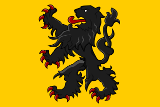
Sorbs are a West Slavic ethnic group predominantly inhabiting Lusatia, a region divided between Germany and Poland. Sorbs traditionally speak the Sorbian languages, which are closely related to Polish, Kashubian, Czech, Silesian, and Slovak. Sorbian is an officially recognized minority language in Germany. Sorbs are genetically closest to the Poles and Czechs.

Lusatia is a historical region in Central Europe, split between Germany and Poland. Lusatia stretches from the Bóbr and Kwisa rivers in the east to the Pulsnitz and Black Elster rivers in the west, and is located within the German states of Saxony and Brandenburg as well as in the Polish voivodeships of Lower Silesia and Lubusz. Lusatia's central rivers are the Spree and the Lusatian Neisse, which constitutes the border between Germany and Poland since 1945. The Lusatian Mountains, separate Lusatia from Bohemia in the south. Lusatia is traditionally divided into Upper Lusatia and Lower Lusatia.
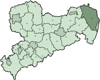
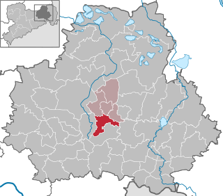
The Niederschlesischer Oberlausitzkreis was the easternmost Kreis (district) of the Free State of Saxony and Germany. Neighboring districts were Löbau-Zittau, Bautzen, Kamenz and the district Spree-Neiße in Brandenburg. The urban district Görlitz was in the east, at the border to Poland.

Bautzen is a hill-top town in eastern Saxony, Germany, and administrative centre of the eponymous district. It is located on the Spree. In 2018 its population was 39,087.
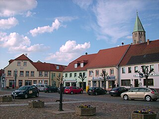
Hoyerswerda is a major district town in the district of Bautzen in the German state of Saxony. It is located in the Sorbian settlement area of Upper Lusatia, a region where some people speak the Sorbian language in addition to German.
Lower Lusatia is a historical region in Central Europe, stretching from the southeast of the German state of Brandenburg to the southwest of Lubusz Voivodeship in Poland. Like adjacent Upper Lusatia in the south, Lower Lusatia is a settlement area of the West Slavic Sorbs whose endangered Lower Sorbian language is related to Upper Sorbian and Polish.

Upper Lusatia is a historical region in Germany and Poland. Along with Lower Lusatia to the north, it makes up the region of Lusatia, named after the Slavic Lusici tribe. Both Lusatias are home to the West Slavic minority group of the Sorbs.

Weißwasser is a town in Upper Lusatia in eastern Saxony, Germany.

Sohland an der Spree is a municipality in the district of Bautzen in Saxony in Germany near the border of the Czech Republic in a region called Lusatia. The river Spree flows through the village. Together with some smaller villages it constitutes one of the biggest villages or communities with about 7,700 inhabitants. The most iconic monument of the village is the "Himmelsbrücke" ; it is said that the bridge will break when someone tells a lie while standing on it.
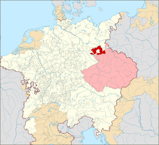
The Margravate of Meissen was a medieval principality in the area of the modern German state of Saxony. It originally was a frontier march of the Holy Roman Empire, created out of the vast Marca Geronis in 965. Under the rule of the Wettin dynasty, the margravate finally merged with the former Duchy of Saxe-Wittenberg into the Saxon Electorate by 1423.

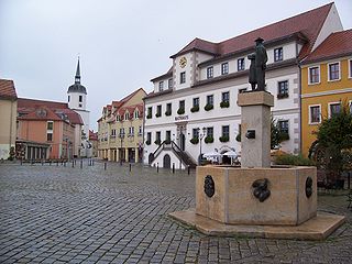
Schirgiswalde is a town and a former municipality in the district of Bautzen in Saxony in Germany. Since 1 January 2011, it is part of the town Schirgiswalde-Kirschau. It is located on the river Spree, 15 km south of Bautzen. The small town is an official place of relaxation. Together with the villages of Crostau and Kirschau it represents the administrative community of Schirgiswalde. Some smaller parts of the town are Neuschirgiswalde upon a hill and Petersbach.
Wittichenau is a bilingual town in the district of Bautzen in the Free State of Saxony, Germany. It is situated on the river Schwarze Elster, 6 km south of Hoyerswerda.

Kirschau is a village and a former municipality in Upper Lusatia in the district of Bautzen in Saxony in Germany. Since 1 January 2011, it is part of the town Schirgiswalde-Kirschau. It is situated in a region called Lausitzer Bergland in the valley of the Spree and the Pilke, between the "Mönchswalderberg" and the "Lärchenberg" and belongs in respects of administration to the district of Bautzen.

The Milceni or Milzeni were a West Slavic tribe, who settled in the present-day Upper Lusatia region. They were first mentioned in the middle of the 9th century AD by the Bavarian Geographer, who wrote of 30 civitates which possibly had fortifications. They were gradually conquered by Germans during the 10th century. Modern descendants of the Milceni are the Sorbs of the Free State of Saxony, Germany.
Panschwitz-Kuckau, in Sorbian Pančicy-Kukow, is a municipality in the district of Bautzen, in Saxony, Germany. It is the site of the well-known monastery Sankt Marienstern.

Kito Lorenc was a Sorbian-German writer, lyric poet and translator. He was a grandson of the Sorbian writer and politician Jakub Lorenc-Zalěski.

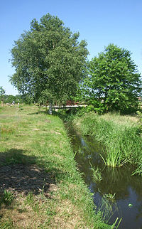
Breiter Graben is a canal in Landkreis Görlitz, Saxony, Germany. It is also known as Flutgraben and runs between the north-western edge of the lignite open-cast mine Nochten and the village of Mulkwitz where it joins the river Struga, a tributary of the river Spree. On its course, it passes north of the village Mühlrose. Its acidic, iron-rich water, originating from an open-cast mine, heavily pollutes Struga river.
The Muskau Heath, is a natural region in Saxony that lies south of the town of Bad Muskau. It has an area of 400 square kilometres.