Related Research Articles

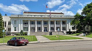
Douglas County is one of the 36 counties in the U.S. state of Oregon. As of the 2020 census, the population was 111,201. The county seat is Roseburg. The county is named after Stephen A. Douglas, an American politician who supported Oregon statehood. Douglas County comprises the Roseburg, OR Micropolitan Statistical Area. In regards to area, Douglas County is the largest county west of the Oregon Cascades.

Roseburg is the most populous city in and the county seat of Douglas County, Oregon. It is located in the Umpqua River Valley in southern Oregon. Founded in 1851, the population was 23,683 at the 2020 census, making it the principal city of the Roseburg, Oregon Micropolitan Statistical Area. The community developed along both sides of the South Umpqua River and is traversed by Interstate 5. Traditionally a lumber industry town, Roseburg was the original home of Roseburg Forest Products, which is now based in nearby Springfield.

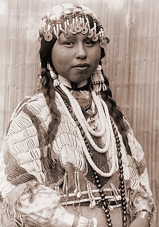
The Siuslaw are an Indigenous people of the Pacific Northwest. Their autonym is sha’yuushtl’a.

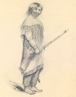
The Umpqua people are an umbrella group of several distinct tribal entities of Native Americans of the Umpqua Basin in present-day south central Oregon in the United States. The area south of Roseburg is now known as the Umpqua Valley.
Cow Creek may refer to:

The Umpqua River on the Pacific coast of Oregon in the United States is approximately 111 miles (179 km) long. One of the principal rivers of the Oregon Coast and known for bass and shad, the river drains an expansive network of valleys in the mountains west of the Cascade Range and south of the Willamette Valley, from which it is separated by the Calapooya Mountains. From its source northeast of Roseburg, the Umpqua flows northwest through the Oregon Coast Range and empties into the Pacific at Winchester Bay. The river and its tributaries flow almost entirely within Douglas County, which encompasses most of the watershed of the river from the Cascades to the coast. The "Hundred Valleys of the Umpqua" form the heart of the timber industry of southern Oregon, generally centered on Roseburg.

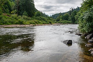
The South Umpqua River is a tributary of the Umpqua River, approximately 115 miles (185 km) long, in southwestern Oregon in the United States. It drains part of the Cascade Range east of Roseburg. The river passes through a remote canyon in its upper reaches then emerges in the populated South Umpqua Valley east of Canyonville.

The Confederated Tribes of the Coos, Lower Umpqua and Siuslaw Indians of Oregon are a federally recognized Native American tribe of Hanis Coos, Miluk Coos, Lower Umpqua, and Siuslaw people in Oregon.
Umpqua Community College (UCC) is a public community college near Roseburg, Oregon. The college has sixteen campus buildings located on 100 acres (40 ha) bordering the North Umpqua River. The campus also features a track, tennis courts, and an outdoor pool. In 2009, a vineyard was added to the campus. About 3,300 full-time students and 16,000 part-time students attend UCC. Umpqua Community College serves the greater Douglas County region with the exception of Reedsport and its immediate area along the Oregon Coast.

The Confederated Tribes of the Grand Ronde Community of Oregon (CTGR) is a federally recognized tribe of Indigenous peoples of the Northwest Plateau. They consist of at least 27 Native American tribes with long historical ties to present-day western Oregon between the western boundary of the Oregon Coast and the eastern boundary of the Cascade Range, and the northern boundary of southwestern Washington and the southern boundary of northern California.
The Confederated Tribes of Siletz Indians in the United States is a federally recognized confederation of more than 27 Native American tribes and bands who once inhabited an extensive homeland of more than 20 million acres from northern California to southwest Washington and between the summit of the Cascades and the Pacific Ocean. After the Rogue River Wars, these tribes were removed to the Coast Indian Reservation, now known as the Siletz Reservation. The tribes spoke at least 11 distinct languages, including Tillamook, Shasta, Lower Chinook, Kalapuya, Takelma, Alsea-Yaquina, Siuslaw/Lower Umpqua, Coos, the Plateau Penutian languages Molala and Klickitat, and several related Oregon Athabaskan languages.

Umpqua National Forest, in southern Oregon's Cascade Range, covers an area of 983,129 acres (3,978.58 km2) in Douglas, Lane, and Jackson counties, and borders Crater Lake National Park. The four ranger districts for the forest are the Cottage Grove, Diamond Lake, North Umpqua, and Tiller ranger districts. The forest is managed by the United States Forest Service, headquartered in Roseburg.

Seven Feathers Casino Resort is a 298-room, AAA three-star hotel and casino located in Canyonville, Oregon, United States. The casino is owned by the Cow Creek Band of Umpqua Tribe of Indians. At 232,500 square feet (21,600 m2), with 68,000 square feet (6,300 m2) of gaming space, it is the largest facility of its kind in Southern Oregon. The resort attracts over one million visitors annually.

The Cow Creek Band of Umpqua Tribe of Indians, known to the Bureau of Indian Affairs (BIA) as the Cow Creek Band of Umpqua Indians of Oregon is a federally recognized Native American tribal government based in Roseburg, Oregon, United States. The tribe takes its name from Cow Creek, a tributary of the South Umpqua River.

Cow Creek is a medium-sized river in southwestern Oregon, a tributary of the South Umpqua River. It drains an area of over 400 square miles (1,000 km2) on the western foothills of the Cascade Range and within the Oregon Coast Range. Although the vast majority of the basin is within Douglas County, a tiny portion in the southeast extends into northern Jackson County.

The Native American peoples of Oregon are the set of Indigenous peoples who have inhabited or who still inhabit the area delineated in today's state of Oregon in the Pacific Northwest region of the United States. While the state of Oregon currently maintains relations with nine federally recognized tribal groups, the state was previously home to a much larger number of autonomous tribal groups, which today either no longer exist or have been absorbed into these larger confederated entities. Six of the nine tribes gained federal recognition in the late 20th century, after undergoing the termination and restoration of their treaty rights starting in the 1950s.
The Western Oregon Indian Termination Act or Public Law 588, was passed in August 1954 as part of the United States Indian termination policy. It called for the termination of federal supervision over the trust and restricted property of numerous Native American bands and small tribes, all located west of the Cascade Mountains in Oregon. The act also called for disposition of federally owned property which had been bought for the administration of Indian affairs, and for termination of federal services which these Indians received under federal recognition. The stipulations in this act were similar to those of most termination acts.

The Walk of Flags, or Walk of the Flags, is located in Willson Park, on the Oregon State Capitol grounds, in Salem, Oregon, United States. It features the flags of the U.S. states, displayed in the order in which they were admitted to the Union.
References
- ↑ "Sue Shaffer, longtime tribal leader, Oregon political figure, dies". oregonlive. Associated Press. April 14, 2017.
- ↑ "Sue Shaffer Memorial Law Clerk Scholarship Established". May 22, 2018.
- 1 2 3 4 5 News-Review, DAN BAIN The (April 12, 2017). "Sue Shaffer, who propelled Cow Creeks into prominence, dies at 94". nrtoday.com.
- ↑ "Shaffer Leaves Lasting Legacy at UCC - Umpqua Community College". umpqua.edu.
- ↑ "Sue Shaffer, longtime Cow Creek tribe chairwoman, dies at 94". AP NEWS. April 13, 2017.