
Southwark is a district of Central London situated on the south bank of the River Thames, forming the north-western part of the wider modern London Borough of Southwark. The district, which is the oldest part of South London, developed due to its position at the southern end of the early versions of London Bridge, for centuries the only dry crossing on the river. Around 43 AD, engineers of the Roman Empire found the geographic features of the south bank here suitable for the placement and construction of the first bridge.

Newington is a district of South London, just south of the River Thames, and part of the London Borough of Southwark. It was an ancient parish and the site of the early administration of the county of Surrey. It was the location of the County of London Sessions House from 1917, in a building now occupied by the Inner London Crown Court.

The London Inner Ring Road, or Ring Road as signposted, is a 12-mile (19 km) route with an average diameter of 2.75–5.5 miles (4.43–8.85 km) formed from a number of major roads that encircle Central London. The ring road forms the boundary of the London congestion charge zone, although the ring road itself is not part of the zone.

Charles Brandon, 1st Duke of Suffolk was an English military leader and courtier. Through his third wife, Mary Tudor, he was brother-in-law to King Henry VIII.
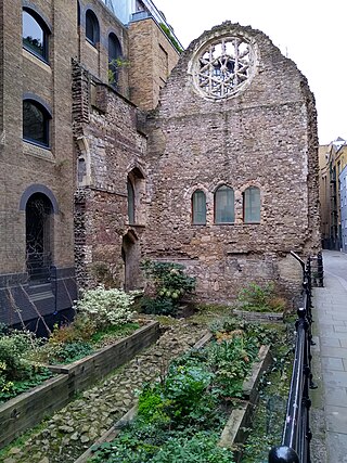
Winchester Palace was a 12th-century bishop's palace that served as the London townhouse of the Bishops of Winchester. It was located in the parish of Southwark in Surrey, on the south bank of the River Thames on what is now Clink Street in the London Borough of Southwark, near St Saviour's Church. Grade II listed remains of the demolished palace survive on the site today, designated a Scheduled Ancient Monument, under the care of English Heritage.
Borough High Street is a road in Southwark, London, running south-west from London Bridge, forming part of the A3 route which runs from London to Portsmouth, on the south coast of England.
The Tabard was an inn in Southwark established in 1307, which stood on the east side of Borough High Street, at the road's intersection with the ancient thoroughfare to Canterbury and Dover. It was built for the Abbot of Hyde in Winchester, who purchased the land to construct a place for himself and his ecclesiastical brethren to stay when on business in London.
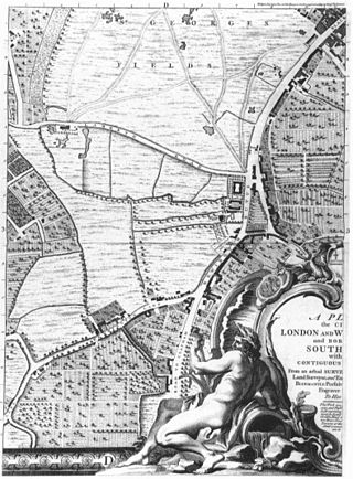
St George's Fields was an area of Southwark in south London, England.
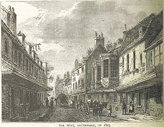
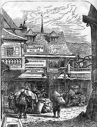
The Mint was a district in Southwark, south London, England, on the west side of Borough High Street, around where Marshalsea Road is now located. It was so named because a mint authorised by King Henry VIII was set up in Suffolk Place, a mansion house, in about 1543. The mint ceased to operate in the reign of Mary I and Suffolk Place was demolished in 1557. In the late-17th and early-18th centuries, the area was known for offering protection against prosecution for debtors due to its legal status as a "liberty", or a jurisdictional interzone.

Arundel House was a London town-house located between the Strand and the River Thames, near the Church of St Clement Danes.

St Mary Bothaw was a parish church in the Walbrook ward of the City of London. It was destroyed in the Great Fire of London in 1666 and not rebuilt. However, some of its materials were used in the rebuilding of St Swithin, London Stone, with which parish it was merged.
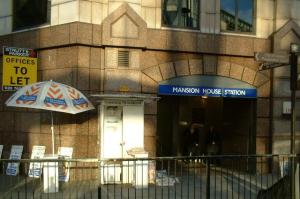
Holy Trinity the Less was a parish church in Knightrider Street in the City of London, destroyed in the Great Fire of London. Following the fire the site was used for a Lutheran church, which was eventually demolished in 1871 to make way for Mansion House underground station.

St John the Evangelist Friday Street was a church in Bread Street Ward of the City of London. It was destroyed in the Great Fire of London of 1666, and not rebuilt, the parish being united with that of All Hallows, Bread Street.
The King's Manor - formally 'The City of London's King's Manor of the Town and Borough of Southwark' - is an institution of the City of London which is not a Livery Company as it is territorially rather than trade based, being the organisation of the Juror freemen of the Court Leet. The Manor covers the area from the western-side of Borough High Street, Southwark, to the borders of Newington and Lambeth. The manor originally lay in Surrey.

Eastminster, also known as New Abbey, St Mary Graces, and other variants, was a Cistercian abbey on Tower Hill at East Smithfield in London.

Sir William Brandon, of Wangford in Suffolk, was an English landowner, administrator, soldier, courtier and politician. His grandson was Charles Brandon, 1st Duke of Suffolk, a courtier and close friend of King Henry VIII.
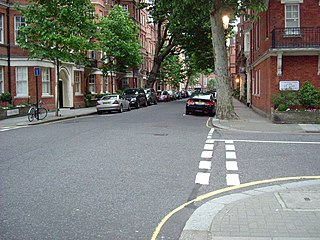
Flood Street is a residential street in Chelsea, London, England. It runs between King's Road to the north and Royal Hospital Road to the south. Just further to the south is the River Thames. The closest tube station is Sloane Square to the northeast. The street commemorates Luke Thomas Flood, a major Chelsea land owner and a benefactor of the poor.
All Saints Church, Wandsworth, is a Grade II* listed church in Wandsworth High Street, London. It is a Church of England parish church, and the original parish church of Wandsworth.
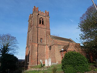
St Luke's Church in Charlton, London, England, is an Anglican parish church in the Diocese of Southwark.

