Related Research Articles
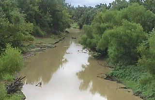
The Poteau River is a 141-mile (227 km) long river located in the U.S. states of Arkansas and Oklahoma. It is the only river in Oklahoma that flows north and is the seventh largest river in the state. It is a tributary of the Arkansas River, which itself is a tributary of the Mississippi River. During the Indian Territory period prior to Oklahoma's statehood (1838-1906), the stream served as the boundary between Skullyville County and Sugar Loaf County, two of the counties making up the Moshulatubbee District of the Choctaw Nation.
The Sequoyah Constitutional Convention was an American Indian-led attempt to secure statehood for Indian Territory as an Indian-controlled jurisdiction, separate from the Oklahoma Territory. The proposed state was to be called the State of Sequoyah.
Kiamitia County, also known as Kiamichi County, was a political subdivision of the Choctaw Nation, Indian Territory. The county formed part of the nation's Pushmataha District, or Third District, one of three administrative super-regions.
Jack's Fork County, also known as Jack Fork County, was a political subdivision of the Choctaw Nation of Indian Territory. The county formed part of the nation's Pushmataha District, or Third District, one of three administrative super-regions.
Jackson County was a political subdivision of the Choctaw Nation of Indian Territory, prior to Oklahoma being admitted as a state. The county formed part of the Nation's Pushmataha District, or Third District, one of three administrative super-regions.
Nashoba County was a political subdivision of the Choctaw Nation of Indian Territory. The county formed part of the Nation’s Apukshunnubbee District, or Second District, one of three administrative super-regions in the Nation. This territory was later made part of the state of Oklahoma.
Blue County was a political subdivision of the Choctaw Nation of Indian Territory, prior to Oklahoma being admitted as a state. The county formed part of the Nation’s Pushmataha District, or Third District, one of three administrative super-regions.

Pushmataha County was a proposed political subdivision created by the Sequoyah Constitutional Convention. The convention, meeting in Muskogee, Indian Territory in 1905, established the political and administrative layout of a prospective U.S. state it called the State of Sequoyah.
Wade County was a political subdivision of the Choctaw Nation of Indian Territory, prior to Oklahoma being admitted as a state. The county formed part of the Nation's Apukshunnubbee District, or First District, one of three administrative super-regions.

Atoka County was a political subdivision of the Choctaw Nation of Indian Territory, prior to Oklahoma being admitted as a state. The county formed part of the Nation's Pushmataha District, or Third District, one of three administrative super-regions.
Towson County was a political subdivision of the Choctaw Nation of Indian Territory, prior to Oklahoma being admitted as a state. The county formed part of the Nation's Apukshunnubbee a District, or Second District, one of three administrative super-regions.
Bok Tuklo County was a political subdivision of the Choctaw Nation of Indian Territory, prior to Oklahoma being admitted as a state. The county formed part of the Nation’s Apukshunnubbee District, or Second District, one of three administrative super-regions. The subdivision was located within the current McCurtain County.
Bok Tuklo County was a political subdivision of the Choctaw Nation of Indian Territory, prior to Oklahoma being admitted as a state. The county formed part of the Nation’s Apukshunnubbee District, or Second District, one of three administrative super-regions.
Eagle County was a political subdivision of the Choctaw Nation of Indian Territory, prior to Oklahoma being admitted as a state. The county formed part of the Nation's Apukshunnubbee District, or Second District, one of three administrative super-regions.
Red River County was a political subdivision of the Choctaw Nation of Indian Territory, prior to Oklahoma being admitted as a state. The county formed part of the Nation's Apukshunnubbee District, or Second District, one of three administrative super-regions.
Skullyville County was a political subdivision of the Choctaw Nation of Indian Territory, prior to Oklahoma being admitted as a state. The county formed part of the Nation's Moshulatubbee District, or First District, one of three administrative super-regions.
Sans Bois County was a political subdivision of the Choctaw Nation of Indian Territory, prior to Oklahoma being admitted as a state. The county formed part of the Nation's Moshulatubbee District, or First District, one of three administrative super-regions.
Gaines County was a political subdivision of the Choctaw Nation of Indian Territory, prior to Oklahoma being admitted as a state. The county formed part of the Nation's Moshulatubbee District, or First District, one of three administrative super-regions.
Tobucksy County was a political subdivision of the Choctaw Nation of Indian Territory, prior to Oklahoma becoming a state. It was part of the Moshulatubbee District, or First District, one of three administrative super-regions.

Pickens County was a political subdivision of the Chickasaw Nation in the Indian Territory from 1855, prior to Oklahoma being admitted as a state in 1907. The county was one of four that comprised the Chickasaw Nation. Following statehood, its territory was divided among several Oklahoma counties that have continued to the present.
References
- ↑ “Organization of Counties in the Choctaw and Chickasaw Nations,” Chronicles of Oklahoma, Vol. 8, No. 3, September 1930, p. 319-320.
- ↑ “Organization of Counties in the Choctaw and Chickasaw Nations,” Chronicles of Oklahoma, Vol. 8, No. 3, September 1930, p. 319-320.
- ↑ Map of the Indian and Oklahoma Territories. Rand McNally and Company, 1892; John W. Morris, Historical Atlas of Oklahoma, Plate 38.
- ↑ Angie Debo, The Rise and Fall of the Choctaw Republic, p. 15; “Organization of Counties in the Choctaw and Chickasaw Nations,” Chronicles of Oklahoma, Vol. 8, No. 3, September 1930, p. 323, 332.
- ↑ Map, “State of Sequoyah,” compiled by the Sequoyah Constitutional Convention, 1905. Amos Maxwell, Sequoyah Constitutional Convention. Meador Publishing Col., 1953. Although the map carried in Wikipedia's article on the State of Sequoyah speaks to the matter of borders, Maxwell's book offers further insight.