Related Research Articles

Murray County is a county located in the southern part of the U.S. state of Oklahoma. As of the 2020 census, the population was 13,904. The county seat is Sulphur. The county was named for William H. Murray, a member and president of the Oklahoma Constitutional Convention and later a Governor of Oklahoma.

Marshall County is a county located on the south central border of Oklahoma. As of the 2020 census, the population was 15,312. Its county seat is Madill. The county was created at statehood in 1907 from the former Pickens County of the Chickasaw Nation. It was named to honor the maiden name of the mother of George Henshaw, a member of the 1906 Oklahoma Constitutional Convention. The county and its cities are part of the Texoma region.

Johnston County is a county located in the U.S. state of Oklahoma. As of the 2020 census, the population was 10,272. Its county seat is Tishomingo. It was established at statehood on November 16, 1907, and named for Douglas H. Johnston, a governor of the Chickasaw Nation.

Bryan County is a county in the U.S. state of Oklahoma. As of the 2020 census, the population was 46,067. Its county seat is Durant. It is the only county in the United States named for Democratic politician William Jennings Bryan.

Mill Creek is a town in Johnston County, Oklahoma, United States. The population was 319 at the 2010 census, a decline from the figure of 340 in 2000. Mill Creek Community is an unincorporated area of Johnston County that surrounds the town and claims to have about 1,000 residents, including those who live within the town limits. Local residents consider the town as the focal point of the community.

Sulphur is a city in and county seat of Murray County, Oklahoma, United States. The population was 5,065 at the 2020 census, a 2.8 percent gain over the figure of 4,929 in 2010. The area around Sulphur has been noted for its mineral springs, since well before the city was founded late in the 19th century. The city received its name from the presence of sulfur in the water.

Okmulgee is a city in, and the county seat of, Okmulgee County, Oklahoma, United States, and is part of the Tulsa Metropolitan Area. The name is from the Mvskoke word okimulgee, which means "boiling waters". The site was chosen because of the nearby rivers and springs. Okmulgee is 38 miles south of Tulsa and 13 miles north of Henryetta via US-75.

The St. Louis–San Francisco Railway, commonly known as the "Frisco", was a railroad that operated in the Midwest and South Central United States from 1876 to November 21, 1980. At the end of 1970, it operated 4,547 miles (7,318 km) of road on 6,574 miles (10,580 km) of track, not including subsidiaries Quanah, Acme and Pacific Railway and the Alabama, Tennessee and Northern Railroad; that year, it reported 12,795 million ton-miles of revenue freight and no passengers. It was purchased and absorbed into the Burlington Northern Railroad in 1980. Despite its name, it never came close to San Francisco.

Chickasaw National Recreation Area is a national recreation area in the foothills of the Arbuckle Mountains in south-central Oklahoma near Sulphur in Murray County. It includes the former Platt National Park and Arbuckle Recreation Area.
Boggy Depot is a ghost town and Oklahoma State Park that was formerly a significant city in the Indian Territory. It grew as a vibrant and thriving town in present-day Atoka County, Oklahoma, United States, and became a major trading center on the Texas Road and the Butterfield Overland Mail route between Missouri and San Francisco. After the Civil War, when the MKT Railroad came through the area, it bypassed Boggy Depot and the town began a steady decline. It was soon replaced by Atoka as the chief city in the area. By the early 20th century, all that remained of the community was a sort of ghost town.
The Kansas, Oklahoma and Gulf Railway (“KO&G”) had at its height 310.5 miles of track from Denison, Texas through Oklahoma to Baxter Springs, Kansas. Its various predecessor companies built the line between 1904 and 1913. The railroad was consolidated into a Missouri Pacific Railroad subsidiary—the Texas and Pacific Railway—in 1963.
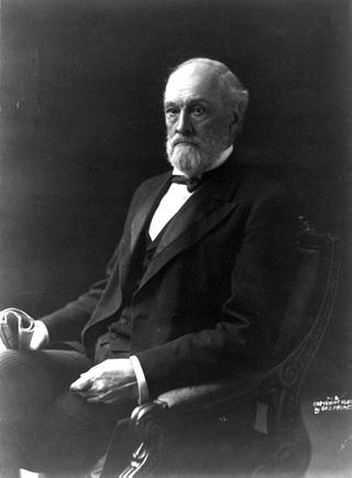
Orville Hitchcock Platt was a United States senator from Connecticut. Platt was a prominent conservative Republican and by the 1890s he became one of the "big four" key Republicans who largely controlled the major decisions of the Senate, along with William B. Allison of Iowa, John Coit Spooner of Wisconsin and Nelson W. Aldrich of Rhode Island.
The Choctaw, Oklahoma and Gulf Railroad (CO&G), known informally as the "Choctaw Route," was an American railroad in the states of Arkansas and Oklahoma.

The Fort Worth and Rio Grande Railway, chartered under the laws of Texas on June 1, 1885, was part of a plan conceived by Buckley Burton Paddock and other Fort Worth civic leaders to create a transcontinental route linking New York, Fort Worth, and the Pacific port of Topolobampo, which they believed would stimulate the growth and development of southwest Texas in general, and the economy of Fort Worth in particular.
The Miami Mineral Belt Railroad (MMBR) served the Miami and Picher lead mining areas in that portion of the Tri-state mining district located in far northeastern Oklahoma. It was closely associated with the St. Louis-San Francisco Railway (Frisco) for its entire history, and was eventually absorbed into the Frisco.
The Oklahoma City and Western Railroad, together with its affiliate the Oklahoma City and Texas Railroad, built a line from Oklahoma City through Lawton, Oklahoma and on to Quanah, Texas in the 1901-1903 timeframe. By the time of its completion, the line was owned by the St. Louis-San Francisco Railway (Frisco), and all assets were absorbed into the Frisco in 1907.
The Eastern Oklahoma Railway was incorporated under the laws of Oklahoma Territory on July 24, 1899. The railroad constructed much of its own track. This included Guthrie junction to Cushing junction, 47.9 miles, in the 1900-1902 timeframe; Ripley to Esau Junction, 40.4 miles, also in the 1900-1902 timeframe; Newkirk to Pauls Valley, 182.5 miles, in the 1900-1904 timeframe; and, Davis to Sulphur, 9.3 miles, in 1906.
The Ozark and Cherokee Central Railway (O&CC) was formed under the name of the North Arkansas & Western Railway in 1899. At its maximum, it owned a standard gauge, single track line running between Fayetteville, Arkansas and Okmulgee, Oklahoma. Its assets were merged into the St. Louis and San Francisco Railway (Frisco) in 1907.
The St. Louis, San Francisco and New Orleans Railroad ran from Hope, Arkansas to a point near Ardmore, Oklahoma, and encompassed about 219 miles of track including a branch line. It existed from 1895 to 1907, when its assets were taken over by the St. Louis-San Francisco Railway (“Frisco”).
The predecessor rail lines which eventually came together as the Northeast Oklahoma Railroad (“NEO”) started as early as 1906, with some routes continuing until NEO was merged into the St. Louis-San Francisco Railroad (“Frisco”) in 1967. At its maximum, NEO ran approximately 34 miles of track in the area of the Tri-state mining district of southeast Kansas, northeast Oklahoma and southwest Missouri, although NEO itself only had operations in Kansas and Oklahoma.
References
- 1 2 3 4 5 6 "Chickasaw National Recreation Area". Constance A. Rudd, Oklahoma Historical Society. Retrieved November 1, 2021.
- 1 2 "A History of Platt National Park" (PDF). Perry E. Brown, Superintendent, February 1956 (accessed on National Park Service History Electronic Library website). Retrieved November 2, 2021.
- 1 2 3 4 "Sulphur Springs Railway Company". Dennis Muncrief, OKGenWeb, June 2001. Retrieved November 1, 2021.
- ↑ "Scullin, Oklahoma". Google Maps. Retrieved November 2, 2021.
- ↑ "Sulphur Springs Railway". Railroads of Oklahoma, June 6, 1870-April 1, 1978, p. 81. Retrieved November 1, 2021.
- ↑ The Historical Guide to North American Railroads. Kalmbach Books. 2000. p. 409.