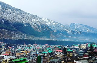
Manali is a town, near Kullu town in Kullu district in the Indian state of Himachal Pradesh. It is situated in the northern end of the Kullu Valley, formed by the Beas River. The town is located in the Kullu district, approximately 270 kilometres (170 mi) north of the state capital of Shimla and 544 kilometres (338 mi) northeast of the national capital of New Delhi. With a population of 8,096 people recorded in the 2011 Indian census Manali is the beginning of an ancient trade route through Lahaul (H.P.) and Ladakh, over the Karakoram Pass and onto Yarkand and Hotan in the Tarim Basin of China. Manali is a popular tourist destination in India and serves as the gateway to the Lahaul and Spiti district as well as the city of Leh in Ladakh.

Chitrakoot is a pilgrimage centre and a nagar panchayat in the Satna district in the state of Madhya Pradesh, India. Connected to the Indian epic Ramayana, it is a place of religious, cultural, historical and archaeological importance, situated in the Baghelkhand region. It borders the Chitrakoot district in Uttar Pradesh, whose headquarters Chitrakoot Dham is located nearby. The city lies in the historical Chitrakoot region, which is divided between the present-day Indian states of Uttar Pradesh and Madhya Pradesh. It is known for a number of temples and sites mentioned in Hindu scriptures.

Una is a City and a Municipal Council in Una district in the Indian state of Himachal Pradesh. It serves as the headquarters of Una district. There are 11 wards under Municipal Council. Una City is home to the Kila, which is a historical fort and an ancestral home of the descendants of the first guru of the Sikhs, Guru Nanak.

Yamunanagar district is one of the 22 districts of the Indian state of Haryana. The district came into existence on 1 November 1989 and occupies an area of 1,756 square kilometres (678 sq mi). Yamunanagar town is the district headquarters.

Bilaspur State or Kahlur State, sometimes Kahloor Riyasat, was a kingdom (697–1849) and later princely state (1849–1948) in the Punjab Province ruled by a separate branch of Chandravanshi Chandel rajput dynasty. Raja Bir Chand 697–730 was the founder of the state but it was named Kahlur only after the Construction of Kahlur Fort by Raja Kahal Chand around 890–930CE and Raja Anand Chand the 44th Raja was the last ruler.

Gopalganj is a town, municipality and headquarters of Gopalganj district in the Indian state of Bihar.

Sri Muktsar Sahib district, is one of the 23 districts in the Indian state of Punjab. The capital city of district is Sri Muktsar Sahib. The district itself was historically referred as Khidrane Di Dhaab. There are 4 Tehsils in District which consists of total 234 villages. 1. Sri Muktsar Sahib 2. Lambi 3. Gidderbaha 4. Malout

Bogadi is a neighborhood in Mysore city in India. The town is located the limits of the Mysore Urban Development Authority, and Mysuru metropolitan area in Mysore district, Karnataka. Amrita Vishwa Vidyapeetham University's campus is located in this town.
Samalkha is a town and Sub district of Panipat district that has its own tehsil as well as a municipal committee located in Indian state of Haryana. It is situated on GT road, 19 km south of Panipat, the district headquarter and 72 kilometres (45 mi) from the national capital Delhi. It is center of Gurjar politics in Haryana after Sohna in gurugram and Faridabad.
Sendarapatti, also known as Senthalai, is a panchayat town in Salem district in the Indian state of Tamil Nadu.
Polaki is a village in Srikakulam district of Andhra Pradesh in India.

Manathana is a village in Peravoor Grama Panchayat of Kannur district, Kerala, India.
Thirumalaisamudram is a village in Thanjavur taluk of Thanjavur district, Tamil Nadu. It is located at a distance of 17 kilometres west of Thanjavur, 5 kilometres from Vallam and 39 kilometres east of Tiruchirapalli on the Thanjavur-Tiruchirapalli highway of National Highway 83 (India). It adjoins the neighbouring village of Vallam Pudursethi.
Raipura is a town which comes under the jurisdiction of Panna district, Madhya Pradesh, India. It is one of the nine tehsils of Panna. It is about 113 km from the district headquarters. It is surrounded by Damoh and Katni districts.
Para is a village in Kekri district, in Rajasthan state of India. As of 2011 census of India, its population is 3752.
Nangal Rajawatan is a tehsil in Dausa district in the state of Rajasthan, India. The tehsil had a population of 22,839 in 2011, spread over 256 villages. The town of Nangal Rajawatan is located 18 kilometres (11 mi) south of the district headquarters of Dausa, and 63 kilometres (39 mi) from the state capital of Jaipur. Nangal Rajawatan's postal index number is 303505 and its postal head office is Nangal Rajawatan town. Nangal Rajawatan became a tehsil by notification of the Government of Rajasthan on 31 May 2012.
Killar or Kilar is a town in Himachal Pradesh, India. It is headquarters of Pangi Tehsil in Chamba district.
Kaniyan is a village consisting of a gram panchayat, Block Kandhla, Tehsil Shamli, District Shamli in the northern state of Uttar Pradesh situated in the Doab region of River Ganga and Yamuna.
Halenahalli is a village in the southern state of Karnataka, India. It is located in the Nelamangala taluk of Bangalore Rural district.


