
Troutdale Airport, also known as Troutdale-Portland Airport, is a corporate, general aviation, and flight-training airport serving the city of Troutdale, in Multnomah County, Oregon, United States. It is one of three airports in the Portland metropolitan area owned and operated by the Port of Portland. Troutdale Airport was established in 1920 as a private airfield, then purchased by the Port of Portland in 1942. It serves as a reliever airport for nearby Portland International Airport (PDX).

Hillsboro Airport, also known as Portland–Hillsboro Airport, is a corporate, general aviation and flight-training airport serving the city of Hillsboro, in Washington County, Oregon, United States. It is one of three airports in the Portland, Oregon, metropolitan area owned and operated by the Port of Portland. Established in 1928, it is Oregon's second busiest airport at over 200,000 operations annually. HIO covers 900 acres and has three runways.
Falmouth Airpark is a public-use airport and residential airpark located four miles (6 km) northeast of the central business district of Falmouth, in Barnstable County, Massachusetts, United States. It is privately owned by Falmouth Airpark Homeowners Association. The airport grew to supersede the Coonamessett Airport which was located in close proximity to the Otis Air National Guard Base and closed in the 1960s.

Columbia Gorge Regional Airport, also referred to as The Dalles Municipal Airport, is a public use airport in Klickitat County in the U.S. state of Washington. It is located near Dallesport, Washington and two nautical miles (4 km) northeast of the city of The Dalles in the state of Oregon.This airport is included in the National Plan of Integrated Airport Systems for 2011–2015, which categorized it as a general aviation facility.
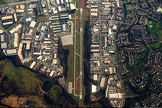
Montgomery County Airpark is a U.S. public airport located three miles (5 km) northeast of the city of Gaithersburg, in Montgomery County, Maryland, United States.
Searchlight Airport is a public use airport owned by the U.S. Bureau of Land Management and located two nautical miles (4 km) south of Searchlight, in Clark County, Nevada, United States. The airport is approximately 70 miles (110 km) south of Las Vegas.

Grove Field is a public airport located three miles (5 km) north of the central business district of Camas, a city in Clark County, Washington, United States. It is located near Lacamas Lake which has a seaplane base. Due to the closing of Evergreen Field, many aircraft have moved to Grove Field.
Sandy Creek Airpark is a private residential airpark located in the East Bay Sector, 10 miles southeast of the central business district of Panama City, in Bay County, Florida, United States. This airport has one dusk-to-dawn lighted runway, and a green-white beacon. The facility is used primarily by residents/association members, their tenants and guests, and members of the EAA Chapter 202.
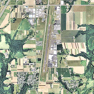
Aurora State Airport is a public airport located one mile (2 km) northwest of the central business district of Aurora, a city in Marion County, Oregon, United States. It is owned by the Oregon Department of Aviation.

Five Oaks Museum, formerly known as the Washington County Museum, is a history museum in Washington County, Oregon, United States. It is located at the Rock Creek campus of Portland Community College (PCC), north of Beaverton, Oregon. From 2012 to 2017, its public exhibit space was located in downtown Hillsboro, Oregon, before it was moved back to PCC, its pre-2012 location and where the museum's research facility had already been located.

Independence State Airport is a public-use airport located one mile (1.6 km) northwest of the central business district of Independence, a city in Polk County, Oregon, United States. It is owned by the Oregon Department of Aviation.
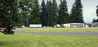
Scappoose Airport is a public use airport located one nautical mile (1.85 km) northeast of the central business district of Scappoose, in Columbia County, Oregon, United States. It is owned and operated by the Port of Columbia County, an Oregon port district and municipal corporation, on behalf of district residents. According to the FAA's National Plan of Integrated Airport Systems for 2009–2013, it is categorized as a general aviation airport.
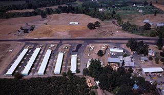
Stark's Twin Oaks Airpark is a privately owned public-use airport located 4 miles (6.4 km) south of the city of Hillsboro in Washington County, Oregon, United States.

Apple Valley Airport is a private airport located one mile southeast of Buxton in Washington County, Oregon, United States. Built in 1994 by a Portland TV personality Rod Anders, the subsequent owners have pushed to expand operations at the airport. Near U.S. 26 west of the Portland metropolitan area, the 2,470 feet (750 m) long turf airstrip is used for agricultural operations.
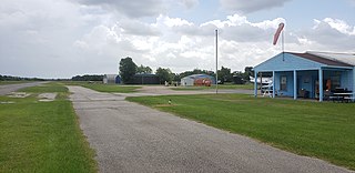
Weiser Airpark(ICAO: KEYQ, FAA LID: EYQ) was a privately owned, public-use airport located on the Northwest Freeway in Cypress, an unincorporated area of Harris County, Texas, United States. The airport was 11 nautical miles northwest of the central business district of Houston. The airport closed permanently in 2019.
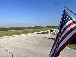
Everglades Airpark is a public-use airport located 1 mile (1.6 km) southwest of the central business district of the city of Everglades City in Collier County, Florida, United States. The airport is publicly owned.
Hernando Village Airpark is a privately owned, public use airport in DeSoto County, Mississippi, United States. It is located two nautical miles (4 km) southwest of the central business district of Hernando, Mississippi. The airport is part of the Green Village Residential Airpark in Hernando.
Lakeway Airpark is a public use airport in Travis County, Texas, United States. The airport is 17 nautical miles west of the central business district of Austin. It is privately owned by Lakeway Airpark, Inc. and is located in Lakeway, Texas.
Evergreen North–South Airpark is a private-use airport located six nautical miles east-northeast of the central business district of Vancouver, in Clark County, Washington, United States. It is owned by North/South Airpark Association.


