See also
![]() This article incorporates public domain material from "Suter Island". Geographic Names Information System . United States Geological Survey.
This article incorporates public domain material from "Suter Island". Geographic Names Information System . United States Geological Survey.
Suter Island ( 68°36′S77°54′E / 68.600°S 77.900°E ) is a small island off the Vestfold Hills, lying 0.5 miles (0.8 km) southwest of the south entrance point to Heidemann Bay. Mapped by Norwegian cartographers from air photos taken by the Lars Christensen Expedition, 1936–37. Named by Antarctic Names Committee of Australia (ANCA) for William James (Bill) Suter, cook at Davis Station in 1960.
![]() This article incorporates public domain material from "Suter Island". Geographic Names Information System . United States Geological Survey.
This article incorporates public domain material from "Suter Island". Geographic Names Information System . United States Geological Survey.

Mount Erebus is the southernmost active volcano on Earth, located on Ross Island in the Ross Dependency in Antarctica. With a summit elevation of 3,794 metres (12,448 ft), it the second most prominent mountain in Antarctica and the second-highest volcano in Antarctica. It is the highest point on Ross Island, which is also home to three inactive volcanoes: Mount Terror, Mount Bird, and Mount Terra Nova. It makes Ross Island the sixth-highest island on Earth.
This is a list of extreme points in Antarctica.

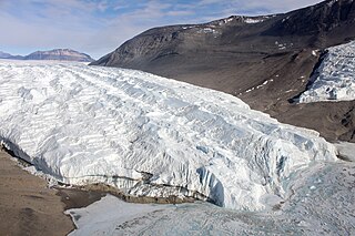
The Taylor Glacier is a glacier in Antarctica about 35 nautical miles long, flowing from the plateau of Victoria Land into the western end of Taylor Valley, north of the Kukri Hills. It flows to the south of the Asgard Range. The middle part of the glacier is bounded on the north by the Inland Forts and on the south by Beacon Valley.

The Dailey Islands are a group of small volcanic islands lying off the coast of Victoria Land, 9 kilometres (5 nmi) northeast of Cape Chocolate, in the northern part of the ice shelf bordering McMurdo Sound. They were discovered by the British National Antarctic Expedition, 1901–04, under Robert Falcon Scott, and named for Fred E. Dailey, the expedition carpenter.

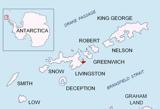
Ropotamo Glacier is a glacier extending 900 m (3,000 ft) from northeast to southwest and 600 m (2,000 ft) from northwest to southeast on the Burgas Peninsula, Livingston Island in the South Shetland Islands, Antarctica. The glacier is northeast of Dobrudzha Glacier, east-southeast of Iskar Glacier, south of Sopot Ice Piedmont and southwest of Strandzha Glacier. It is bounded by Asen Peak and Delchev Peak to the northwest and north, and flows southeastwards mostly into Yantra Cove, Bransfield Strait.

Sheldon Glacier is a glacier flowing southeast from Mount Mangin into Ryder Bay, Adelaide Island, Antarctica. Named by the United Kingdom Antarctic Place-Names Committee (UK-APC) in 1977 for Ernest B. Sheldon, British Antarctic Survey (BAS) meteorological observer, Adelaide Station, 1968–69, and Stonington Island, 1969–70; Base Commander, Adelaide Station, 1975–76, and Rothera Station, 1976–77.
Lady Newnes Bay is a bay about 60 nautical miles long in the western Ross Sea, extending along the coast of Victoria Land from Cape Sibbald to Coulman Island.
Zephyr Glacier 1 is a glacier, about 8 miles (13 km) long, flowing westward from the southwest side of Mount Edgell into George VI Sound to the south of Cape Jeremy. The feature was surveyed by Falkland Islands Dependencies Survey (FIDS), 1948, and British Antarctic Survey (BAS), 1971–72; photographed from the air by U.S. Navy, 1966. Named by United Kingdom Antarctic Place-Names Committee (UK-APC) in 1977 after Zephyrus, the west wind. One of the several features in this area is named after winds.
Avian Island is an island, 1.2 km (0.7 mi) long and 40 metres (130 ft) high, lying close off the south tip of Adelaide Island, Antarctica. It was discovered by the French Antarctic Expedition, 1908–10, under Jean-Baptiste Charcot, and visited in 1948 by the Falkland Islands Dependencies Survey, who so named it because of the large number and variety of birds (avians) found there.

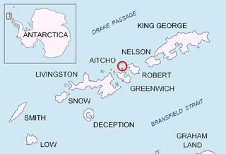
Okol Rocks is a group of rocks in the north of Aitcho Islands group on the west side of English Strait in the South Shetland Islands, Antarctica. The principal feature in the group is Lambert Island (62°22′16″S59°45′49″W).

Barrientos Island is a small, ice-free island in the Aitcho group on the west side of English Strait in the South Shetland Islands, Antarctica. Extending 1.71 by 0.54 km, surface area 65 hectares. The area was visited by early 19th century sealers. Barrientos Island is a popular tourist site frequented by Antarctic cruise ships.
On the continent of Antarctica, the Aramis Range is the third range south in the Prince Charles Mountains, situated 11 miles southeast of the Porthos Range and extending for about 30 miles in a southwest–northeast direction. It was first visited in January 1957 by Australian National Antarctic Research Expeditions (ANARE) southern party led by W.G. Bewsher, who named it for a character in Alexandre Dumas' novel The Three Musketeers, the most popular book read on the southern journey.

The Cathedral Rocks are a series of four abrupt cliffs interspersed by short glaciers and surmounted by sharp peaks. The cliffs extend for 8 nautical miles along the south side of Ferrar Glacier and form part of the north shoulder of the Royal Society Range, in Victoria Land, Antarctica.
Newman Shoal is a shoal at the southwest side of Davis Anchorage, just off the Vestfold Hills. The shoal has depths of 1 fathom or less and lies 0.1 nautical miles (0.2 km) southeast of Hobby Rocks. Charted during an ANARE hydrographic survey in 1961. Named by Antarctic Names Committee of Australia (ANCA) for A.J. Newman, senior diesel mechanic at Mawson Station in 1961, who assisted with the survey around Davis Station.

Warriner Island is a small ice-free island in the Donskiye Islands group lying just off the west end of Breidnes Peninsula in the Vestfold Hills, off the coast of East Antarctica. It is 1.2 km long by 0.7 km wide, reaching an elevation of 52 m.
The Krat Rocks are an area of submerged rocks with a least depth of about 1 metre (3 ft), lying at the west side of Davis Anchorage, 0.8 nautical miles (1.5 km) south of Bluff Island, off the Vestfold Hills, Ingrid Christensen Coast, Antarctica. The reef was delineated by d'A.T. Gale, an Australian National Antarctic Research Expeditions surveyor aboard the Thala Dan in 1961, and was named by the Antarctic Names Committee of Australia after Ingemann Krat, Danish chief engineer on the Thala Dan.
Flatiron Valley is a north-south valley including a sub-glacial lake, located in the south part of the Ganymede Heights, marginal to Jupiter Glacier, situated in eastern Alexander Island, Antarctica. The name derives from field work in 1978–79 by the Department of Geography, University of Aberdeen, Scotland, with British Antarctic Survey support. It was named from the triangular slope facets between prominent gullies on the west side of the valley. The site lies within Antarctic Specially Protected Area (ASPA) No.147.
Heidemann Bay is a bay, 1 nautical mile (2 km) long, indenting the seaward end of Breidnes Peninsula in the Vestfold Hills of Antarctica, just south of Davis Station. It was mapped by Norwegian cartographers from air photos taken by the Lars Christensen Expedition, 1936–37. The bay was first visited by an Australian National Antarctic Research Expeditions party from the Kista Dan on January 11, 1957, and was named for Frank Heidemann, second mate of the Kista Dan. Heidemann Bay which was gouged by glaciers is flanked by two small peninsulas which rise approximately 20 metres above sea level. Heidemann Bay is an extension of Heidemann Valley which runs in the same compass direction for a further two kilometres. Heidemann Valley is of uniform elevation and relatively flat but covered in a large number of moraine rocks and boulders.
Ranvik Island is a rocky island, 1.5 nautical miles (2.8 km) long, which is the largest island in the southern part of the Rauer Islands. It lies at the northern end of Ranvik Bay, about 3 nautical miles (5.6 km) northwest of Browns Glacier. Mapped by Norwegian cartographers, as being connected to the mainland, from air photos taken by the Lars Christensen Expedition (1936–37). They gave the name "Ranviktangen" because of its association with Ranvik Bay. The Advisory Committee on Antarctic Names (US-ACAN) has approved John H. Roscoe's 1952 recommendation that the Norwegian name be amended to Ranvik Island. Roscoe's examination of this area in air photos taken by U.S. Navy Operation Highjump (1946–47) determined that the feature described is actually separated from the mainland.