
The Arthur R. Marshall Loxahatchee National Wildlife Refuge is a 145,188-acre (587.55 km2) wildlife sanctuary is located west of Boynton Beach, in Palm Beach County, Florida. It is also known as Water Conservation Area 1 (WCA-1). It includes the most northern remnant of the historic Everglades wetland ecosystem.

The Lower Suwannee National Wildlife Refuge (LSNWR) is part of the United States National Wildlife Refuge System. It is located in southeastern Dixie and northwestern Levy counties on the western coast of Florida, approximately fifty miles southwest of the city of Gainesville.

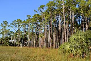
The Okefenokee National Wildlife Refuge is a 402,000‑acre (1,627 km2) National Wildlife Refuge located in Charlton, Ware, and Clinch Counties of Georgia, and Baker County in Florida, United States. The refuge is administered from offices in Folkston, Georgia. The refuge was established in 1937 to protect a majority of the 438,000 acre (1,772 km2) Okefenokee Swamp. The name "Okefenokee" is a Native American word meaning "trembling earth."
The Yazoo National Wildlife Refuge is a 12,941 acre (52.4 km2) National Wildlife Refuge located in Washington County, Mississippi. Named after the Yazoo tribe, it was established to provide waterfowl and other migratory birds in the Mississippi Flyway with nesting, feeding, brooding, and resting habitat.

The Mingo National Wildlife Refuge is a 21,676-acre (87.7-km2) National Wildlife Refuge located in northwestern Stoddard and southeastern Wayne counties in Missouri. Its southwesternmost portion lies on the shores of Lake Wappapello. Named after the Mingo tribe, it was established to preserve bottomland hardwoods and provide waterfowl and other migratory birds in the Mississippi Flyway with nesting, feeding, brooding, and resting habitat.

The Florida Trail is one of eleven National Scenic Trails in the United States. It currently runs 1,500 miles (2,400 km), from Big Cypress National Preserve to Fort Pickens at Gulf Islands National Seashore, Pensacola Beach. Also known as the Florida National Scenic Trail, the Florida Trail provides permanent non-motorized recreation opportunity for hiking and other compatible activities and is within an hour of most Floridians. The Florida National Scenic Trail is designated as a National Scenic Trail by the National Trails System Act of 1968.

The Florida Fish and Wildlife Conservation Commission (FWC) is a Florida government agency founded in 1999 and headquartered in Tallahassee. It manages and regulates the state's fish and wildlife resources, and enforces related laws. Officers are managers, researchers, and support personnel, and perform law enforcement in the course of their duties.

Glacial Ridge National Wildlife Refuge was created on October 12, 2004, the 545th National Wildlife Refuge in the United States. Its creation was the result of cooperation between at least 30 agencies or governmental entities. The creation of the refuge was spearheaded by The Nature Conservancy, and the initial endowment of 2,300 acres (9.3 km2) of land was donated by the Conservancy. In light of its planned final size of 37,756 acres (153 km2), it is described by the US Fish and Wildlife Service as "the largest tallgrass prairie and wetland restoration project in U.S. history."
The Atchafalaya National Wildlife Refuge is located about 30 miles (48 km) west of Baton Rouge, Louisiana, and one mile (1.6 km) east of Krotz Springs, Louisiana, lies just east of the Atchafalaya River. In 1988 under the administration of Governor Foster the "Atchafalaya Basin Master Plan" was implemented that combined the 11,780-acre (4,770 ha) Sherburne Wildlife Management Area (WMA), the 15,220-acre (6,160 ha) Atchafalaya National Wildlife Refuge, and the 17,000-acre (6,900 ha) U.S. Army Corps of Engineers' Bayou Des Ourses into the Sherburne Complex Wildlife Management Area.

The Cosumnes River Preserve is a nature preserve of over 51,000 acres (210 km2) located 20 miles (30 km) south of Sacramento, in the US state of California. The preserve protects a Central Valley remnant that once contained one of the largest expanses of oak tree savanna, riparian oak forest and wetland habitat in North America. Agricultural development has changed the landscape from groves of oaks and tule marshes to productive farmlands.
Chassahowitzka Wildlife Management Area (WMA) preserves 24,243 acres of sandhill, mesic hammock, and forested wetland habitat ten miles north of Weeki Wachee in Hernando County, Florida. The area consists of one large tract of land, with three satellite tracts nearby.
Andrews Wildlife Management Area is located on the Suwannee River, five miles north of Chiefland in Levy County, Florida.

Fred C. Babcock/Cecil M. Webb Wildlife Management Area (WMA) is Florida's oldest wildlife management area and protects 80,772 acres (32,687 ha) just southeast of Punta Gorda in Charlotte and Lee Counties, Florida. The area is accessed from its own exit off of Interstate-75.
Apalachicola River Wildlife and Environmental Area (ARWEA) contains 63,257 acres of pine upland, floodplain swamp, savanna, and estuary habitat north of Eastpoint and Apalachicola in Franklin County and Gulf County, Florida.
Okaloacoochee Slough Wildlife Management Area (WMA) protects 2,992 acres of the larger Okaloacoochee Slough ecosystem approximately 30 miles east of Fort Myers in Hendry County, Florida.
Escribano Point Wildlife Management Area (EPWMA) contains 4,057 acres of salt marsh, shrub bog, and sandhill habitat fourteen miles north of Pensacola in Santa Rosa County, Florida. In 2004, an initial 1,166 acres were acquired by the Florida Forever program and leased to the Florida Fish and Wildlife Conservation Commission to establish the EPWMA.
Fort White Wildlife and Environmental Area (WEA) protects 1,610 acres of primarily sandhill habitat four miles west of Fort White in Gilchrist County, Florida.

Aucilla Wildlife Management Area conserves 50,549 acres of hydric hammock, mesic flatwoods, upland forest, and spring-run river twelve miles southeast of Tallahassee in Jefferson and Taylor Counties in Florida.

Florida hosts many types of fauna. From coral reefs of the Florida Keys to the cypress swamps of the Panhandle, the state's diverse habitats are home to a variety of wildlife. Florida is among the top five states in terms of endemic species. There are over 700 terrestrial animals, 200 freshwater fish species, 1,000 marine fish and thousands of terrestrial insects and other invertebrates that inhabit the state. Florida's peninsular geography spans from subtropical to tropical zones, which, combined with its distinctive geology and climate, contribute to habitat diversity and an array of species. The native wildlife that exists in the state are of temperate and tropical origin.

The New York City borough of the Bronx is one of the most densely populated places in the United States, but is home to a wide range of wildlife. The borough has a land area of 42 sq mi (110 km2), of which 24 percent is parkland. Most of the open area is in the northern section of the borough, adjacent to Westchester County, allowing easy migration of animals from the mainland. The tree canopy of the Bronx cover 25% of the land area, hosting a wide range of avian species.
