Swan Creek (White River)

Last updated

Swan Creek is a stream in the Ozarks of southern Missouri. [1] It is a tributary of the White River downstream from the Lake Taneycomo dam. [2]

Stream A body of surface water flowing down a channel

A stream is a body of water with surface water flowing within the bed and banks of a channel. The stream encompasses surface and groundwater fluxes that respond to geological, geomorphological, hydrological and biotic controls.

Ozarks Highland region in central-southern United States

The Ozarks, also called the Ozark Mountains or Ozark Plateau, is a physiographic region in the U.S. states of Missouri, Arkansas, Oklahoma, and extreme southeastern Kansas. The Ozarks cover a significant portion of northern Arkansas and most of the southern half of Missouri, extending from Interstate 40 in Arkansas to Interstate 70 in central Missouri.

Missouri U.S. state in the United States

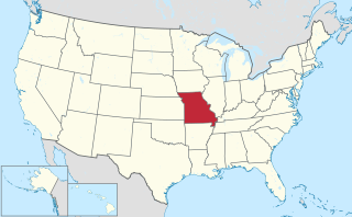
Missouri is a state in the Midwestern United States. With over six million residents, it is the 18th-most populous state of the Union. The largest urban areas are St. Louis, Kansas City, Springfield and Columbia; the capital is Jefferson City. The state is the 21st-most extensive in area. Missouri is bordered by eight states : Iowa to the north, Illinois, Kentucky and Tennessee to the east, Arkansas to the south and Oklahoma, Kansas and Nebraska to the west. In the South are the Ozarks, a forested highland, providing timber, minerals and recreation. The Missouri River, after which the state is named, flows through the center of the state into the Mississippi River, which makes up Missouri's eastern border.

Contents

The stream headwaters are at coordinates: 37°01′01″N92°48′55″W / 37.01694°N 92.81528°W / 37.01694; -92.81528 [1] in northwest Douglas County just southwest of the intersection of Missouri Route 14 and Missouri Route AK at an elevation of about 1640 feet. [3] The stream flows generally west passing Ongo and Honey Branch Cave before leaving Douglas County. [2] After entering Christian County just southwest of Ongo, the stream flows southwest past Keltner and then turns south a short distance east of Chadwick. The stream flows south and is bridged by Missouri Route 125 just east of Garrison. The stream flows southwest and is bridged by Missouri Route AA just southeast of the community of Swan. The stream continues to the south-southwest through incised meanders until reaching its confluence with the White River just east of Forsyth at Shadow Rock Park at coordinates: 36°40′57″N93°06′20″W / 36.68250°N 93.10556°W / 36.68250; -93.10556 Coordinates: 36°40′57″N93°06′20″W / 36.68250°N 93.10556°W / 36.68250; -93.10556 . [1] [2]

Douglas County, Missouri U.S. county in Missouri

Douglas County is a county located in the south-central portion of the U.S. state of Missouri. As of the 2010 census, the population was 13,684. The county seat and only incorporated community is Ava. The county was officially organized on October 19, 1857, and is named after U.S. Senator Stephen A. Douglas (D-Illinois) and later Democratic presidential candidate.

Route 14 is a state highway traveling through the southern part of the U.S. state of Missouri. Its western terminus is at U.S. Route 60 (US 60) in Marionville, and its eastern terminus is at US 63 on the northern edge of West Plains. Route 14 is a two-lane highway for its entire length.

Ongo is an unincorporated community in northwestern Douglas County, Missouri, United States. Ongo is located on Missouri Route UU, on the north bank of Swan Creek. The Douglas-Christian county line is approximately one mile to the west. Missouri Route 14 is about two miles to the north and Honey Branch Cave, about one mile north.

History

Swan Creek has the name of the local Swan family. [4]

See also

Related Research Articles

Cedar Gap, Missouri human settlement in United States of America

Cedar Gap is an unincorporated community in southwestern Wright County, Missouri, United States. Cedar Gap lies just south of US Route 60 between Mansfield to the east and Seymour in adjacent Webster County to the west.

Cedar Creek is a stream in Dade and Cedar counties of southwest Missouri.

Horse Creek is a stream in Barton, Cedar, Dade and Vernon counties in southwest Missouri. It is a tributary of Cedar Creek.

Turnback Creek is a stream in the Ozarks of southwest Missouri. The stream headwaters are in western Christian County just southwest of Billings. The stream flows north-northwest after passing under U.S. Route 60 and on through the extreme southwest corner of Greene County and into Lawrence County. In Lawrence County the stream flows northwest passing under Interstate 44 southwest of Halltown and into southeast Dade County. In Dade County the stream flows generally north and enters the Sac River arm of Stockton Lake at U.S. Route 160 east of Greenfield.

Greasy Creek is a stream in Dallas and Webster counties the Ozarks of southwest Missouri. It is a tributary of the Niangua River.

Whites Creek (Hunter Creek) Stream in Missouri

Whites Creek is an Ozark stream in Douglas County, Missouri. It is a tributary of Hunter Creek.

Pickerel Creek is a stream in Christian and Greene counties in the Ozarks of southwest Missouri. The stream is a tributary to the Sac River.

Medicine Creek is a stream in Grundy, Livingston, Putnam, and Sullivan counties of the U.S. state of Missouri. It is a tributary to the Grand River.

Center Creek is a stream in southwest Missouri.

White Oak Creek is a stream in Lawrence and Jasper counties of southwest Missouri. It is a tributary of the Spring River.

Williams Creek is a stream in the Lawrence County of southwest Missouri. It is a tributary of the Spring River.

Barren Creek is a stream in Polk County in the U.S. state of Missouri. It is a tributary of Bear Creek.

Panther Creek is a stream in Polk, Hickory and St. Clair counties of southwest Missouri. It is a tributary of Brush Creek.

Piper Creek is a stream in Polk County in the Ozarks of southwest Missouri. It is a tributary of the Pomme de Terre River.

Slagle Creek is a stream in Polk County in the Ozarks of southwest Missouri. It is a tributary of the Little Sac River.

Goff Creek is a stream in Stone County in the Ozarks of southwest Missouri. It is a tributary of the James River.

The North Fork Spring River is a stream in Lawrence, Dade, Barton and Jasper counties of southwest Missouri. It is a tributary to the Spring River.

Clear Creek is a stream in Cedar, Barton, Vernon and St. Clair counties of southwest Missouri. It is a tributary to the Osage River.

Keyger Mountain is an irregular mountain ridge in Douglas and Christian counties in the Ozarks of southern Missouri.

References

  1. 1 2 3 U.S. Geological Survey Geographic Names Information System: Swan Creek (White River)
  2. 1 2 3 Missouri Atlas & Gazetteer, DeLorme, 1998, First edition, p. 62, ISBN   0-89933-224-2
  3. Dogwood Missouri 7.5 Minute Topographic Quadrangle, USGS, 1982
  4. "Taney County Place Names, 1928–1945". The State Historical Society of Missouri. Archived from the original on June 24, 2016. Retrieved December 27, 2016.