Chadwick is an unincorporated community in eastern Christian County, Missouri, United States. It is located approximately six miles southeast of Sparta along Missouri Route 125. The community of Oldfield is approximately three miles to the north along Route 125. It is part of the Springfield, Missouri Metropolitan Statistical Area. Its ZIP code is 65629.
Powersite is an unincorporated community in Taney County, Missouri, United States. It is located across Lake Taneycomo from Forsyth on the southeast end of Powersite Dam. The community is part of the Branson, Missouri Micropolitan Statistical Area.
Chestnutridge is an unincorporated community in southwestern Christian County, Missouri, United States and is located approximately fourteen miles south of Ozark and about 3.5 miles southeast of Spokane. The community is located on Chestnut Ridge, at an elevation of 1325 feet. It is on Missouri Route BB just east of Missouri Route 176 and about two miles west of U.S. Route 65.
Jenkins is an unincorporated community in Barry County, Missouri, United States. It is located on Route 39, just north of Route 248, approximately twelve miles northeast of Cassville. Jenkins Creek flows through the community and its confluence with Flat Creek is just to the south.

Linden is an unincorporated community in northern Christian County, Missouri United States. It is located approximately 4.5 miles northwest of Sparta on Route 125, where the highway crosses the Finley Creek. The river has been dammed, creating a small lake, Lake Lindenlure, just east of Route 125.
Bengal was an unincorporated community in Christian County, in the U.S. state of Missouri. It was located along Tory Creek about one mile upstream (south) of Montague along the road to Ponce de Leon which is approximately three miles to the southwest. Spokane was about 2.5 miles to the south-southeast. The location is within South Galloway Township. The elevation of Bengal is 1,243 feet.
Eaudevie is an extinct town in southern Christian County, in the U.S. state of Missouri. The community was located along the east bank of Bull Creek at 36°50′30″N93°10′59″W at an elevation of 900 feet. U.S. 65 passes two miles west of the location.
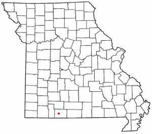
Griffin is an unincorporated community in Christian County, in the U.S. state of Missouri.
Lawing is an extinct town in Christian County, in the U.S. state of Missouri. The community was located on Logan Ridge along the south edge of the Springfield Plateau. Missouri Route W passes through the location and Christian Center is about one mile to the north. The city of Ozark is approximately seven miles to the north-northwest.
Montague is an unincorporated community in western Christian County, in the U.S. state of Missouri. The community is on Tory Creek, west of Highlandville.
Pembina is an unincorporated community in northern Christian County, in the U.S. state of Missouri. The community was located at the intersection of Missouri routes 125 and U, approximately 1.5 miles north of Linden and Finley Creek. The Pembina Cemetery is approximately one mile to the northwest, across Parched Corn Hollow in the center of Section 33.
Selmore is an unincorporated community in Christian County, in the U.S. state of Missouri.
Velsor is an extinct town in northern Christian County, in the U.S. state of Missouri. The GNIS classifies it as a populated place. The community was northeast of Sparta between Missouri Route 14 and Finley Creek.
Mentor is an unincorporated community in southern Greene County, in the U.S. state of Missouri. The community is located southeast of Springfield, south of U.S. Route 60, west of Missouri Route NN and one mile north of the Greene-Christian county line.
Bennetts Bayou is a stream in the U.S. states of Arkansas and Missouri. The stream source is in Howell County, Missouri, just south of US Route 160 west of Hocomo. The stream flows southwest into Ozark County, Missouri, and under Missouri Route 142 on the east side of Bakersfield. It then flows south through the extreme northwest corner of Fulton County, Arkansas, and into the northwest corner of Baxter County, Arkansas. It continues to the southwest and enters the northeast arm of Norfork Lake to the east of Gamaliel, Arkansas. The similarly named Bennetts River runs subparallel to Bennetts Bayou just to the southeast.
Davis is an unincorporated community in Lincoln County, in the U.S. state of Missouri.
Pyrmont is an unincorporated community in western Morgan County, in the U.S. state of Missouri. The community is located just east of Missouri Route 135 approximately midway between Stover to the south and Florence to the northeast. Gabriel Creek flows past to the east.
Day is an unincorporated community in Taney County, in the Ozarks of southern Missouri. Day is located in the northwest part of the county, just south of the Taney-Christian county line on Missouri Route 176 and approximately one mile west of U.S. Route 65.
Swan Creek is a stream in the Ozarks of southern Missouri. It is a tributary of the White River downstream from the Lake Taneycomo dam.
Garrison Township is an inactive township in Christian County, Missouri. A post office with the same name was established in 1887, named after a family of Garrisons. A school with the same name had its name transferred from either the township or the post office.

