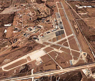
Cass County is a county located in the western part of the U.S. state of Missouri. As of the 2010 census, the population was 99,478. Its county seat is Harrisonville. The county was organized in 1835 as Van Buren County, but was renamed in 1849 after U.S. Senator Lewis Cass of Michigan, who later became a presidential candidate.

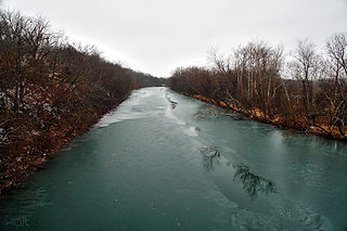
Zalma, once known as Bollinger's Mill, is a town on the banks of the winding Castor River at a point where the river makes a horseshoe bend in southern Bollinger County in southeast Missouri. When the railroad moved to town, the name Bollinger's Mill was changed to Zalma, after railroad worker Zalma Block. Zalma is also said to come from a Native American word meaning "the end." As of the 2010 U.S. Census, Zalma had a population of 122.

The Ozarks, also referred to as the Ozark Mountains and Ozark Plateau, is a physiographic region in the U.S. states of Arkansas, Missouri, Oklahoma, and Kansas. The Ozarks cover a significant portion of northern Arkansas and southern Missouri, extending from Interstate 40 in Arkansas to the suburbs of St. Louis. A portion of the Ozarks extends into northeastern Oklahoma and southeastern Kansas.

The Spring River is a 129-mile-long (208 km) waterway located in southwestern Missouri, southeastern Kansas, and northeastern Oklahoma. The head of Spring River is a spring south of Verona just south of Highway 60 which crosses it, meanders through Verona northwest and turns west across Lawrence and Jasper counties. There used to be a trout farm at the head where the spring is. It passes through Carthage, before crossing into Cherokee County, Kansas, where it widens considerably. It flows past the east sides of Riverton and Baxter Springs before emptying into the Grand Lake o' the Cherokees in Ottawa County, Oklahoma.

The James River is a 130-mile-long (210 km) river in southern Missouri. It flows from northeast Webster County until it is impounded into Table Rock Lake. It is part of the White River watershed. The river forms Lake Springfield and supplies drinking water for the city of Springfield.

Yarrow is an unincorporated community in southwestern Adair County, Missouri, United States. It is located on Missouri Supplemental Route N, approximately ten miles southwest of Kirksville. Yarrow's post office has closed and mail now comes from Kirksville.

Burfordville is an unincorporated community in western Cape Girardeau County, Missouri, United States, on the banks of the Whitewater River. It is located five miles west of Jackson on Route 34. Bufordville is part of the Cape Girardeau–Jackson, MO-IL Metropolitan Statistical Area.
Bonnots Mill is an unincorporated community in northern Osage County, Missouri, United States. It is located approximately ten miles east of Jefferson City on the Osage River, near its confluence with the Missouri River. The community of Osage City is about four miles to the west-southwest on the Osage and the community of Tebbetts lies across the Missouri River valley to the north. It has also been known as Dauphine, Bonnets Mills, Bonnots, or Bonnotts Mill.

Linden is an unincorporated community in northern Christian County, Missouri United States. It is located approximately 4.5 miles northwest of Sparta on Route 125, where the highway crosses the Finley Creek. The river has been dammed, creating a small lake, Lake Lindenlure, just east of Route 125.

The Chariton River is a 218-mile-long (351 km) tributary to the Missouri River in southeast Iowa and northeast Missouri. The river forms in southeastern Clarke County, Iowa. It is dammed at 11,000-acre (45 km2) Rathbun Reservoir in Appanoose County, Iowa and then flows 30 miles (48 km) before entering Missouri where it forms the boundary between Putnam and Schuyler counties. It enters the Missouri River in Chariton County near Keytesville. 112 miles (180 km) are in Missouri and 106 miles (171 km) are in Iowa. The river has been called Missouri's "Grand Divide" because streams west of the Chariton flow into the Missouri and streams east of it flow into the Mississippi River.
Big Sugar Creek is a 47-mile-long (76 km) waterway in the Ozark Mountains of southwest Missouri. The creek starts near the Arkansas state line. Big Sugar starts from three tributaries. One flows north from Garfield, Arkansas, and one, west near Seligman, Missouri, and another, south from Washburn, Missouri. Big Sugar flows west down Sugar Creek Valley, where in the Jacket community it is joined by Otter Creek, from Pea Ridge, Arkansas.

Chilhowee was a prehistoric and historic Native American site in Blount County and Monroe County, Tennessee, in the southeastern United States. Although now submerged by the Chilhowee Lake impoundment of the Little Tennessee River, the Chilhowee site was home to a substantial 18th-century Overhill Cherokee village and may have been the site of the Creek village "Chalahume" visited by Spanish explorer Juan Pardo in 1567.

Cedar Gap is an unincorporated community in southwestern Wright County, Missouri in the United States. Cedar Gap lies just south of US Route 60 between Mansfield to the east and Seymour in adjacent Webster County to the west.
Elk Valley is a valley in Christian County in the Ozarks of southwest Missouri.
Stewart Creek is a stream in the northwestern Douglas and northeastern Christian counties of southern Missouri. The headwaters are north of Dogwood. The stream flows southwest crossing Missouri Route Z and enters Christian County west of Dogwood turning west and flowing past the community of Abadyl northeast of Bruner. The stream turns northwest paralleling Stewart Creek Road toward its confluence with Finley Creek.
Tory Creek is a stream in Christian and Stone counties of southwest Missouri. It is a tributary of the James River.
Finley Falls is an extinct town in southern Webster County, in the U.S. state of Missouri. The GNIS classifies it as a populated place. The community is located on Little Finley Creek, approximately 3.5 miles west-southwest of Seymour on Webster County Road 322.
Olga is an unincorporated community in the southwest corner of Webster County, in the Ozarks of southern Missouri. Olga is located on Missouri Route Z about 5 miles northwest of Dogwood in northwest Douglas County. Finley Creek is just north of the community.
Pedelo Creek is a stream in Webster and Christian counties in the Ozarks of southern Missouri. It is a tributary of Finley Creek. The stream headwaters are in the southwestern corner of Webster County west of the community of Zenar. The stream flows west and then southwest into northern Christian County gaining the waters of Olie Lasley Spring then turns to the south and crosses under Missouri Route U. Its confluence with the Finley about three miles east of Linden.


