References
- ↑ U.S. Geological Survey Geographic Names Information System: McCracken, Missouri
- ↑ "Ozark, Missouri to McCracken, Missouri". Google Maps. Retrieved November 7, 2020.
- 1 2 3 "An Early Mobile Photographic Studio" (PDF). All Aboard, The Frisco Railroad Museum, August, 1988 (accessed on CondrenRails.com). Retrieved October 14, 2020.
- ↑ "Post Offices". Jim Forte Postal History. Retrieved September 19, 2016.
- ↑ "Christian County Place Names, 1928–1945 (archived)". The State Historical Society of Missouri. Archived from the original on June 24, 2016. Retrieved September 19, 2016.
{{cite web}}: CS1 maint: bot: original URL status unknown (link) - ↑ "Pokin Around: Plans call for part of Chadwick Flyer spur line to become recreational trail". Steve Pokin, Springfield News-Leader, April 4, 2020.
Municipalities and communities of Christian County, Missouri, United States | ||
|---|---|---|
| Cities | 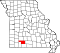 | |
| Village | ||
| Townships | ||
| CDP | ||
| Unincorporated communities | ||
| Ghost towns | ||
| Footnotes | ‡This populated place also has portions in an adjacent county or counties | |
37°01′03″N93°09′29″W / 37.01750°N 93.15806°W
| | This Christian County, Missouri state location article is a stub. You can help Wikipedia by expanding it. |