References
- ↑ U.S. Geological Survey Geographic Names Information System: South Galloway Township, Christian County, Missouri
- ↑ "Christian County Place Names, 1928–1945 (archived)". The State Historical Society of Missouri. Archived from the original on June 24, 2016. Retrieved January 25, 2017.
{{cite web}}: CS1 maint: bot: original URL status unknown (link)
Municipalities and communities of Christian County, Missouri, United States | ||
|---|---|---|
| Cities | 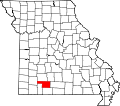 | |
| Village | ||
| Townships | ||
| CDP | ||
| Unincorporated communities | ||
| Ghost towns | ||
| Footnotes | ‡This populated place also has portions in an adjacent county or counties | |
36°51′21″N93°16′14″W / 36.8558°N 93.2706°W
| | This Christian County, Missouri state location article is a stub. You can help Wikipedia by adding missing information. |