Sweetwater Creek (Gray County, Texas)

Last updated

Sweetwater Creek is a stream in the Texas Panhandle and western Oklahoma. It is a tributary to the North Fork of the Red River. [1]

Contents

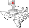
The stream headwaters arise in northern Gray County, Texas at 35°36′29″N100°35′55″W / 35.60806°N 100.59861°W / 35.60806; -100.59861 northeast of Laketon and southeast of Miami at an elevation of 3010 feet. [2] The stream flows southeast into Wheeler County southwest of Mobeetie and under Texas State Highway 152 and U.S. Route 83 and through the southwest corner Roger Mills County, Oklahoma, and into Beckham County, Oklahoma, southwest of Sweetwater, Oklahoma. The stream turns south and southwest to enter the North Fork of the Red River 2.5 miles from the Oklahoma-Texas line. [3] The confluence is at 35°18′03″N99°56′46″W / 35.30083°N 99.94611°W / 35.30083; -99.94611 Coordinates: 35°18′03″N99°56′46″W / 35.30083°N 99.94611°W / 35.30083; -99.94611 and an elevation of 1978 ft. [1] The confluence is 6.5 miles northwest of Erick, Oklahoma on I-40. [4]

Sweetwater Creek is central to the range of the southern buffalo herd. Along its banks were located favored hunting camps of Plains tribes, such as the Comanche and Kiowa. The encroachment of American hide hunters at Sweetwater Creek was contested by the Comanche and their Kiowa allies. It figured in the Red River War of 1874, which was a campaign by the US Army to confine Native American tribes on the reservations to minimize conflict between the Americans and Native tribes.[ citation needed ]

Fort Elliott was located on the banks of Sweetwater Creek. [5]

The town of Mobeetie, Texas, a Native American word meaning "sweet water", and Sweetwater, Oklahoma, are named for the creek.
See also

Related Research Articles

Mobeetie, Texas City in Texas, United States

Mobeetie is a city in northwestern Wheeler County, Texas, United States, located on Sweetwater Creek and State Highway 152. Its population was 101 at the 2010 census, six below the 2000 figure.

Canadian River

The Canadian River is the longest tributary of the Arkansas River in the United States. It is about 906 miles (1,458 km) long, starting in Colorado and traveling through New Mexico, the Texas Panhandle, and Oklahoma. The drainage area is about 47,700 square miles (124,000 km2).

First Battle of Adobe Walls

The First Battle of Adobe Walls was a battle between the United States Army and American Indians. The Kiowa, Comanche and Plains Apache tribes drove from the battlefield a United States Expeditionary Force that was reacting to attacks on white settlers moving into the Southwest. The battle, on November 25, 1864, resulted in light casualties on both sides but was one of the largest engagements fought on the Great Plains.

Beaver River (Oklahoma)

The Beaver River is an intermittent river, 280 miles (450 km) long, in western Oklahoma and northern Texas in the United States. It is a tributary of the North Canadian River, draining an area of 11,690 square miles (30,300 km2) in a watershed that extends to northeastern New Mexico and includes most of the Oklahoma Panhandle.

North Fork Red River

The North Fork Red River, sometimes called simply the "North Fork", is a tributary of the Red River of the South about 271 mi (436 km) long, heading along the eastern Caprock Escarpment of the Llano Estacado about 11.4 mi (18.3 km) southwest of Pampa, Texas. Rising in Gray County, Texas, it terminates at the confluence with Prairie Dog Town Fork of the Red River at the Texas-Oklahoma border.

Straight, Oklahoma

Straight is an unincorporated community in Texas County in the Oklahoma Panhandle, United States.

Greasy Creek is a stream in southwest Barry County in the Ozarks of southwest Missouri. It is a tributary of Big Sugar Creek.

Wyaconda River is a stream in Davis County, in the U.S. state of Iowa, and Lewis and Clark counties in Missouri. It is a tributary of the Mississippi River. It is the third most northeastern stream in Missouri, following the Des Moines River and the Fox River.

Cedar Fork is a stream in Franklin County in the U.S. state of Missouri. It is a tributary of Boeuf Creek.

Buck Creek is a stream in Lincoln County in the U.S. state of Missouri. It is a tributary of the North Fork of the Cuivre River.

Patterson Creek is a stream in McDonald County, Missouri and Delaware County, Oklahoma in the United States. It is a tributary of Buffalo Creek in eastern Oklahoma.

Fivemile Creek is a stream in Newton County, Missouri and Ottawa County, Oklahoma in the United States. It is a tributary of the Spring River in northeastern Oklahoma.

Bills Creek is a stream in Iron and Reynolds counties in the U.S. state of Missouri. It is a tributary of the West Fork of the Black River and is located in the Mark Twain National Forest.

Pike Run is a stream in St. Francois County in the U.S. state of Missouri. It is a tributary of Terre Bleue Creek just upstream of that stream's confluence with Big River.

Tory Creek is a stream in Christian and Stone counties of southwest Missouri. It is a tributary of the James River.

Bull Creek is a stream in Christian and Taney counties in the Ozarks of southern Missouri.

Little Creek is a stream in Wright, Texas and Douglas counties of Missouri. It is a tributary of the North Fork River.

Howell Creek is a stream in Howell and Oregon counties of southern Missouri. The stream is a tributary to the Warm Fork Spring River.

Lost Creek is a stream in Newton County, Missouri and Ottawa County, Oklahoma. It is a tributary to the Spring River.

West Piney Creek also known as the Little Piney River is a stream in Texas County in the Ozarks of south central Missouri. It is a tributary to the Big Piney River.

References

  1. 1 2 U.S. Geological Survey Geographic Names Information System: Sweetwater Creek (Gray County, Texas)
  2. Tatty School, TX, 7.5 Minute Topographic Quadrangle, USGS, 1967
  3. Mayfield, Oklahoma, 7.5 Minute Topographic Quadrangle, USGS, 1969
  4. Texas Atlas & Gazetteer, DeLorme, 4th ed. 2001, p.31 ISBN   0-89933-320-6
  5. Lester Fields Sheffy, The Life and Times of Timothy Dwight Hobart, 1855-1935: Colonization of West Texas (Canyon, Texas: Panhandle-Plains Historical Society, 1950), p. 137