Filipów, is a village in Suwałki County, Podlaskie Voivodeship, in north-eastern Poland. It is the seat of the gmina called Gmina Filipów. It lies approximately 24 kilometres (15 mi) north-west of Suwałki and 124 km (77 mi) north of the regional capital Białystok. In 2006 the village has a population of 1,814.
Gębalówka is a village in the administrative district of Gmina Bakałarzewo, within Suwałki County, Podlaskie Voivodeship, in north-eastern Poland. It lies approximately 3 kilometres (2 mi) south of Bakałarzewo, 20 km (12 mi) west of Suwałki, and 112 km (70 mi) north of the regional capital Białystok.
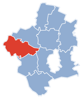
Agrafinówka is a village in the administrative district of Gmina Filipów, within Suwałki County, Podlaskie Voivodeship, in north-eastern Poland. It lies approximately 10 kilometres (6 mi) south-east of Filipów, 14 km (9 mi) north-west of Suwałki, and 118 km (73 mi) north of the regional capital Białystok.
Bitkowo is a village in the administrative district of Gmina Filipów, within Suwałki County, Podlaskie Voivodeship, in north-eastern Poland. It lies approximately 8 kilometres (5 mi) north-west of Filipów, 31 km (19 mi) north-west of Suwałki, and 129 km (80 mi) north of the regional capital Białystok.
Garbas is a village in the administrative district of Gmina Filipów, within Suwałki County, Podlaskie Voivodeship, in north-eastern Poland. It lies approximately 8 kilometres (5 mi) east of Filipów, 18 km (11 mi) north-west of Suwałki, and 122 km (76 mi) north of the regional capital Białystok.
Jemieliste is a village in the administrative district of Gmina Filipów, within Suwałki County, Podlaskie Voivodeship, in north-eastern Poland. It lies approximately 8 kilometres (5 mi) east of Filipów, 19 km (12 mi) north-west of Suwałki, and 124 km (77 mi) north of the regional capital Białystok.
Mieruniszki is a village in the administrative district of Gmina Filipów, within Suwałki County, Podlaskie Voivodeship, in north-eastern Poland. It lies approximately 4 kilometres (2 mi) south-west of Filipów, 26 km (16 mi) west of Suwałki, and 124 km (77 mi) north of the regional capital Białystok.
Piecki is a village in the administrative district of Gmina Filipów, within Suwałki County, Podlaskie Voivodeship, in north-eastern Poland. It lies approximately 11 kilometres (7 mi) east of Filipów, 14 km (9 mi) north-west of Suwałki, and 118 km (73 mi) north of the regional capital Białystok.
Rospuda is a village in the administrative district of Gmina Filipów, within Suwałki County, Podlaskie Voivodeship, in north-eastern Poland. It lies approximately 5 kilometres (3 mi) north of Filipów, 26 km (16 mi) north-west of Suwałki, and 128 km (80 mi) north of the regional capital Białystok.
Supienie is a village in the administrative district of Gmina Filipów, within Suwałki County, Podlaskie Voivodeship, in north-eastern Poland. It lies approximately 6 kilometres (4 mi) north-west of Filipów, 29 km (18 mi) north-west of Suwałki, and 129 km (80 mi) north of the regional capital Białystok.
Biała Woda is a village in the administrative district of Gmina Suwałki, within Suwałki County, Podlaskie Voivodeship, in north-eastern Poland. It lies approximately 8 kilometres (5 mi) north of Suwałki and 116 km (72 mi) north of the regional capital Białystok.
Białe is a village in the administrative district of Gmina Suwałki, within Suwałki County, Podlaskie Voivodeship, in north-eastern Poland. It lies approximately 9 kilometres (6 mi) west of Suwałki and 109 km (68 mi) north of the regional capital Białystok.
Bród Mały is a village in the administrative district of Gmina Suwałki, within Suwałki County, Podlaskie Voivodeship, in north-eastern Poland. It lies approximately 6 kilometres (4 mi) north-west of Suwałki and 113 km (70 mi) north of the regional capital Białystok.
Kropiwne Nowe is a village in the administrative district of Gmina Suwałki, within Suwałki County, Podlaskie Voivodeship, in north-eastern Poland. It lies approximately 9 kilometres (6 mi) west of Suwałki and 109 km (68 mi) north of the regional capital Białystok.
Kropiwne Stare is a village in the administrative district of Gmina Suwałki, within Suwałki County, Podlaskie Voivodeship, in north-eastern Poland. It lies approximately 9 kilometres (6 mi) west of Suwałki and 112 km (70 mi) north of the regional capital Białystok.
Kuków is a village in the administrative district of Gmina Suwałki, within Suwałki County, Podlaskie Voivodeship, in north-eastern Poland. It lies approximately 6 kilometres (4 mi) west of Suwałki and 112 km (70 mi) north of the regional capital Białystok.
Wesołowo is a village in the administrative district of Gmina Szypliszki, within Suwałki County, Podlaskie Voivodeship, in north-eastern Poland, close to the border with Lithuania. It lies approximately 7 kilometres (4 mi) south-east of Szypliszki, 21 km (13 mi) north-east of Suwałki, and 123 km (76 mi) north of the regional capital Białystok.
Markajmy is a village in the administrative district of Gmina Lidzbark Warmiński, within Lidzbark County, Warmian-Masurian Voivodeship, in northern Poland. It lies approximately 5 kilometres (3 mi) north-east of Lidzbark Warmiński and 42 km (26 mi) north of the regional capital Olsztyn.
Kamionek Wielki is a village in the administrative district of Gmina Węgorzewo, within Węgorzewo County, Warmian-Masurian Voivodeship, in northern Poland, close to the border with the Kaliningrad Oblast of Russia. It lies approximately 11 kilometres (7 mi) south-west of Węgorzewo and 85 km (53 mi) north-east of the regional capital Olsztyn.