Related Research Articles

The federative units of Brazil are subnational entities with a certain degree of autonomy and endowed with their own government and constitution, which together form the Federative Republic of Brazil. There are 26 states and one federal district. The states are generally based on historical, conventional borders which have developed over time. The states are divided into municipalities, while the Federal District assumes the competences of both a state and a municipality.

Amapá is one of the 26 states of Brazil. It is in the northern region of Brazil. It is the second least populous state and the eighteenth largest by area. Located in the far northern part of the country, Amapá is bordered clockwise by French Guiana to the north, the Atlantic Ocean to the east, Pará to the south and west, and Suriname to the northwest. The capital and largest city is Macapá. The state has 0.4% of the Brazilian population and is responsible for only 0.22% of the Brazilian GDP.

Macapá is a city in Brazil with a population of 512,902. It is the capital of Amapá state in the country's North Region. It is located on the northern channel of the Amazon River near its mouth on the Atlantic Ocean. The city is on a small plateau on the Amazon in the southeast of the state of Amapá. The only access by road from outside the province is from the overseas French department of French Guiana, although there are regular ferries to Belem, Brazil. Macapá is linked by road with some other cities in Amapá. The equator runs through the middle of the city, leading residents to refer to Macapá as "The capital of the middle of the world." It covers 6,407.12 square kilometres (2,473.80 sq mi) and is located northwest of the large inland island of Marajó and south of the border with French Guiana.
The Campeonato Amapaense, commonly known simply as Amapazão, is the football league of the State of Amapá, Brazil. It is organized by the Amapá State Football Federation.
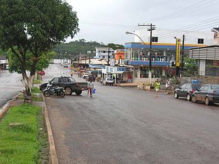
Oiapoque is a municipality in the north of the state of Amapá, Brazil. Its population is 27,906 and its area is 22,625 square kilometres (8,736 sq mi). Oiapoque is also a major river in the same state, forming the international border with French Guiana. The Oyapock River Bridge, connecting the village with Saint-Georges in French Guiana, was completed in 2011 but not opened to pedestrian or vehicle traffic until 2017.

The coastline of Brazil measures 7,491 km, which makes it the 16th longest national coastline of the world. All the coast lies adjacent to the Atlantic Ocean.

Caripi River is a river of Amapá state in north-eastern Brazil. The Karipuna do Amapá Amerindians are located on along the river. Manga is the main settlement on the river.

The State of Maranhão was the northern of two 17–18th century administrative divisions of the colonial Portuguese Empire in South America.

Events from the year 2008 in Brazil.
Events from the year 2004 in Brazil.
Events in the year 1992 in Brazil.
Events in the year 2005 in Brazil.
Events in the year 2006 in Brazil.
Events in the year 2009 in Brazil.
Events in the year 1993 in Brazil.
Events in the year 1994 in Brazil.

Events in the year 1981 in Brazil.