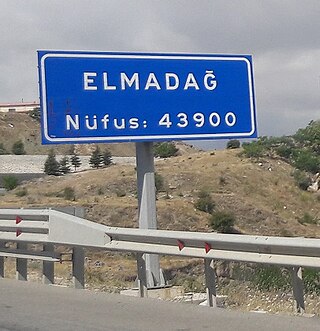
Elmadağ is a municipality and district of Ankara Province, Turkey. Its area is 647 km2, and its population is 44,379 (2022). Its average elevation is 1,135 m (3,724 ft), with the highest point being Mt. İdris at 1,995 m (6,545 ft).

Bala, formerly known as Balbadon, is a municipality and district of Ankara Province, Turkey. Its area is 1,851 km2, and its population is 20,521 (2022). It is 67 km south-east of the city of Ankara. Its elevation is 1,310 m (4,298 ft).
Afşar is a neighbourhood in the municipality and district of Bala, Ankara Province, Turkey. Its population is 1,527 (2022). Before the 2013 reorganisation, it was a town (belde).
Karaşar is a neighbourhood of the municipality and district of Beypazarı, Ankara Province, Turkey. Its population is 429 (2022). Before the 2013 reorganisation, it was a town (belde).
Kırbaşı is a neighbourhood of the municipality and district of Beypazarı, Ankara Province, Turkey. Its population is 618 (2022). Before the 2013 reorganisation, it was a town (belde).
Uruş is a neighbourhood of the municipality and district of Beypazarı, Ankara Province, Turkey. Its population is 276 (2022). Before the 2013 reorganisation, it was a town (belde).
Sorgun is a neighbourhood in the municipality and district of Güdül, Ankara Province, Turkey. Its population is 391 (2022). Before the 2013 reorganisation, it was a town (belde).
Yeşilöz is a neighbourhood in the municipality and district of Güdül, Ankara Province, Turkey. Its population is 419 (2022). Before the 2013 reorganisation, it was a town (belde).
Çağa is a neighbourhood in the municipality and district of Güdül, Ankara Province, Turkey. Its population is 502 (2022). Before the 2013 reorganisation, it was a town (belde).
Yurtbeyli is a neighbourhood in the municipality and district of Haymana, Ankara Province, Turkey. Its population is 611 (2022). Before the 2013 reorganisation, it was a town (belde).
Çalış is a neighbourhood in the municipality and district of Haymana, Ankara Province, Turkey. Its population is 433 (2022). Before the 2013 reorganisation, it was a town (belde).
Çeltikçi is a neighbourhood in the municipality and district of Kızılcahamam, Ankara Province, Turkey. Its population is 291 (2022). Before the 2013 reorganisation, it was a town (belde). It is situated to the south of Çamlıdere Dam reservoir and to the south west of Kızılcahamam. The earliest references to Çeltikçi are of 1691 when the Ottoman government forced a small Turkmen tribe to settle. But later other people like Circassians from the Caucasus, Turks from Veliko Tarnovo, Circassians and Tatars from Dobruja were also settled in Çeltikçi.
Çayırhan is a neighbourhood in the municipality and district of Nallıhan, Ankara Province, Turkey. Its population is 8,156 (2022). Before the 2013 reorganisation, it was a town (belde).
Sarıyar is a neighbourhood in the municipality and district of Nallıhan, Ankara Province, Turkey. Its population is 501 (2022). Before the 2013 reorganisation, it was a town (belde).
Tekirler is a neighbourhood in the municipality and district of Nallıhan, Ankara Province, Turkey. Its population is 138 (2022).
Devekovan is a neighbourhood in the municipality and district of Şereflikoçhisar, Ankara Province, Turkey. Its population is 293 (2022). Before the 2013 reorganisation, it was a town (belde).
Kacarlı is a neighbourhood in the municipality and district of Şereflikoçhisar, Ankara Province, Turkey. Its population is 286 (2022). Before the 2013 reorganisation, it was a town (belde).
Çalören is a neighbourhood in the municipality and district of Şereflikoçhisar, Ankara Province, Turkey. Its population is 421 (2022). Before the 2013 reorganisation, it was a town (belde).
Bumsuz is a neighbourhood in the municipality and district of Haymana, Ankara Province, Turkey. Its population is 570 (2022). Before the 2013 reorganisation, it was a town (belde).
Balçıkhisar is a neighbourhood in the municipality and district of Haymana, Ankara Province, Turkey. Its population is 598 (2022). Before the 2013 reorganisation, it was a town (belde).

