Lampa province is a province of the Puno region in Peru. Its population is about 50,000. The capital is Lampa.
Ocuviri District is one of ten districts of the province Lampa in Peru.
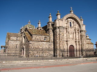
Pucará District is one of ten districts of the province Lampa in Peru.

Intikancha is a mountain with an archaeological site of the same name in the Andes of Peru, about 4,400 metres (14,436 ft) high. It is located in the Puno Region, Lampa Province, Nicasio District, and in the San Román Province, Juliaca District.

Pukaqucha is a lake in the Puno Region in southern Peru. It is situated in the Lampa Province, Lampa District, east of Lampa.
Aqup'ukru is a 4,997-metre-high (16,394 ft) mountain in the Andes of Peru. It is located in the Puno Region, Lampa Province, Paratía District. Aqup'ukru is situated south of the mountain Yanawara, west of the lake Sayt'uqucha and southeast of the mountain Pachakutiq.
Illani is a mountain in the Andes of Peru, about 5,000 metres (16,404 ft) high. It is located in the Puno Region, Lampa Province, Paratía District. Illani is situated southeast of the mountain Yanawara, east of the lake Sayt'uqucha and northwest of a group of lakes named Kimsaqucha.
Machu Kunturi or Pampachuku(Pampachuco) is a mountain in the Andes of Peru, about 5,100 metres (16,732 ft) high. It is located in the Puno Region, Lampa Province, Ocuviri District. Machu Kunturiri lies between the mountain Pichaqani in the west and Qillqa in the east.
Yanawara is a mountain in the Andes of Peru, about 5,000 metres (16,404 ft) high. It is located in the Puno Region, Lampa Province, on the border of the districts Ocuviri, Paratía and Santa Lucía. Yanawara lies east of Ananta Lake.
Uturunqani is a 5,092-metre-high (16,706 ft) mountain in the Andes of Peru. It is situated in the Puno Region, Lampa Province, Santa Lucía District. Uturunqani lies west and northwest of the lakes Ananta and Suyt'uqucha and southeast of the mountain Mamañawi. A little lake named Suraqucha (Soracocha) lies at its southeastern slope.
Pichaqani is a mountain in the Andes of Peru, about 4,800 metres (15,748 ft) high. It is situated in the Puno Region, Lampa Province, Ocuviri District. Pichaqani lies north of the lakes Ananta and Suyt'uqucha and west of the mountains Qillqa and Machu Kunturi.
Mich'i Mich'ini is a 4,826-metre-high (15,833 ft) mountain in the Andes of Peru. It is situated in the Puno Region, Lampa Province, Ocuviri District.
Chuqi Pirwa is a mountain in the Andes of Peru, about 5,200 m (17,100 ft) high. It is situated in the Cusco Region, Espinar Province, Condoroma District, and in the Puno Region, Lampa Province, Ocuviri District. Chuqi Pirwa lies southwest of Sawanani Lake (Saguanani) and northwest of Qullqi Q'awa.
Puka Punchu is a mountain in the Andes of Peru, about 5,000 m (16,000 ft) high. It is situated in the Puno Region, Lampa Province, on the border of the districts of Ocuviri and Santa Lucía. Puka Punchu lies southeast of Qullqi Q'awa.
Mamañawi is a mountain in the Andes of Peru, about 5,100-metre (16,732 ft) high. It is situated in the Puno Region, Lampa Province, Santa Lucía. Mamañawi lies northwest of the mountain Uturunqani and southeast of Pukapunchu.
Pariwana is a 5,022-metre-high (16,476 ft) mountain in the Andes of Peru. It is located in the Puno Region, Lampa Province, on the border of the districts of Palca and Vilavila. Pariwana lies north of Qillqa.
Qullqa Sirka is a mountain in the Andes of Peru, about 5,000 m (16,000 ft) high. It is located in the Puno Region, Lampa Province, Ocuviri District. Qullqa Sirka lies north of Machu Kunturi and northeast of T'akra.
Kimsa Chuta is a mountain in the Andes of Peru, about 5,050 m (16,570 ft) high. It is located in the Puno Region, Lampa Province, Ocuviri District. Kimsa Chuta lies south of Lamparasi.
Ch'ulla Rinri is a mountain in the Andes of Peru, about 4,950 m (16,240 ft) high. It is located in the Puno Region, Lampa Province, Ocuviri District, and in the Melgar Province, Ayaviri District. Ch'ulla Rinri lies northwest of Achuqallani and north of Warmi Sayana.


