Taban, Libya

Last updated
Taban

زاوية النيان
Village
Libya location map.svg
Red pog.svg
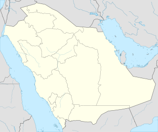
Taban
Location in Libya
Coordinates: 32°12′N21°32′E / 32.200°N 21.533°E / 32.200; 21.533 Coordinates: 32°12′N21°32′E / 32.200°N 21.533°E / 32.200; 21.533
CountryFlag of Libya.svg  Libya
Region Cyrenaica
District Jabal al Akhdar
Time zone UTC+2

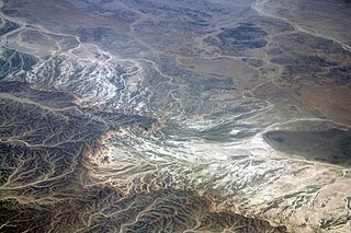
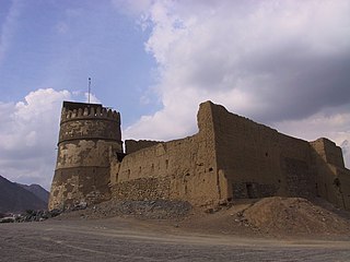
Zawiat at-Taban, or Taban (Arabic : زاوية النيان); also An-Nayan or Wadi Sammalus, is a check point in the District of Jabal al Akhdar in north-eastern Libya. [1] It is located on the cross-roads between the Charruba–Mechili–Timimi desert road and the Marawa–Wadi Sammalus.

Jabal al Akhdar District in Libya

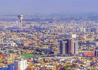
Jabal al Akhdar, also known as Jebel el-Akhdar, is one of the districts of Libya. It lies in the north east of the country. The capital is Bayda. In its territory, close to the city of Shahhat, can be found the remains of the old Greek colony of Cyrene, and the neighbouring city of Apollonia, a major port in the Mediterranean Sea in antiquity. On land, it borders Derna in east, Al Wahat in south and Marj in west.

Libya Country in north Africa

Libya, officially the State of Libya, is a country in the Maghreb region in North Africa, bordered by the Mediterranean Sea to the north, Egypt to the east, Sudan to the southeast, Chad to the south, Niger to the southwest, Algeria to the west, and Tunisia to the northwest. The sovereign state is made of three historical regions: Tripolitania, Fezzan and Cyrenaica. With an area of almost 1.8 million square kilometres (700,000 sq mi), Libya is the fourth largest country in Africa, and is the 16th largest country in the world. Libya has the 10th-largest proven oil reserves of any country in the world. The largest city and capital, Tripoli, is located in western Libya and contains over one million of Libya's six million people. The second-largest city is Benghazi, which is located in eastern Libya.

Marawa, Libya Town in Cyrenaica, Libya

Marawa is a town in the District of Jabal al Akhdar in north-eastern Libya, about 65 km south of Bayda. It is located on the cross-roads between the Marj-Lamluda inner road, and the Qasr Libya-Taban road.

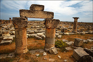
Between February 1925 and August 1927, Wadi Sammalus was the site of several colonial battles between Italian forces and Senussi Rebels. [2]

Senussi

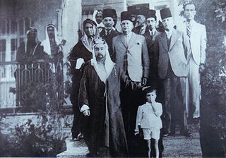
The Senussi or Sanusi are a Muslim political-religious tariqa and clan in colonial Libya and the Sudan region founded in Mecca in 1837 by the Grand Senussi, the Algerian Muhammad ibn Ali as-Senussi. Senussi was concerned with what he saw as both the decline of Islamic thought and spirituality and the weakening of Muslim political integrity.

Related Research Articles

Arabah valley in Israel

The Arabah, or Arava / Aravah, as it is known by its respective Arabic and Hebrew names, is a geographic area south of the Dead Sea basin, which forms part of the border between Israel to the west and Jordan to the east.

Wadi River valley, especially a dry (ephemeral) riverbed that contains water only during times of heavy rain

Wadi, alternatively wād, is the Arabic term traditionally referring to a valley. In some instances, it may refer to a dry (ephemeral) riverbed that contains water only when heavy rain occurs.

Tabuk, Saudi Arabia Place in Tabuk province, Saudi Arabia

Tabuk, also spelled Tabouk, is the capital city of the Tabuk Region in northwestern Saudi Arabia. It has a population of 534,893. It is close to the Jordanian–Saudi Arabia border, and houses the largest air force base in Saudi Arabia.

Eastern Desert

The Eastern Desert is the part of the Sahara desert that is located east of the Nile river, between the river and the Red Sea. It extends from Egypt in the north to Eritrea in the south, and also comprises parts of Sudan and Ethiopia. The Eastern Desert is also known as the Red Sea Hills and the Arabian Desert because to the east it is bordered by the Red Sea and the Arabian Peninsula, respectively.

Hunayn, Saudi Arabia Locality in Makkah, Saudi Arabia

Hunayn is a location in the Hijaz, Saudi Arabia, close to the city of Ta’if. It is located between Mecca and Ta’if in the Sarawat Mountains.

Hamaam, Israel Place in Northern

Hamaam, or Wadi Hamam, is an Arab village near the Sea of Galilee and Mount Arbel in northern Israel. It is the easternmost part of the al-Batuf Regional Council. It contains one fairly modern mosque and the trail head for the steep ascent of Mount Arbel. In 2017 its population was 1,455.

Wadi Hammamat river in Egypt

Wadi Hammamat is a dry river bed in Egypt's Eastern Desert, about halfway between Al-Qusayr and Qena. It was a major mining region and trade route east from the Nile Valley in ancient times, and three thousand years of rock carvings and graffiti make it a major scientific and tourist site today.

Charruba–Timimi Road road in Libya

Charruba-Timimi road is an asphalt road in the Cyrenaica region of eastern Libya running from Charruba to Taban, Mechili, and Timimi. It’s about 186 kilometres (116 mi) long and known in Libya as “Et Terigh El Foghiya”.

Wadi Hunayn

Wadi Hunayn was a Palestinian Arab village in the Ramle Subdistrict, located 9 km west of Ramla. According to a local tradition, it was named after the Yemeni home of the Qada'a tribe who settled here in the early Islamic period.

Jumeirah Beach a white sand beach in Dubai

Jumeira Beach is a white sand beach that is located and named after the Jumeirah district of Dubai, on the coast of the Persian Gulf. It stretches along the coast south of the city's historic district to the junction with The Palm Jumeirah and terminates between the southern end of the Jumeirah Beach Residence and the port facilities at Jebel Ali.

Route 417 (Israel/Palestine)

Route 417 is an intercity road in Israel and the West Bank that stretches from the west side of Jerusalem to Ma'ale Adumim and Highway 1 east to the Jordan Valley.

Wadi al-Uyun Town in Hama, Syria

Wadi al-'Uyun is a town in northwestern Syria, administratively part of the Hama Governorate, located west of Hama.

Al Baqa or Al Baqa'a, also spelled Al-Beqa or Al baqr, is a Palestinian village located just east of Hebron. It is occupied by Israel since 1967, together with the rest of the West Bank. It is sandwiched between the Israeli settlements Givat Harsina and Kiryat Arba. Wadi al-Ghrous or Wadi al Gruz is a locality of Hebron that borders Al Baqa on the west.

Wadi al-Hussein

Wadi al Hussein, sometimes referred to as 'Wadi Nasara, is a wadi east of and adjacent to the city of Hebron. The valley connects the Kiryat Arba settlement with the Israeli-controlled H2 area of Hebron's old city. The borders of the valley are Othman Bin Afan Street, also known as Zion Street or Worshipers' Way in the west; Wadi Al Nassara in the north; the Kiryat Arba fence in the east; Wadi Al Ghrous and the road connecting Kiryat Arba with Zion Street in the south.

Siege of Wadi Deif (2014)

The Siege of Wadi Deif refers to the siege of two Syrian Army bases, Wadi Deif and Hamadiyah, by rebel forces, during the 2014 Idlib offensive of the Syrian Civil War. The first siege of these two bases was broken by the Syrian Army on 18 April 2013. During the siege, rebels detonated several 'tunnel bombs' underneath Army positions surrounding the bases, which was similar to the tactics used during the First World War.

Tell Taban archaeological site in Syria

Tell Taban is an archaeological site in north-eastern Syria in the Al-Hasakah Governorate. It is the site of the ancient city of Ṭābetu.

Wadi Barada offensive (2016–17)

The Wadi Barada offensive (2016–17) was a military operation against rebel-held villages in the Barada River valley by the Syrian Army and allied forces, including pro-government militias and Lebanese Hezbollah between December 2016 and January 2017. The Barada River valley includes the village of Ain al-Fijah which holds a water spring that provides drinking water to towns throughout the Rif Dimashq Governorate.

Wadi Ham Wikimedia disambiguation page

Wadi Ham is a wadi in Fujairah, United Arab Emirates.

References

  1. Maplandia world gazetteer
  2. Kalifa Tillisi, Mu’jam Ma’arek Al Jehad fi Libia, 3rd ed., Beirut, Lebanon, 1973, p.509