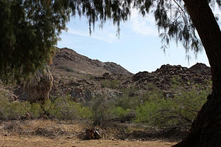
Lake Mead National Recreation Area is a U.S. national recreation area in Southeastern Nevada and Northwestern Arizona. Operated by the National Park Service, Lake Mead NRA follows the Colorado River corridor from the westernmost boundary of Grand Canyon National Park to just north of the cities of Laughlin, Nevada and Bullhead City, Arizona. It includes all of the eponymous Lake Mead as well as the smaller Lake Mohave – reservoirs on the river created by Hoover Dam and Davis Dam, respectively – and the surrounding desert terrain and wilderness.
The Chuckwalla Mountains are a mountain range in the transition zone between the Colorado Desert—Sonoran Desert and the Mojave Desert, climatically and vegetationally, in Riverside County of southern California.

The Turtle Mountains, are located in northeastern San Bernardino County, in the southeastern part of California. The colorful Turtle Mountains vary from deep reds, browns, tans and grays, to black. The area has numerous springs and seeps. The Turtle Mountains are also a National Natural Landmark, with two mountain sections of entirely different composition.

The Santa Rosa and San Jacinto Mountains National Monument is a National Monument in southern California. It includes portions of the Santa Rosa and San Jacinto mountain ranges, the northernmost ones of the Peninsular Ranges system. The national monument covers portions of Riverside County, west of the Coachella Valley, approximately 100 miles (160 km) southeast of downtown Los Angeles.
Sonoran Desert National Monument is south of Goodyear and Buckeye and east of Gila Bend, Arizona. Created by Presidential proclamation on January 17, 2001, the 496,400 acres (200,886 ha) monument is managed by the U.S. Bureau of Land Management as part of the National Landscape Conservation System. The BLM already managed the lands, however under monument status, the level of protection and preservation of resources is enhanced. Sonoran Desert National Monument protects but a small portion of the Sonoran Desert, which is 120,000 square miles (311,000 km2), and extends well into California and the country of Mexico. The North Maricopa Mountains, South Maricopa Mountains and the Table Top Wildernesses protect the richest regions of desert habitat from development.

The Harquahala Mountains are the highest mountain range in southwestern Arizona, United States and are located southwest of the towns of Aguila and Wenden. The name originated from the Yavapai 'ʼHakhe:la", which means "running water". The range is oriented from northeast to southwest and is approximately 32 km long and 20 km at its widest point. At the northeast are two prominent peaks, Eagle Eye Peak and Eagle Eye Mountain. One has a natural opening or bridge through it appearing as an eye high up, and is the namesake for the peaks and Aguila. The highest point, Harquahala Peak, rises to 5,681 ft. Socorro Peak, 3270 ft, is at the southwest end of the range.

Arizona is a landlocked state situated in the southwestern region of the United States of America. It has a vast and diverse geography famous for its deep canyons, high- and low-elevation deserts, numerous natural rock formations, and volcanic mountain ranges. Arizona shares land borders with Utah to the north, the Mexican state of Sonora to the south, New Mexico to the east, and Nevada to the northwest, as well as water borders with California and the Mexican state of Baja California to the southwest along the Colorado River. Arizona is also one of the Four Corners states and is diagonally adjacent to Colorado.

The Cleghorn Lakes Wilderness is a 39,167-acre (158.50 km2) wilderness area in the southern Mojave Desert. It is located 16 miles (26 km) northeast of Twentynine Palms, California, and 20 miles (32 km) north of Joshua Tree National Park. It is managed by the Bureau of Land Management.

The Santa Rosa Wilderness is a 72,259-acre (292.42 km2) wilderness area in Southern California, in the Santa Rosa Mountains of Riverside and San Diego counties, California. It is in the Colorado Desert section of the Sonoran Desert, above the Coachella Valley and Lower Colorado River Valley regions in a Peninsular Range, between La Quinta to the north and Anza Borrego Desert State Park to the south. The United States Congress established the wilderness in 1984 with the passage of the California Wilderness Act, managed by both the US Forest Service and the Bureau of Land Management. In 2009, the Omnibus Public Land Management Act was signed into law which added more than 2,000 acres (8.1 km2). Most of the Santa Rosa Wilderness is within the Santa Rosa and San Jacinto Mountains National Monument.
The Whipple Mountains Wilderness is a 76,122-acre (30,805 ha) wilderness administered by the Bureau of Land Management (BLM). Most of the Whipple Mountains are within the wilderness area. It is located in the northeastern Colorado Desert near the Colorado River. Lake Havasu and Lake Havasu City are 25 miles (40 km) to the North. Earp, California and Parker, Arizona are 20 miles (32 km) to the South. The Parker Dam is 8 miles (13 km) due east.
The Rawhide Mountains are a mountain range of western Arizona, in the southwest of Mohave County. It is part of a block of mountain ranges on the north of an insular region called the Maria fold and thrust belt, containing mountain ranges, valleys, and plains. The Rawhide Mountains border the much smaller Artillery Mountains southeast, bordering on Alamo Lake State Park and the south-flowing Big Sandy River.

The Hummingbird Springs Wilderness is a 31,200-acre (12,626 ha) wilderness administered by the Bureau of Land Management (BLM). The wilderness is located in the northwest of Maricopa County in northern regions of the central Sonoran Desert of Arizona.
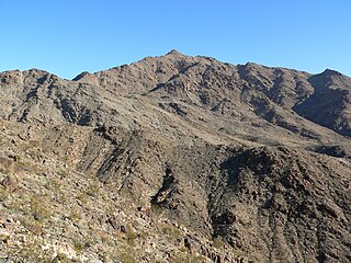
Mount Wilson is a mountain in Mohave County, Arizona, U.S. At 5,456 feet (1,663 m), it is the second highest point of the Black Mountains after Mount Perkins.

Sand to Snow National Monument is a U.S. National Monument located in San Bernardino County and northern Riverside County, Southern California.
Woolsey Peak Wilderness is a protected wilderness area centered around its namesake Woolsey Peak, rising 2,500 feet to a summit at 3270 feet in the Gila Bend Mountains in the U.S. state of Arizona. Established in 1990 under the Arizona Desert Wilderness Act the area is managed by the Bureau of Land Management. This desert wilderness is best described as "a perfect example of pristine Sonoran Desert."
Signal Mountain Wilderness is a protected wilderness area centered around its namesake Signal Mountain, rising 1,200 feet (370 m) to a summit at 2,057 feet (627 m) in the Gila Bend Mountains in the U.S. state of Arizona. Established in 1990 under the Arizona Desert Wilderness Act, the area is managed by the Bureau of Land Management. The desert wilderness is made up of steep canyons, winding arroyos, and volcanic peaks within a Sonoran Desert ecosystem.
Wabayuma Peak Wilderness is a protected wilderness area centered around its namesake Wabayuma Peak, rising to 7,601 feet in the Hualapai Mountains in the U.S. state of Arizona. Established in 1990 under the Arizona Desert Wilderness Act the area is managed by the Bureau of Land Management. This desert and mountain wilderness exists in between the Sonoran and Mojave Deserts, filled with massive ridgelines that rise from the desert floor.
Tres Alamos Wilderness is a protected wilderness area centered around the southern portion of the Black Mountains and the range high point of Sawyer Peak in the U.S. state of Arizona. The namesake feature, Tres Alamos, is a prominent and colorful monolith in the mountains. Established in 1990 under the Arizona Desert Wilderness Act the area is managed by the Bureau of Land Management.
White Canyon Wilderness is a protected wilderness area in the southeastern portion of the Mineral Mountains in the U.S. state of Arizona. Established in 1990 under the Arizona Desert Wilderness Act the area is managed by the Bureau of Land Management.
Cadiz Dunes Wilderness is a protected wilderness area in the Mojave Trails National Monument in San Bernardino County, California. Established in 1994 by the U.S. Congress, the area is managed by the Bureau of Land Management. This wilderness area is north of Joshua Tree National Park, Sheephole Valley Wilderness lies to the west, Old Woman Mountains Wilderness to the east. The dunes of Cadiz Dunes were formed by blowing sands from the Cadiz dry lake, all located in the Cadiz Valley between the Calumet Mountains and the Old Woman Mountains. The ecology is typical of the Mojave Desert with wildlife that includes coyote, black-tailed jackrabbits, ground squirrels, kangaroo rats, quail, roadrunners, and rattlesnakes. The area is known for a brilliant display of springtime desert wildflowers including the Borrego milkvetch.
