
Kodad is a town in Suryapet district of the Indian state of Telangana. It is a municipality and the mandal headquarters of Kodad mandal in Kodad revenue division. It lies on the National Highway 65 between Hyderabad and Vijayawada.It is 44 km far away from the district headquarters Suryapet.

Vijayawada (rural) mandal is one of the 50 mandals in Krishna district of the Indian state of Andhra Pradesh. It is under the administration of Vijayawada revenue division and has its headquarters at Nunna. The mandal is bounded by Ibrahimpatnam, G. Konduru, Agiripalle, Gannavaram, Kankipadu, Penamaluru and Vijayawada (urban) mandals. The mandal is also a part of the Andhra Pradesh Capital Region under the jurisdiction of APCRDA.

Challapalli, officially known as Challapalle, is a village in Krishna district of the Indian state of Andhra Pradesh. It is located in Challapalli mandal of Machilipatnam revenue division. Challapalli is one of the villages in the mandal to be a part of Andhra Pradesh Capital Region.
Visakhapatnam Rural Mandal is one of the 46 mandals in Visakhapatnam district of Andhra Pradesh, India. It is administered under Visakhapatnam revenue division and its headquarters is located at Chinagadili, Visakhapatnam. The mandal lies on the coast of Bay of Bengal and is bounded by Bheemunipatnam, Anandapuram mandals to the north and Visakhapatnam Urban-1 to the south.
Tirupati (rural) mandal is one of the 66 mandals in Chittoor district of Andhra Pradesh in India. It has its headquarters at Tirupati (rural) town. The mandal is bounded by Chandragiri mandal, Tirupati (urban) mandal, Renigunta mandal, Kammapalle mandal and Vadamalapeta mandal.
Rompicherla is a village in Chittoor district of the Indian state of Andhra Pradesh. It is the mandal headquarters of Rompicherla mandal.

Tadepalli is a Town in Guntur district of the Indian state of Andhra Pradesh. The town lies on the south bank of the Krishna river and is the headquarters of Tadepalle mandal of Guntur revenue division. It lies in Andhra Pradesh Capital Region and a small portion of the town is a part of the state capital, Amaravati.
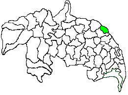
Kakinada (rural) mandal is one of the 59 mandals in East Godavari of the state of Andhra Pradesh, India. It has its headquarters at Kakinada. The mandal is bounded by Samalkota mandal, Pedapudi mandal, Karapa mandal, Kothapalle mandal and waters of Bay of Bengal.
Rajahmundry Rural mandal, officially known as Rajamahendravaram Rural mandal, is one of the 59 mandals in East Godavari district of the state of Andhra Pradesh, India. It has its headquarters at Rajahmundry. The mandal is bounded by Seethanagaram mandal, Korukonda mandal, Rajanagaram mandal, Kadiam mandal and Atreyapuram mandal.
Penugonda or "Vasavi Penugonda" is a town in West Godavari district of the Indian state of Andhra Pradesh.
Kolanukonda is a village in Guntur district of the Indian state of Andhra Pradesh. It is located in Tadepalle mandal of Guntur revenue division. It is a suburb of Vijayawada.
Markondapadu is a village near by a town Nidadavole (South-West) and Kovvur (North-East) in Chagallu mandal, West Godavari District, Andhra Pradesh State, India.
Tadepalle mandal is one of the 57 mandals in Guntur district of the Indian state of Andhra Pradesh. It is under the administration of Guntur Revenue Division and the headquarters are located at Tadepalle town. The mandal is situated on the banks of Krishna River, bounded by Thullur and Mangalagiri mandals. from the mandal are under the jurisdiction of Andhra Pradesh Capital City.
Kakinada (urban) mandal is one of the 59 mandals in East Godavari district of the state of Andhra Pradesh, India. It has its headquarters at Kakinada city, that covers the entire mandal. The mandal is surrounded by Kakinada (rural) mandal and lies on the coast of Bay of Bengal.
Rajahmundry Urban mandal, officially known as Rajamahendravaram Urban mandal, is one of the 59 mandals in East Godavari of the state of Andhra Pradesh, India. It has its headquarters at Rajahmundry city, that covers the entire urban mandal. The mandal is surrounded by Rajahmundry (rural) mandal and lies on the banks of Godavari River.

Thullur mandal is one of the 57 mandals in Guntur district of the Indian state of Andhra Pradesh. It is under the administration of Guntur Revenue Division and the headquarters are located at Thullur. The mandal is situated on the banks of Krishna River, bounded by Amaravathi, Tadikonda, Tadepalle and Mangalagiri mandals. The mandal is also a part of the new capital city of Andhra Pradesh to be developed. 18 villages from the mandal fall under the jurisdiction of Andhra Pradesh Capital City.
Vaddeswaram is a census town in Guntur district of the Indian state of Andhra Pradesh. It is located at a distance of 5 km (3.1 mi) from Krishna River, in Tadepalle mandal of Guntur revenue division.

Challapalli mandal is one of the 50 mandals in the Krishna district of the Indian state of Andhra Pradesh. The headquarters of this mandal are located in Challapalli.

Ghantasala mandal is one of the 40 mandals in the Krishna district of the Indian state of Andhra Pradesh. The headquarters of this mandal is located in the town of Ghantasala.


