
Shimane Prefecture is a prefecture of Japan located in the Chūgoku region of Honshu. Shimane Prefecture is the second-least populous prefecture of Japan at 665,205 and has a geographic area of 6,708.26 km2. Shimane Prefecture borders Yamaguchi Prefecture to the southwest, Hiroshima Prefecture to the south, and Tottori Prefecture to the east.

Fushimi Inari-taisha (伏見稲荷大社) is the head shrine of the kami Inari, located in Fushimi-ku, Kyoto, Kyoto Prefecture, Japan. The shrine sits at the base of a mountain also named Inari which is 233 metres (764 ft) above sea level, and includes trails up the mountain to many smaller shrines which span 4 kilometres (2.5 mi) and take approximately 2 hours to walk up.
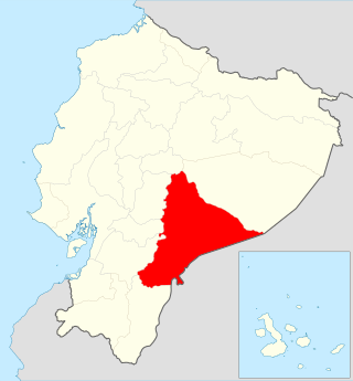
Edmundo Carvajal Airport (Spanish: Aeropuerto "Coronel Edmundo Carvajal", also known as Macas Airport, is an airport serving Macas, the capital of Morona-Santiago Province in Ecuador. The airport is named for Edmundo Carvajal Flores, a former commander of the Ecuadorian Air Force.

Río Amazonas Airport is an airport serving Shell Mera, a town in the Pastaza Province of Ecuador. The airport was established in 1937 by Royal Dutch Shell and abandoned in 1948. In 1949 the Mission Aviation Fellowship, a Christian missionary group, established themselves in the area and used the airport as their main base.

San Cristóbal Airport is an airport on the island of San Cristóbal, in the Galápagos Islands of Ecuador. The airport is on the southwestern end of the island, with rising terrain to the northeast. Approaches to both runways are over the ocean.
Lago Agrio Airport is an airport serving Nueva Loja, the capital of Sucumbíos Province in Ecuador.
Chachoan Airport is a high elevation airport serving Ambato, capital of the Tungurahua Province in Ecuador. The airport is 6 kilometres (3.7 mi) northeast of Ambato, in a broad basin of the central Andes mountains cut through by the Ambato River.
José María Velasco Ibarra Airport is an airport serving Macará, a city in the Loja Province of Ecuador. Macará is on Ecuador's border with Peru.
Tarapoa Airport is an airport serving Tarapoa, a town in the Sucumbíos Province of Ecuador.
Taisha Canton is a canton of Ecuador, located in the Morona-Santiago Province. Its capital is the town of Taisha. Its population at the 2001 census was 13,078.
Los Perales Airport is an airport serving the city of Bahía de Caráquez in Manabí Province, Ecuador. The airport is across the Chone River from the city and is reached via a 1.7 kilometres (1 mi) causeway.
Gualaquiza Airport is an airport serving the town of Gualaquiza in Morona-Santiago Province, Ecuador. The airport is at the entrance to a mountain valley, with nearby rising and high terrain west through north through east. The southern quadrants are open.
Atahualpa Airport was an airport formerly serving the town of Ibarra in Imbabura Province, Ecuador.
El Carmen Airport is an airport serving the Bobonaza River village of Montalvo in Pastaza Province, Ecuador. The runway is within a bend of the river, and approaches to either end will cross the water.
Putumayo Airport is an airport serving the Putumayo River village of Puerto El Carmen de Putumayo in Sucumbíos Province, Ecuador. The runway is in a bend of the river 1 kilometre (0.6 mi) east of the village.
Chimborazo Airport is an airport serving the city of Riobamba in Chimborazo Province, Ecuador.
Santa Cecilia Airport is an airport serving the village of Santa Cecilia in Sucumbíos Province, Ecuador.
Sucúa Airport is an airport serving the town of Sucúa in Morona-Santiago Province, Ecuador.
Taura Air Base is a military airport 24 kilometres (15 mi) east of Guayaquil in Guayas Province, Ecuador. The base is on the west bank of the Taura River.
Tiputini Airport is an airport serving the Napo River village of Tiputini in Orellana Province, Ecuador.
