Tajwal Utli | |
---|---|
Coordinates: 34°00′N73°13′E / 34.00°N 73.21°E | |
Country | |
Province | Khyber Pakhtunkhwa |
Elevation | 1,957 m (6,421 ft) |
Time zone | PST (UTC+5) |
Tajwal Utli is a village in Abbottabad District of Khyber Pakhtunkhwa province of Pakistan.
Abbottabad District is located in Khyber Pakhtunkhwa province of Pakistan. The district covers an area of 1,969 km2, with the city of Abbottabad being the principal town. Neighbouring districts are Mansehra to the north, Muzaffarabad to the east, Haripur to the west, and Rawalpindi to the south.
Khyber Pakhtunkhwa is one of the four administrative provinces of Pakistan, located in the northwestern region of the country along the international border with Afghanistan. It was previously known as the North-West Frontier Province (NWFP) until 2010 when the name was changed to Khyber Pakhtunkhwa by the 18th Amendment to Pakistan's Constitution, and is known colloquially by various other names. Khyber Pakhtunkhwa is the third-largest province of Pakistan by the size of both population and economy, though it is geographically the smallest of four. Within Pakistan, Khyber Pakhtunkhwa shares a border with Punjab, Balochistan, Azad Kashmir, Gilgit-Baltistan, and Islamabad. It comprises 10.5% of Pakistan's economy, and is home to 17.9% of Pakistan's total population, with the majority of the province's inhabitants being Pashtuns. The province is the site of the ancient kingdom Gandhara, including the ruins of its capital Pushkalavati near modern-day Charsadda. Originally a stronghold of Buddhism, the history of the region was characterized by frequent invasions under various Empires due to its geographical proximity to the Khyber Pass.
Pakistan, officially the Islamic Republic of Pakistan, is a country in South Asia. It is the world’s sixth-most populous country with a population exceeding 212,742,631 people. In area, it is the 33rd-largest country, spanning 881,913 square kilometres. Pakistan has a 1,046-kilometre (650-mile) coastline along the Arabian Sea and Gulf of Oman in the south and is bordered by India to the east, Afghanistan to the west, Iran to the southwest, and China in the far northeast. It is separated narrowly from Tajikistan by Afghanistan's Wakhan Corridor in the northwest, and also shares a maritime border with Oman.
Lammi is a former municipality of Finland. It was consolidated with Hämeenlinna on 2009-01-01.
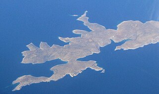
Levitha is a small Greek island located in the east of the Aegean Sea, between Kinaros and Kalymnos, part of the Dodecanese islands. It is part of the municipality Leros. The island is mentioned in two of Ovid's works Ars Amatoria and the Metamorphoses in connection with the saga of Daedalus and Icarus. While escaping from Crete, Daedalus and Icarus flew over Lebynthos.
Ballickmoyler or Ballicmoyler is a small town in County Laois, Ireland. It lies 30 km (18.64 mi) southeast of Portlaoise, at the junction of the N80 national secondary road and the R429 regional road.
Lipovník is a municipality in the Topoľčany District of the Nitra Region, Slovakia. In 2011 it had 326 inhabitants.
Dalola is one of the 51 union councils (sub-divisions) of Abbottabad District in Khyber-Pakhtunkhwa province of Pakistan.
Poor Meadow Brook is a 5.8-mile-long (9.3 km) stream within the Taunton River Watershed in southeastern Massachusetts. The stream runs from a wetland near County Street in Hanson to the confluence with the Satucket River in East Bridgewater.
Wilcze Jary is a village in the administrative district of Gmina Więcbork, within Sępólno County, Kuyavian-Pomeranian Voivodeship, in north-central Poland. It lies approximately 13 kilometres (8 mi) west of Więcbork, 19 km (12 mi) south-west of Sępólno Krajeńskie, and 54 km (34 mi) north-west of Bydgoszcz.
Gunie-Ostrów is a village in the administrative district of Gmina Kołaki Kościelne, within Zambrów County, Podlaskie Voivodeship, in north-eastern Poland. It lies approximately 10 kilometres (6 mi) east of Zambrów and 54 km (34 mi) west of the regional capital Białystok.
Vissulaid is a small, uninhabited island in the Baltic Sea belonging to the country of Estonia. Its coordinates are 59°00′40″N22°50′26″E
Imanan is a village and rural commune in Niger.
Ouro Gueladjo is a village and rural commune in Niger.
Geniai (Varėna) is a village in Varėna district municipality, in Alytus County, in southeastern Lithuania. According to the 2001 census, the village has a population of 43 people.
Ljubić is a village in the municipality of Čačak, Serbia. According to the 2011 census, the village has a population of 61 people.
False Divi Point is a low headland located at the northern terminus of the Coromandel Coast, within the state of Andhra Pradesh of southeastern India.
Jõe is a village in Saaremaa Parish, Saare County in western Estonia.
Margance is a village in the municipality of Vranje, Serbia. According to the 2002 census, the village has a population of 20 people.
Leuben is a district of the German city of Dresden.
Pekmezci is a village in the District of Kozan, Adana Province, Turkey.
Changlingpi station is a Metro station of Shenzhen Metro Line 5. It opened on 22 June 2011. This station is an elevated station.
Malpur State was a small princely state belonging to the Mahi Kantha Agency of the Bombay Presidency during the era of the British Raj. It was centered on Malpur town, in present-day Aravalli district of Gujarat State.
Coordinates: 34°0′40″N73°21′20″E / 34.01111°N 73.35556°E
A geographic coordinate system is a coordinate system that enables every location on Earth to be specified by a set of numbers, letters or symbols. The coordinates are often chosen such that one of the numbers represents a vertical position and two or three of the numbers represent a horizontal position; alternatively, a geographic position may be expressed in a combined three-dimensional Cartesian vector. A common choice of coordinates is latitude, longitude and elevation. To specify a location on a plane requires a map projection.
This Abbottabad District location article is a stub. You can help Wikipedia by expanding it. |