Takino Suzuran Hillside National Government Park

Last updated

Takino Suzuran Hillside National Government Park(国営滝野すずらん丘陵公園,Kokuei Takino Suzuran Kyūryō Kōen) is a Japanese national government park located in Sapporo, Hokkaido. It is the only national government park in the northern island of Hokkaido. The park area spreads over 395.7 hectares of hilly country and ranges in altitude between 160 and 320 m above sea level. Currently, 192.3 is accessible to the public. The park grounds are separated into six zones: the Mountain Stream Zone, Central Zone, Lodging Zone, Forest Experience Zone (planned to be open in 2009), Nature Observation Zone (planned to be open in 2010), and Preservation Zone (not open to the public). During the winter season, the park operates as the “Takino Snow World”, providing visitors with a wide variety of winter outdoor activities. [1]

Japan's National Government Parks are parks or open spaces established by the Ministry of Land, Infrastructure, Transport and Tourism under the City Park Law.

Sapporo Designated city in Hokkaido, Japan

Sapporo is the fifth largest city of Japan by population, and the largest city on the northern Japanese island of Hokkaido. It is the capital city of Hokkaido Prefecture and Ishikari Subprefecture. It is an ordinance-designated city.

Hokkaido Island, region, and prefecture of Japan

Hokkaido, formerly known as Ezo, Yezo, Yeso, or Yesso, is the second largest island of Japan, and the largest and northernmost prefecture. The Tsugaru Strait separates Hokkaido from Honshu. The two islands are connected by the undersea railway Seikan Tunnel. The largest city on Hokkaido is its capital, Sapporo, which is also its only ordinance-designated city. About 43 km north of Hokkaido lies Sakhalin Island, Russia. To its east and north-east are the disputed Kuril Islands.

Contents

History

In 1975, the Hokkaido Regional Development Bureau set up a committee to select a possible location for a national government park in Hokkaido. In 1976, the committee chose the current site, and the construction of the park was officially decided in 1977. In 1983, the park, with approximately 30 hectares of the planned 395.7 hectare area opened to the public, begins its operation as the fifth national government. [2]

Access

By train

From Sapporo, take the Sapporo Municipal Subway Nanboku Line to Makomanai Station and transfer to the Chuō Bus Takino Line; get off either at Suzuran Kōen Higashi-guchi Stop or Atsubetsu no Taki Stop.

Sapporo Municipal Subway metro system

The Sapporo Municipal Subway is a mostly-underground rubber-tyred metro system in Sapporo, Hokkaido, Japan. Operated by the Sapporo City Transportation Bureau, it is the only subway system on the island of Hokkaido.

By car

Drive on the Central Hokkaido Expressway and exist at the Sapporo South Interchange; head for Makomanai/Takino and follow the road signs.

Related Research Articles

Assabu, Hokkaido Town in Hokkaido, Japan

Assabu is a small town located in Hiyama Subprefecture, Hokkaido, Japan.

Hakusan National Park national park of Japan

Hakusan National Park is a national park in the Chūbu region of Honshū, Japan. Established in 1962, it spans the borders of Fukui, Gifu, Ishikawa, and Toyama prefectures. Its main geographical feature is Mount Haku. In 1980 an area of 480 km² corresponding to the national park was designated a UNESCO Man and the Biosphere Reserve.

Tomakomai Station railway station in Tomakomai, Hokkaido, Japan

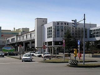
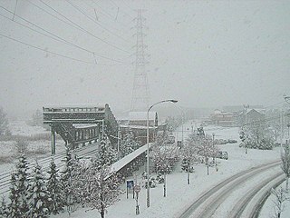
Tomakomai Station is a railway station in Tomakomai, Hokkaido, Japan, operated by the Hokkaido Railway Company.

Yamaman Yūkarigaoka Line railway line in Sakura, Chiba prefecture, Japan

The Yūkarigaoka Line is a Japanese people mover of Yamaman Co., Ltd., the developer of Yūkarigaoka town. The line, which opened in two stages between November 2, 1982 and September 22, 1983, runs from Yūkarigaoka Station and the entire route is in Sakura, Chiba. The line takes a racket-shaped route as shown in the route diagram.

Minami-ku, Sapporo Ward in Hokkaidō, Japan

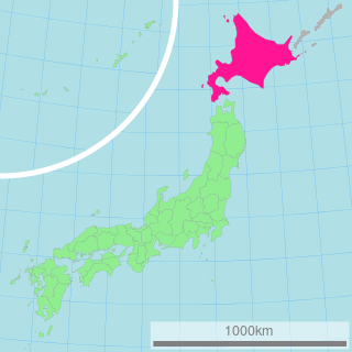
Minami-ku (南区) is one of the 10 wards in Sapporo, Hokkaidō, Japan. Minami-ku is directly translated as "south ward". Having the area of 657.23 km² in total, Minami-ku occupies 60 percent of the area of Sapporo.

Musashi Kyūryō National Government Park

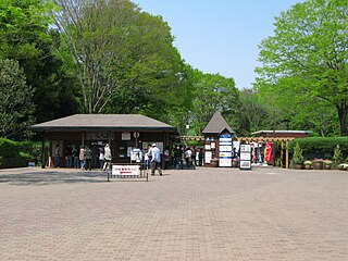
Musashi Kyūryō National Government Park is a national government park located on the Hiki Hills of the town of Namegawa, Saitama Prefecture, Japan. It is also known as Shinrin Kōen (森林公園). In 1974, it opened as the first National Government Park. The park covers a vast area of forest and offers opportunities for various outdoor activities. The park has four entrances: the Central, North, West, and South Entrances. It takes roughly 80 minutes to walk the 5 kilometres (3.1 mi) from the South Entrance to the North Entrance and 30 minutes from the West to the Central Entrance, a distance of 1.7 kilometres (1.1 mi).

Inazumi-Kōen Station railway station in Sapporo, Hokkaido, Japan

Inazumi-Kōen Station is a railway station in Teine-ku, Sapporo, Hokkaido, Japan, operated by Hokkaido Railway Company. The station is numbered S06.

Shinrin-Kōen Station (Hokkaido) railway station in Sapporo, Hokkaido, Japan

Shinrin-Kōen Station is a railway station on the Hakodate Main Line in Atsubetsu-ku, Sapporo, Hokkaido, Japan, operated by Hokkaido Railway Company. The station is numbered "A05".

Ainosato-kōen Station railway station in Sapporo, Hokkaido, Japan

Ainosato-kōen Station is a railway station on the Sasshō Line in Kita-ku, Sapporo, Hokkaido, Japan, operated by the Hokkaido Railway Company. The station is numbered G11.

Toyohira-Kōen Station metro station in Sapporo, Hokkaido, Japan

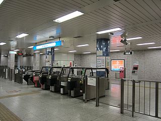
Toyohira-Kōen Station is a subway station on the Tōhō Line in Toyohira-ku, Sapporo, Hokkaido, Japan, operated by Sapporo Municipal Subway. The station is numbered H11.

Makomanai Station metro station in Sapporo, Hokkaido, Japan

Makomanai Station (真駒内駅) is a rapid transit station in Minami-ku, Sapporo, Hokkaido, Japan. The station number is N16. It is the south terminus of the Namboku Line.

Maruyama-Kōen Station metro station in Sapporo, Hokkaido, Japan

Maruyama-Kōen Station is a Sapporo Municipal Subway station in Chūō-ku, Sapporo, Hokkaido, Japan. The station is numbered T06.

Nakajima-Kōen Station metro station in Sapporo, Hokkaido, Japan

Nakajima-Kōen Station (中島公園駅) is a metro station in Chūō-ku, Sapporo, Hokkaido, Japan. The station number is N09.

Nopporo Shinrin Kōen Prefectural Natural Park

Nopporo Shinrin Kōen Prefectural Natural Park is a Prefectural Natural Park in western Hokkaidō, Japan. Established in 1968, the park spans the municipalities of Ebetsu, Kitahiroshima, and Sapporo.

Hamura Kusabana Kyūryō Prefectural Natural Park is a Prefectural Natural Park in Tokyo, Japan. The park was established in 1953.

Nakajima Park

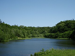
Nakajima Park is a city park in Chūō-ku, Sapporo, Hokkaido, Japan. The park has a lake, two streams, a museum, a concert hall, an observatory, a historical building housing a tea shop, and several lawns and forests. At the south end, there are two shrines.

Maruyama Park (Sapporo)

Maruyama Park is a park in Chūō-ku, Sapporo, Hokkaido, Japan. The park was modeled after the park with the same name sited in Kyoto.

Makomanai Park (真駒内公園) is a city park in Minami-ku, Sapporo, Hokkaido, Japan. It is home to attractions such as Makomanai Open Stadium, Makomanai Ice Arena and the Sapporo Salmon Museum. It also contains a small gymnasium, restaurant and a shop.

Asahiyama Memorial Park park in Sapporo, Japan

Asahiyama Memorial Park is a park located in Chūō-ku, Sapporo, Hokkaidō, Japan. The park’s peak, at 137.5 metres (451 ft) above sea level, offers a great panoramic view of Sapporo, and the Sea of Japan beyond.

References

  1. ja:滝野すずらん丘陵公園 Retrieved from the Japanese Wikipedia, on 2008 September 7.
  2. ja:滝野すずらん丘陵公園 Retrieved from the Japanese Wikipedia, on 2008 September 7.

Coordinates: 42°55′00″N141°23′20″E / 42.916787°N 141.388785°E / 42.916787; 141.388785

Geographic coordinate system Coordinate system

A geographic coordinate system is a coordinate system that enables every location on Earth to be specified by a set of numbers, letters or symbols. The coordinates are often chosen such that one of the numbers represents a vertical position and two or three of the numbers represent a horizontal position; alternatively, a geographic position may be expressed in a combined three-dimensional Cartesian vector. A common choice of coordinates is latitude, longitude and elevation. To specify a location on a plane requires a map projection.